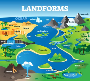
Landforms collection with educational labeled formation examples scenery. Landscape view with geographical nature surface terrains vector illustration. Typical topography view with ground and water.
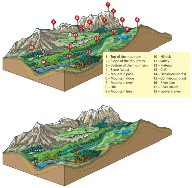
Vector illustration of inland relief types - landforms: mountains and valley relief.
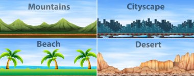
Four background scenes of different places illustration

Desert colored Vector Icon

Cliff colored Vector Icon
Contour vector illustration. Abstract topographic map background. Geography scheme

Creative vector illustration of a conceptual landmass

Long road among the jungle. High way through mountains and palms somewhere in Asia. Cartoon background

Contour vector illustration. Abstract topographic map background. Geography scheme

Creative vector illustration of a conceptual landmass

Flat Icon of Landscape 11
Black Abstract Weather Map. Contour Card Background. Meteorological Linear Pattern. Vector Temperature Card.
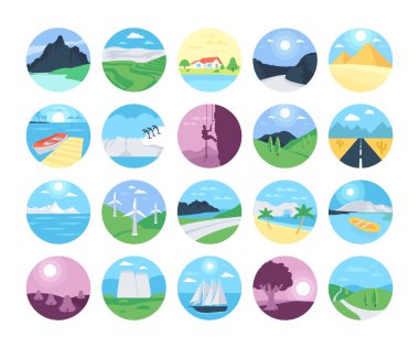
Colorful landscape with mountain vectors, lake and trees. This Landscapes Vector Icons set will make you want to go backpacking now and leave it all behind.

Forest and house lowpoly scene

Illustration of a child with a backpack and a watch near the hills

A fresh view of nature and greenery

Winter sports icons

Sri Lanka Physical Map Isolated on White. No text - High detail map of Sri Lanka - Vector illustration.

North America map, Vector illustraton

Illustration of the different landforms

A fresh view of nature and greenery

Road colored Vector Icon

Illustration of calm green tone color mountains with lake

Flat Icon of Landscape 3

Scene with cliff and plain illustration

Abstract weather map. Vector background concept with dotted lines

River colored Vector Icon

Creative vector illustration of a conceptual landmass

Illustration of a young boy at the riverbank holding a plastic full of fishes

Forest and camping tent lowpoly

Nature geographic landscape vector illustration

A fresh view of nature and greenery

Desert forest landscape at daytime scene with desert animals and plants illustration

Different scenes with desert forest landscape with animals and plants illustration
Weather map background concept. Vector abstract illustration

Different desert forest scenes with animals and plants illustration

Trees and mountains at the forest

Different desert forest scenes with animals and plants illustration

Road through the desert forest landscape scene with desert animals illustration

Different desert forest landscape scenes with various desert plants illustration

Desert forest landscape at daytime scene with desert animals and plants illustration

Different desert forest landscape scenes with animals and plants illustration

Four different desert forest landscape scenes with animals and plants illustration

Different desert forest scenes with animals and plants illustration

Different desert forest landscape scenes with animals and plants illustration

Island colored Vector Icon

A pathway going to the mountains
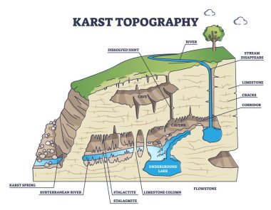
Karst topography as geological underground cave formation explanation outline diagram. Labeled educational detailed ground structure with limestone cavern, stalactite or stalagmite vector illustration
Blue topographic background pattern with topographic or isolines.
Grey contours vector topography. Geographic mountain topography vector illustration. Topographic pattern texture. Map on land vector terrain. Elevation graphic contour height lines.
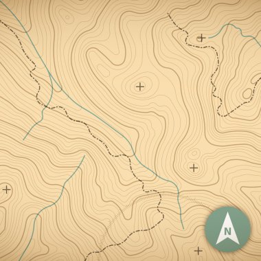
Topographic map background concept with space for your copy.
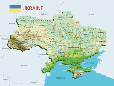
Topographic map of Ukraine. Geographic map of Ukraine with borders of the regions. High detailed Ukraine physical map with labeling. Atlas of Ukraine with rivers, lakes, seas, mountains and plains.Vector illustration

Glyph icon of roadside fields

Line icon of valley

A fresh view of nature and greenery, valley icon vector

A grassland with beautiful trees range, meadow flat icon image

A beautiful landscape of mountains with sun and clouds

A pathway going to the mountains
Contour illustration. Abstract topographic map background. Geography scheme.

Chinese handwritten title font design, "Taiwan Mountains", characteristic handwritten calligraphy font style, natural theme of mountains and landforms. Small Chinese character "Taiwan".

Sri Lanka Physical Map - High detail map of Sri Lanka - Vector illustration.

Landscape nature mountain beautiful illustration.

Lake Clark National Park Emblem patch logo illustration
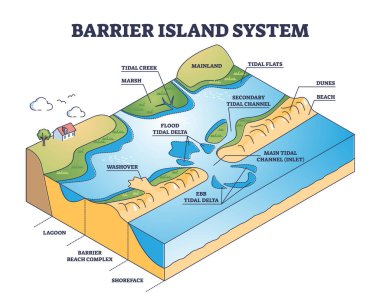
Barrier island systems as dune type and coastal landforms outline diagram. Labeled educational beach with lagoon and shoreface structure formation description from geological side vector illustration.

Dale valley glyph icon

Different desert forest scenes with various desert plants illustration

Palmyra colored Vector Icon

Pattern depicting different planets in space. Seamlessly repeatable.

Grey contours vector topography. Geographic mountain topography vector illustration. Topographic pattern texture. Map on land vector terrain. Elevation graphic contour height lines.

A group of different landforms

Elevation line pattern. topographic terrain map

A beautiful view of mountains and grassland, countryside

Mountain formation. Tectonic Plates collide, buckle and fold, forming mountains. Vector illustration

Road landscape line icon

This is a serene abstract landscape artwork featuring gentle rolling hills and a soft sun portrayed in pastel colors

Grey contours vector topography. Geographic mountain topography vector illustration. Topographic pattern texture. Map on land vector terrain. Elevation graphic contour height lines.

Grey contours vector topography. Geographic mountain topography vector illustration. Topographic pattern texture. Map on land vector terrain. Elevation graphic contour height lines.

Different desert forest landscape scenes with animals and plants illustration

Illustration of different rocks and stones

Dense forest with various types of trees

A beautiful landscape of mountains with sun and clouds

Glyph icon of valley

Formation of natural levees infographic

Frisco Colorado united states of america

Depositional landforms and sediment created relief area types outline diagram. Labeled educational scheme with gulf, peninsula, delta, bay and island water geological formation vector illustration.

Grey contours vector topography. Geographic mountain topography vector illustration. Topographic pattern texture. Map on land vector terrain. Elevation graphic contour height lines.

Grey contours vector topography. Geographic mountain topography vector illustration. Topographic pattern texture. Map on land vector terrain. Elevation graphic contour height lines.

Grey contours vector topography. Geographic mountain topography vector illustration. Topographic pattern texture. Map on land vector terrain. Elevation graphic contour height lines.

Waterfall Flat Vector Icon

Illustration of river landforms diagram

River and mountains lowpoly scene

Grey contours vector topography. Geographic mountain topography vector illustration. Topographic pattern texture. Map on land vector terrain. Elevation graphic contour height lines.

Mountain set. Isolated mountain peaks vector
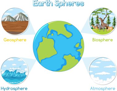
Vector graphic depicting geosphere, biosphere, hydrosphere, atmosphere.

Green Wheat Fields, Auvers by Vincent van Gogh, 189

Vector illustration of inland relief types - landforms: mountains, rivers and sea.

Landscape Flat Vector Icons Set

Landform types plain, valley, hill, mountain, canyon, and plateau for teaching geography and Earth science diagram hand drawn schematic vector. Science educational illustration

A beautiful landscape of mountains with sea waves

A beautiful landscape of mountains with sun and clouds