Map of faroe Islands. High detailed vector map - faroe Islands.

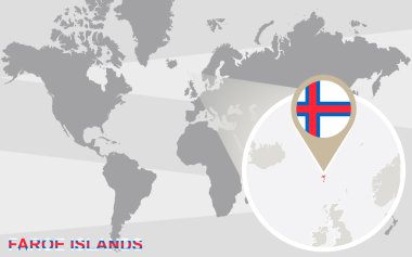
Map of Faroe Islands on political world map with magnifying glass

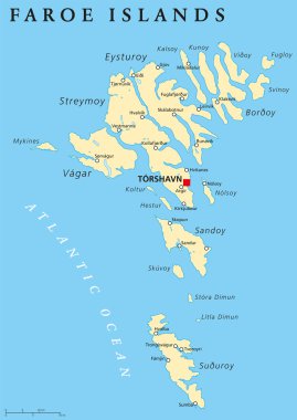
Faroe Islands political map with capital Torshavn, also the Faeroes. Autonomous country and part of the Kingdom of Denmark. Archipelago in North Atlantic. Gray illustration. English labeling. Vector.

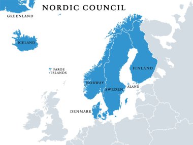
Nordic Council members, political map. Cooperation among the Nordic states Denmark, Finland, Iceland, Norway and Sweden, the autonomous territories Faroe Islands and Greenland, and the region Aland.

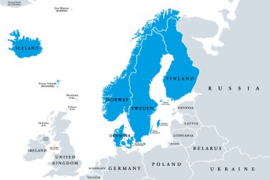
Scandinavia, political map. A subregion in Northern Europe, most commonly referring to Denmark, Norway, and Sweden, and more broadly also with Aland, Faroe Islands, Finland and Iceland. Illustration.

Map of Faroe Islands - vector illustration

White map markers with flags - Europe. Original colors

Nordic Council countries and territories flags. Finland, Iceland, Norway, Faroe Islands, Sweden, Denmark, Aland Islands, and Greenland. Vector icon set.

Abstract mash line and point scales on dark background with Map of faroe Islands. Wire frame 3D mesh polygonal network line, design sphere, dot and structure. communications map of faroe Islands. Vector.

Black map markers with flags - Europe. Original colors

Map of Faroe Islands. High Detailed Silhouette Map - Vector

Map of Faroe Islands with flag - vector illustration

Faroe Islands Map Flag. Map of Faroes with flag isolated on white background. Autonomous territory within the Kingdom of Denmark. Vector illustration.

Faroe Islands political map with capital Torshavn and important cities. English labeling and scaling. Illustration.

World map with magnified Faroe Islands. Faroe Islands flag and map.

Set of Faroe Islands pin, icon and map pointer flags. Vector illustration

Rectangular Maps of Europe with Flag Pins. Europe Map Collection.

Faroe Islands Map Pin with National Flag on Open World Map.

Streymoyar, Suduroyar, Vago outline maps

Eysturoyar, Norderoerne, Sandoyar outline maps

Europe with selected Faroe Islands map and Faroe Islands flag icon.

Faroe Islands grey map isolated on white background with abstract mesh line and point scales. Vector illustration eps 10

Faroe Islands Highlighted on Europe Map with Flag Icon.

Alphabetically Ordered European Flags in Modern Design. National flags collection

Detailed Faroe Islands Map Collection with Outline, Silhouette, Regions, and Flag Overlay Variations

National Flags of the European countries, Postage Flag Set. European Flags with World Map.

Road map of the Faroe Islands North Atlantic Archipelago with flag, Denmark

Vector maps and flags of Europe countries with administrative divisions (regions borders)

Faroe Islands map vector illustration, scribble sketch Faroe Islands

Denmark political map of administrative divisions - regions. Grey blank vector editable map EPS.