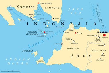
Sunda Strait, Indonesia, political map. Strait between the Indonesian islands Java and Sumatra, connecting Java Sea with the Indian Ocean. With Krakatau Archipelago and active volcano Anak Krakatau.
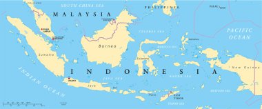
Political map of Malaysia and Indonesia with capitals Kuala Lumpur and Jakarta, with national borders and lakes. Vector illustration with English labeling and scaling.

Indonesia is depicted on a folded paper map and pinned location marker with flag of Indonesia.

Indonesia map, black and white detailed outline regions of the country. Vector illustration
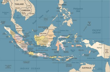
Indonesia Map - Vintage Detailed Vector Illustration

Stylized map of Indonesia. Isometric 3D green map with cities, borders, capital Jakarta, regions. Vector illustration. Editable layers clearly labeled. English language.

World map with magnified Indonesia. Indonesia flag and map.
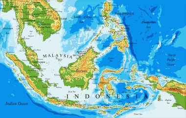
Highly detailed physical map of Indonesia,in vector format,with all the relief forms,countries and big cities
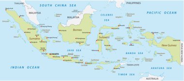
Map of Indonesia with the provinces

Indonesia map hand drawn sketch. Vector concept illustration flag, childrens drawing, scribble map. Country map for infographic, brochures and presentations isolated on white background. Vector
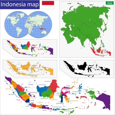
Map of the Republic of Indonesia with the provinces colored in bright colors

Indonesia Map - Vintage Detailed Vector Illustration

Pacific Centered World map with magnified Indonesia. Flag and map of Indonesia.

Indonesia detailed map shape, Flat web graphic concept icon symbol vector illustration .

Indonesia Map - Detailed Vector Illustration

Map of Indonesia with the provinces

Location of Indonesia on Southeast Asia

City map Jakarta, travel vector poster design

Downtown vector map of Jakarta, Indonesia. This printable map of Jakarta contains lines and classic colored shapes for land mass, parks, water, major and minor roads as such as major rail tracks.
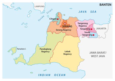
Banten administrative and political vector map, Indonesia

Colorful Jakarta administrative and political map

Colourful Watercolour Map design of Country Indonesia isolated on white background - vector illustration
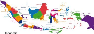
Map of the Republic of Indonesia with the provinces colored in bright colors
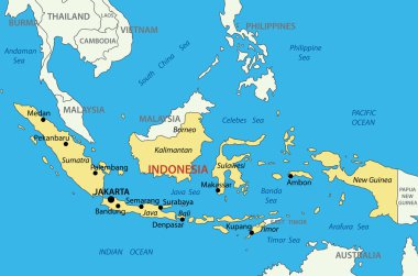
Republic of Indonesia - vector map

Indonesia Map - Detailed Info Graphic Vector Illustration

Indonesia Map - Vintage Detailed Vector Illustration

Indonesia country vector color map

Colorful Jakarta administrative and political map with coat of arms.
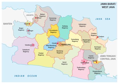
Jawa Barat, West Java administrative and political vector map, Indonesia

Indonesia detailed map shape, Flat web graphic concept icon symbol vector illustration .

Asia with selected Indonesia map and Indonesia flag icon.
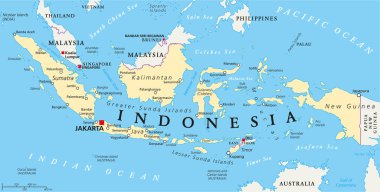
Indonesia political map with capital Jakarta, national borders and important cities. English labeling and scaling. Illustration.

Indonesia map and flag - highly detailed vector illustration

Indonesia - blue map with neighboring countries and names. Vector illustration

Vector map of the Indonesian megacity (urban area) Jabodetabek

Indonesia map and flag - highly detailed vector illustration

Map of Indonesia and national flag in a circle. Indonesia map contour with flag. Vector Illustration.

Blue-gray detailed map of Indonesia administrative divisions and location on the globe. Vector illustration

Map of administrative divisions of Indonesia

Outline Indonesia map with provinces

Black Indonesia map separated on the provinces

Indonesia map with provinces and capital cities

Indonesia map, administrative division with names regions, colors map isolated on white background vector

Bali high detailed map. Island silhouette icon. Isolated Bali black map outline. Vector illustration.

Map of administrative divisions of Indonesia

Abstract vector illustrations of Singapore, Kuala Lumpur, Bangkok, Jakarta and Manila skylines at night (with flags and maps of their countries) in black and white color palette

Vector map of the Indonesian islands of Java and Bali

Indonesia map and flag in white background

Indonesia round sign. Futuristic satelite view of the world centered to Indonesia. Country badge with map, round text and binary background. Authentic vector illustration.

Mail to/from Indonesia

Vector map of the rail transit systems of the Indonesian capital Jakarta

Indonesia map with flag inside and ribbon

Bintan Island map. Blank vector map of the Island. Borders of Bintan Island for your infographic. Vector illustration.

Vector map of Indonesia. High detailed country map with division, cities and capital Jakarta. Political map, world map, infographic elements.

Bali - communication network map of island. Bali trendy geometric design on dark background. Technology, internet, network, telecommunication concept. Vector illustration.

Flag of Indonesia - vector illustration

Vector map of the Indonesian megacity (urban area) Jabodetabek

Vector road and national park map of the Indonesian island java

City map Jakarta, monochrome detailed plan, vector illustration

Flag of Indonesia as a country with a shadow

Indonesia map. Country poster with colored regions. Old grunge texture. Vector illustration of Indonesia with country name.

Indonesia polygonal map. Mosaic style maps collection. Bright abstract tessellation, geometric, low poly, modern design. Indonesia polygonal maps for infographics or presentation.

Low poly map of Bali. Geometric illustration of the island. Bali polygonal map. Technology, internet, network concept. Vector illustration.

Bali map. Map of the island with beautiful geometric waves in red blue colors. Vivid Bali shape. Vector illustration.
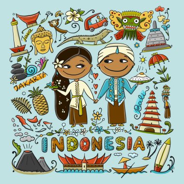
Travel to Indonesia. Greeting card for your design. Vector illustration

Magnifying glass showing a map of Indonesia on a world map.

Lombok map. Island silhouette icon. Isolated Lombok black map outline. Vector illustration.

Lombok high detailed map. Island silhouette icon. Isolated Lombok black map outline. Vector illustration.

Thailand Famous Landmarks Infographic Templates for Traveling Minimal Style and Icon, Symbol Set Vector Illustration Can be use for Poster Travel book, Postcard, Billboard

Sumba map. Island silhouette icon. Isolated Sumba black map outline. Vector illustration.

Sumatra map. Island silhouette icon. Isolated Sumatra black map outline. Vector illustration.

Lembeh map. Island silhouette icon. Isolated Lembeh black map outline. Vector illustration.

Polygonal map of Bintan Island. Geometric illustration of the island in emerald amethyst colors. Bintan Island map in low poly style. Technology, internet, network concept. Vector illustration.

Map of world with main cities in gray

Sumatra icon. Island map on dark background. Stylish Sumatra map with island name. Vector illustration.
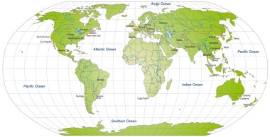
Map of world with main cities in green

Map of world with borders in green

3d verctor map of cities and roads in Asia. Countries and their neighbors.

Map of world with borders in pastel green

Map of world with main cities in green

Map of world with borders with bright colors

Jakarta Indonesia City Map in Black and White Color. Outline Map. Vector Illustration.

Explore jakarta maps with isometric style and pin location tag on top vector illustration

Map of world with borders in green

Map of world with main cities in green

Jakarta Indonesia City Map in Retro Style. Outline Map. Vector Illustration.

Map of world with borders as scrible

Map of world with abstract background in green

Map of world with abstract background in blue

Map of world with main cities in pastel orange

Map of world with main cities in green

Map of world with borders with bright colors
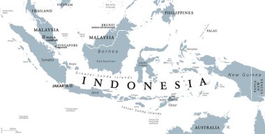
Indonesia political map with capital Jakarta, islands, neighbor countries Malaysia, Singapore, Brunei, East Timor and capitals. Gray illustration with English labeling on white background. Vector.

Illustrated map of Indonesia with cities and landmarks. Editable vector illustration

Indonesia map with cities. Luminous dots - neon lights on dark background. Vector illustration.

Megacities of the world, political map. Largest cities with more than ten million people. Metropolitan areas Tokyo, Shanghai and Jakarta with most inhabitants. English labeling. Illustration. Vector.

Java high detailed map. Island silhouette icon. Isolated Java black map outline. Vector illustration.

Map of world with borders in antique

Netherlands Map - Detailed Info Graphic Vector Illustration

Indonesia map in gray on a white background