10 FREE IMAGES of ShutterstockTry Shutterstock and Get 10 Free Images

map peru SVG, Vector And Clipart Images

() map peru SVG Vectors and Transparent background map peru ClipArts. All Download the royalty free graphic in the form of SVG, PNG, EPS, AI or PSD.

Description:

This SVG clipart features a detailed map of Peru, showcasing its geographical outlines and major cities. Designed in a format compatible with various design software, this vector graphic can be easily resized without losing quality. The style is flat, making it suitable for both modern and traditional design projects. With clear demarcations, this map serves to enhance educational materials or travel brochures. It can also be utilized for apps and websites focusing on geographic education. Offering a clean and informative representation, this SVG is versatile for multiple applications.

Usage ideas:

This Peru map SVG can be employed in various commercial and educational contexts. For instance, educators can use it in lesson plans about South America, while businesses may integrate it into travel websites to show routes and attractions. Designers can incorporate it into promotional materials for tourism, such as brochures or social media campaigns. Additionally, app developers can utilize this map for location-based services or games. Overall, this clipart serves a wide array of purposes, enhancing both digital and print projects.

Peru map flag glass card paper 3D vector clipart svg vector

Peru map flag glass card paper 3D vector

Peru vector set. Detailed country shape with region borders, flags and icons isolated on white background. clipart svg vector

Peru vector set. Detailed country shape with region borders, flags and icons isolated on white background.

Map of Peru clipart svg vector
Map of Peru

Grunge rubber stamp with the name and map of Peru, vector illustration clipart svg vector

Grunge rubber stamp with the name and map of Peru, vector illustration

Vintage America map with country inscription united states, canada, mexico, brasil, peru, argentina drawing on dirty paper background clipart svg vector

Vintage America map with country inscription united states, canada, mexico, brasil, peru, argentina drawing on dirty paper background

Vector set of Peru country.  Isometric 3d map, Peru map, South America map - with region, state names and city names. clipart svg vector

Vector set of Peru country. Isometric 3d map, Peru map, South America map - with region, state names and city names.

Gray South America map with the countries labels clipart svg vector

Gray South America map with the countries labels

Flag of PERU in abstract glossy globe in background. Vector illustration clipart svg vector

Flag of PERU in abstract glossy globe in background. Vector illustration

High Quality map of Ucayali is a province of Peru, with borders of the districts clipart svg vector

High Quality map of Ucayali is a province of Peru, with borders of the districts

Peru blank detailed outline map set clipart svg vector

Peru blank detailed outline map set

Peru Map - Vintage Detailed Vector Illustration clipart svg vector

Peru Map - Vintage Detailed Vector Illustration

Peru map and words cloud with larger cities clipart svg vector

Peru map and words cloud with larger cities

Peru country black outline silhouettes in three different levels of smoothness. Simplified maps. Vector icons isolated on white background. clipart svg vector

Peru country black outline silhouettes in three different levels of smoothness. Simplified maps. Vector icons isolated on white background.

High Quality map of Piura is a province of Peru, with borders of the districts clipart svg vector

High Quality map of Piura is a province of Peru, with borders of the districts

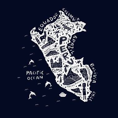
Hand drawn Peru map with the main symbols and the geographic names lettering. Vector illustration. clipart svg vector

Hand drawn Peru map with the main symbols and the geographic names lettering. Vector illustration.

Peru-highly detailed physical map clipart svg vector

Peru-highly detailed physical map

Peru map outline with stars and lines abstract framework. Communication, connection concept. Modern futuristic low polygonal, wireframe, lines and dots design. Vector illustration. clipart svg vector

Peru map outline with stars and lines abstract framework. Communication, connection concept. Modern futuristic low polygonal, wireframe, lines and dots design. Vector illustration.

Peru map icon vector illustration symbol design clipart svg vector

Peru map icon vector illustration symbol design

Political map of South America. Vector illustration. clipart svg vector

Political map of South America. Vector illustration.

Map Latin America. Poster map of Latin America. Black and white print map of Latin America for t-shirt, poster or geographic themes. Hand-drawn graphic map with countries. Vector Illustration clipart svg vector

Map Latin America. Poster map of Latin America. Black and white print map of Latin America for t-shirt, poster or geographic themes. Hand-drawn graphic map with countries. Vector Illustration

Vector map of Peru. Country map with division, cities and capital Lima. Political map,  world map, infographic elements. clipart svg vector

Vector map of Peru. Country map with division, cities and capital Lima. Political map, world map, infographic elements.

Vector Illustration of the National Emblem of the Republic of Peru clipart svg vector

Vector Illustration of the National Emblem of the Republic of Peru

Flat treasure map of Peru. Colorful cartoon with icons of ship, jolly roger, treasure chest and banner ribbon. Flat design vector illustration. clipart svg vector

Flat treasure map of Peru. Colorful cartoon with icons of ship, jolly roger, treasure chest and banner ribbon. Flat design vector illustration.

Peru map blackboard chalkboard vector clipart svg vector
Peru map blackboard chalkboard vector

Cartoon map of Peru. Vector illustration with all main symbols of the country. clipart svg vector
Cartoon map of Peru. Vector illustration with all main symbols of the country.

Vector map of South America with flags and location on world map clipart svg vector
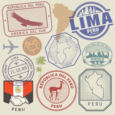
Vector map of South America with flags and location on world map

Travel stamps or symbols set Peru, South America theme, vector illustration clipart svg vector

Travel stamps or symbols set Peru, South America theme, vector illustration

Soccer jersey or football kit, template for Peru National Football Team. Front and back view soccer uniform. Flat football logo on Peru flag label and map in hexagon pattern. Vector Illustration. clipart svg vector

Soccer jersey or football kit, template for Peru National Football Team. Front and back view soccer uniform. Flat football logo on Peru flag label and map in hexagon pattern. Vector Illustration.

Flag of Peru from brush strokes and Blank map Peru. High quality map of Peru  and flag on transparent background. Stock vector. Vector illustration EPS10. clipart svg vector

Flag of Peru from brush strokes and Blank map Peru. High quality map of Peru and flag on transparent background. Stock vector. Vector illustration EPS10.

Peru  infographics, statistical data, sights. Vector illustration clipart svg vector

Peru infographics, statistical data, sights. Vector illustration

Peru on map, top view of colorful travel essentials on table clipart svg vector

Peru on map, top view of colorful travel essentials on table

America Map in Typography word cloud concept clipart svg vector
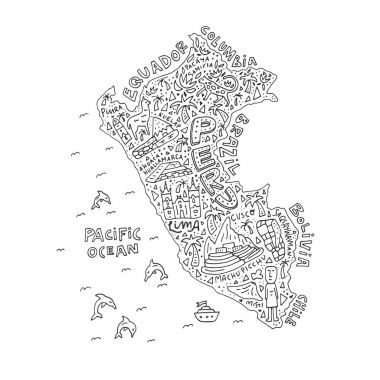
America Map in Typography word cloud concept

Hand drawn Peru map with the main symbols and the geographic names lettering. Vector illustration. clipart svg vector

Hand drawn Peru map with the main symbols and the geographic names lettering. Vector illustration.

South American in traditional outfit clipart svg vector

South American in traditional outfit

Energy industry and ecology of Peru vector map with power stations infographic. clipart svg vector

Energy industry and ecology of Peru vector map with power stations infographic.

Abstract stamp with text Original Product of Peru, vector illustration clipart svg vector

Abstract stamp with text Original Product of Peru, vector illustration

Map of Peru with borders in gray clipart svg vector
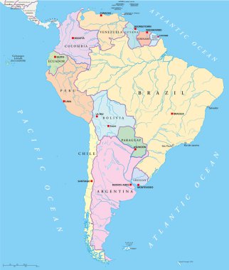
Map of Peru with borders in gray

Political map of South America with single states,capitals, national borders, lakes and rivers. Vector illustration with English labeling and scaling. clipart svg vector

Political map of South America with single states,capitals, national borders, lakes and rivers. Vector illustration with English labeling and scaling.

Travel around the  world. Peru. Watercolor map clipart svg vector

Travel around the world. Peru. Watercolor map

Map of Peru network. Vector illustration clipart svg vector

Map of Peru network. Vector illustration

Map of South America. Political division - countries and capital ciites. Countries are separate objects, you can change color of every country. clipart svg vector

Map of South America. Political division - countries and capital ciites. Countries are separate objects, you can change color of every country.

Hand drawn vector map of South America with flags. Elements different layers. Perfect for infographics. Includes Brazil, Argentina, Chile, Paraguay, Uruguay, Colombia, Venezuela, Peru, Ecuador. clipart svg vector

Hand drawn vector map of South America with flags. Elements different layers. Perfect for infographics. Includes Brazil, Argentina, Chile, Paraguay, Uruguay, Colombia, Venezuela, Peru, Ecuador.

High quality map of Peru with borders of the regions clipart svg vector

High quality map of Peru with borders of the regions

The Peru map divided into regions with labels clipart svg vector
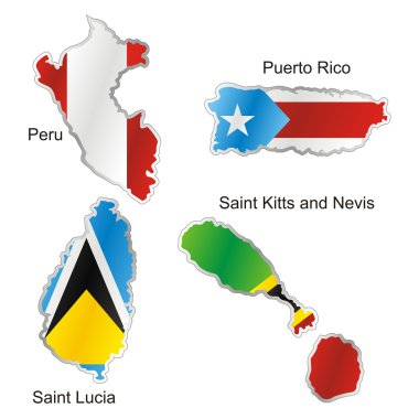
The Peru map divided into regions with labels

Fully editable vector illustration of isolated international flag in map shape clipart svg vector

Fully editable vector illustration of isolated international flag in map shape

Road vector map of the brazilian state amazonas clipart svg vector
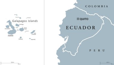
Road vector map of the brazilian state amazonas

Ecuador political map with capital Quito and the Galapagos Islands in the Pacific Ocean. Republic in South America. Gray illustration with English labeling on white background. Vector. clipart svg vector

Ecuador political map with capital Quito and the Galapagos Islands in the Pacific Ocean. Republic in South America. Gray illustration with English labeling on white background. Vector.
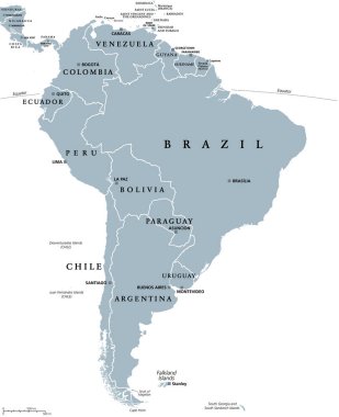
South America, gray political map with international borders and capitals. A continent, bordered by the Pacific and Atlantic Ocean, North America and the Caribbean Sea. Isolated illustration. Vector. clipart svg vector

South America, gray political map with international borders and capitals. A continent, bordered by the Pacific and Atlantic Ocean, North America and the Caribbean Sea. Isolated illustration. Vector.

Chile map, black and white detailed outline regions of the country. Vector illustration clipart svg vector
Chile map, black and white detailed outline regions of the country. Vector illustration

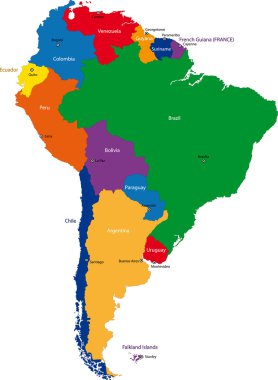
Colorful South America map with countries and capital cities clipart svg vector

Colorful South America map with countries and capital cities

Illustration of a gray South america map on white background clipart svg vector

Illustration of a gray South america map on white background

South America political division map - vector illustration. clipart svg vector

South America political division map - vector illustration.

Blue-green detailed map of Ecuador administrative divisions with country flag and location on the globe. Vector illustration clipart svg vector

Blue-green detailed map of Ecuador administrative divisions with country flag and location on the globe. Vector illustration

Map of south america. map concept south america vector sketch clipart svg vector

Map of south america. map concept south america vector sketch

Map of South America in high resolution. Vector illustration. clipart svg vector

Map of South America in high resolution. Vector illustration.

Republic of Peru road and national park map clipart svg vector

Republic of Peru road and national park map

Latin America single states map. All countries in different full intense colors and with national borders. From northern border of Mexico to the southern tip of South America, including the Caribbean. clipart svg vector

Latin America single states map. All countries in different full intense colors and with national borders. From northern border of Mexico to the southern tip of South America, including the Caribbean.

Blank political map of South America. Simple flat vector outline map. clipart svg vector
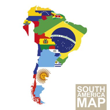
Blank political map of South America. Simple flat vector outline map.

South America map. Vector map of South America with flags. Vector Illustration. clipart svg vector

South America map. Vector map of South America with flags. Vector Illustration.

Map with highlighted Peru map and flag clipart svg vector

Map with highlighted Peru map and flag

Vector halftone Dotted map of Peru country for your design, Travel Illustration concept. clipart svg vector

Vector halftone Dotted map of Peru country for your design, Travel Illustration concept.

Color and black and white detailed map of South America with country silhouettes and flags clipart svg vector

Color and black and white detailed map of South America with country silhouettes and flags

Administrative divisions of Peru clipart svg vector

Administrative divisions of Peru

South America countries political map with national borders. Continent surrounded by Pacific and Atlantic Ocean. English labeling. Illustration. clipart svg vector

South America countries political map with national borders. Continent surrounded by Pacific and Atlantic Ocean. English labeling. Illustration.
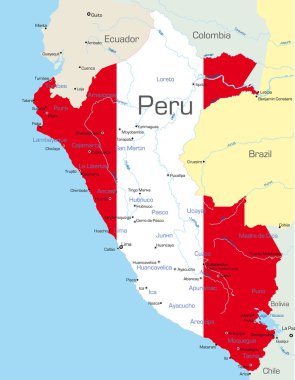
Abstract vector color map of Peru country colored by national flag clipart svg vector

Abstract vector color map of Peru country colored by national flag

Highly Detailed South America Blind Map With Capital Dots. clipart svg vector

Highly Detailed South America Blind Map With Capital Dots.

The illustration of South America map with country borders. Vector Image. clipart svg vector

The illustration of South America map with country borders. Vector Image.

Lima metropolitan area administrative and political map in spanish language clipart svg vector

Lima metropolitan area administrative and political map in spanish language

Vector color map of South America clipart svg vector

Vector color map of South America

Peru map and country name isolated on white background. Vector illustration. clipart svg vector
Peru map and country name isolated on white background. Vector illustration.

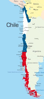
Abstract vector color map of Chile country colored by national flag clipart svg vector

Abstract vector color map of Chile country colored by national flag

Abstract vector color map of Argentina country clipart svg vector

Abstract vector color map of Argentina country

South American flag set in alphabetical order, with an editable map. clipart svg vector

South American flag set in alphabetical order, with an editable map.

South America Region. Map of countries in southern America. Vector illustration. clipart svg vector

South America Region. Map of countries in southern America. Vector illustration.

Administrative divisions of Peru clipart svg vector

Administrative divisions of Peru

Political map of Peru with capital Lima, national borders, most important cities, rivers and lakes. Vector illustration with English labeling and scaling. clipart svg vector

Political map of Peru with capital Lima, national borders, most important cities, rivers and lakes. Vector illustration with English labeling and scaling.
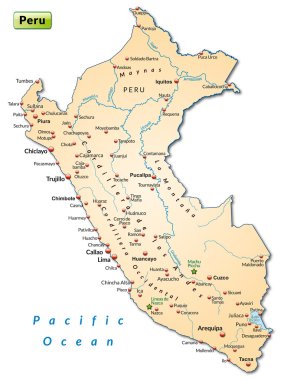
Map of Peru as an overview map in pastel orange clipart svg vector

Map of Peru as an overview map in pastel orange

Vector highly detailed political map of Latin America and their capitals. All elements are separated in editable layers clearly labeled. EPS 10 clipart svg vector

Vector highly detailed political map of Latin America and their capitals. All elements are separated in editable layers clearly labeled. EPS 10

Highly Detailed South America Blind Map. clipart svg vector
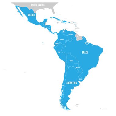
Highly Detailed South America Blind Map.

Political map of Latin America. Latin american states blue highlighted in the map of South America, Central America and Caribbean. Vector illustration. clipart svg vector

Political map of Latin America. Latin american states blue highlighted in the map of South America, Central America and Caribbean. Vector illustration.

Vector map of South America Continent with Countries, Capitals, Main Cities and Seas and islands names in brilliant colors. clipart svg vector

Vector map of South America Continent with Countries, Capitals, Main Cities and Seas and islands names in brilliant colors.

Map of South America with indication of Peru clipart svg vector

Map of South America with indication of Peru

South America continent is divided by country on the Globe clipart svg vector

South America continent is divided by country on the Globe

Black Location Map of the Peruan Department of La Libertad within Grey Map of Peru clipart svg vector

Black Location Map of the Peruan Department of La Libertad within Grey Map of Peru

Set of vector polygonal Peru maps. Bright gradient map of country in low poly style. Multicolored Peru map in geometric style for your infographics. clipart svg vector

Set of vector polygonal Peru maps. Bright gradient map of country in low poly style. Multicolored Peru map in geometric style for your infographics.

Vector map of Chile country clipart svg vector

Vector map of Chile country

Vector high detailed map of South America. All layers detached and labeled. clipart svg vector

Vector high detailed map of South America. All layers detached and labeled.

Highly detailed physical map of the South America continent clipart svg vector

Highly detailed physical map of the South America continent

Peru high detailed map. Country silhouette icon. Isolated Peru black map outline. Vector illustration. clipart svg vector

Peru high detailed map. Country silhouette icon. Isolated Peru black map outline. Vector illustration.

Latin America single states political map. Countries in different colors, with national borders and English country names. From Mexico to the southern tip of South America, including the Caribbean. clipart svg vector

Latin America single states political map. Countries in different colors, with national borders and English country names. From Mexico to the southern tip of South America, including the Caribbean.

Map with the main roads and rivers of Colombia clipart svg vector

Map with the main roads and rivers of Colombia

South America, multi colored political map with international borders and capitals. Continent, bordered by the Pacific and Atlantic Ocean, North America and the Caribbean Sea. Isolated illustration. clipart svg vector

South America, multi colored political map with international borders and capitals. Continent, bordered by the Pacific and Atlantic Ocean, North America and the Caribbean Sea. Isolated illustration.

Peru regions Map black illustration clipart svg vector

Peru regions Map black illustration

Map of the Republic of Peru with the regions colored in bright colors and the main cities clipart svg vector
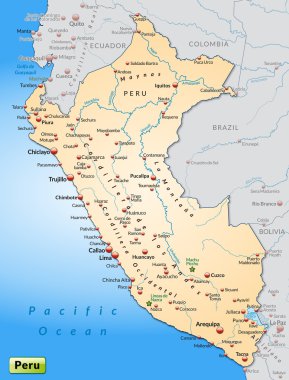
Map of the Republic of Peru with the regions colored in bright colors and the main cities

Map of Peru as an overview map in pastel orange clipart svg vector

Map of Peru as an overview map in pastel orange

Political map of South America with all countries and national borders. Blue outline illustration on white background and english scaling. clipart svg vector

Political map of South America with all countries and national borders. Blue outline illustration on white background and english scaling.

Colombia map, black and white detailed outline regions of the country. Vector illustration clipart svg vector

Colombia map, black and white detailed outline regions of the country. Vector illustration

Vector highly detailed political map of Latin America and their capitals. All elements are separated in editable layers clearly labeled. EPS 10 clipart svg vector

Vector highly detailed political map of Latin America and their capitals. All elements are separated in editable layers clearly labeled. EPS 10

South America - highly detailed map. Vector illustration clipart svg vector

South America - highly detailed map. Vector illustration

Republic of Peru - vector map clipart svg vector

Republic of Peru - vector map