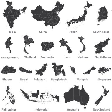
High detailed vector maps of asian countries, Australia and New Zealand

Gray Myanmar map on light grey background. Gray Myanmar map - vector illustration.

Myanmar - detailed map of the country in brown colors, divided into regions. Vector illustration

Pastel Colored Labeled Flat Provinces Map of Asian Country of Myanmar

Asian countries set, maps and flags, Part 2

Yangon Myanmar Asia City map black white vector illustration

Asian Economic Community, Association of Southeast Asia map vector Illustration

World map illustration, vector, Myanmar

Realistic watercolor painting flag of ASEAN ( Association of Southeast Asian Nations ) and membership on isolated background . Vector .

Burma Myanmar map flag glass card paper 3D raster

Illustration of cartoon infographic of myanmar asean community. Use for icons and infographic. Contain traditional costume national flower animal food and landmark.

Myanmar map in gray on a white background
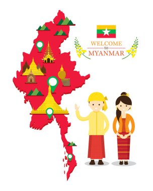
Culture, Travel and Tourist Attraction

Myanmar Travel Landmarks. Vector and Illustration

Flat design elements. vector illustration

Myanmar ( Republic of the Union of Myanmar ) ( flag and map ) ( transportation and tourism concept ) , Myanmar is one of AEC ( ASEAN Economic Community )

AEC asean economic community world map.vector illustration

Map of Union of Myanmar (Burma) with the provinces colored in bright colors

Burma - vector map

Abstract rounded World Map with pinned detailed Myanmar map. Map and flag of Burma. Vector Illustration.

AEC asean economic community world map.vector illustration

Vector Myanmar Map card paper on blue background, high detailed

Infographic for Myanmar, detailed map of Myanmar with flag. Vector Info graphic green map.

Myanmar administrative blue-green map with country flag and location on a globe. Vector illustration

Myanmar political map with capital Naypyidaw. English labeling. Republic of the Union of Myanmar, also known as Burma. Country and sovereign state in Southeast Asia. Gray illustration. Vector.

Myanmar Location Highlighted on Asian Map with Flag Icon.

Myanmar map with waving flag of country. Vector illustration.

Isometric Map of Myanmar. Simple 3D Map. Vector Illustration - EPS 10 Vector

Myanmar Map Pin with National Flag on Open World Map.

Myanmar Travel Landmarks. Vector and Illustration

Myanmar Travel Landmarks. Vector and Illustration
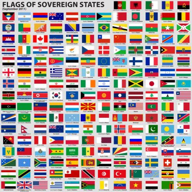
Vector set of Flags of world sovereign states (September 2011). New flags of Libya, South Sudan, Myanmar, Malawi.

Vector illustration of Asia continent map with countries mixed with their national flags

Culture, Travel and Tourist Attraction

Detailed map of the Tibet Autonomous Region, China

Color map of Southeastern Asia divided by the countries
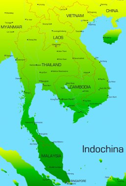
Vector map of Indochina countries

ASEAN Economic Community, AEC, map. Grey map with blue highlighted member countries, Southeast Asia. Vector illustration.

Thailand road vector map

Map of Southeast Asia. Vector map in shades of grey.
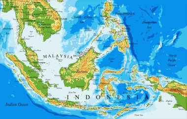
Highly detailed physical map of Indonesia,in vector format,with all the relief forms,countries and big cities

Asian Economic Community, Association of Southeast Asia map doodle ,vector Illustration

South East Asia political map. Black outline on white background. Simple flat vector illustration.

Vector Map of the combined catchment areas of the Ganges, Brahmaputra and Meghna rivers.

Landmarks, Travel and Tourist Attraction

Myanmar vector road map with important cities

Vector map of Southeast Asia.

Asian Economic Community, Association of Southeast Asia map vector Illustration

Landmarks, Travel and Tourist Attraction

Asean Map dotted with Flags illustration, for background (AEC, AFTA, ASEAN), easy to modify

Southeast Asia Region. Colorful map of countries in southeastern Asia. Vector illustration.

Colorful flag, map pointer and map of Myanmar in the colors of the Myanmar flag. High detail. Vector illustration

Vector color southeast asia map

Travel and tourism background. Vector flat illustration

Travel and tourism background. Vector flat illustration

Vector map of the states of southeast asia.

Map of Southeast Asia. Vector map in shades of green.

South East Asia political map. Black outline on white background with black country name labels. Simple flat vector illustration.

Highly detailed Myanmar physical map with labeling.

Map of Southeast Asia. Vector map in shades of turquoise blue.

Vector map of south east asian countries mixed with their national flags

Vector map of Southeast Asia.

Southeast Asia Region. Map of countries in southeastern Asia. Vector illustration.

Association of southeast asian nations (ASEAN) map with flags

Mainland Southeast Asia, northern part of formerly known Indochina, political map. The countries Thailand, Vietnam, Myanmar, Laos, and Cambodia, with borders, their capitals and largest and cities.

ASEAN Economic Community, AEC, map. Grey map with green highlighted member countries, Southeast Asia. Vector illustration.

Southeast Asia Region. Map of countries in southeastern Asia. Vector illustration.

Southeast Asia Region. Map of countries in southeastern Asia. Vector illustration.

Cartoon map of Asean, asia, AEC

Globe centered to Myanmar. Country highlighted with green color on world map. Satellite projection view. Vector illustration.

Asia countries flags in pointer icons

Myanmar round sign. Futuristic satelite view of the world centered to Myanmar. Country badge with map, round text and binary background. Neat vector illustration.

Association of Southeast Asian Nations. South East Asia Map with country names.
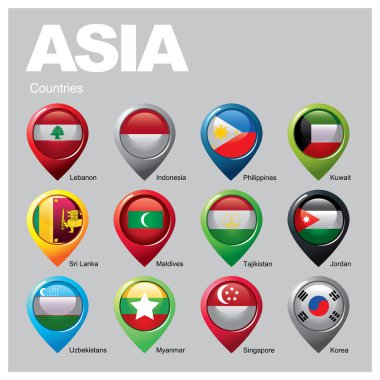
Asia countries flags in pointer icons

Maps collection countries of Asia, black contour maps of Asia. Vector set.

Vector map of China provinces colored by regions with neighbouring countries and territories

South Asia Map Black Color. Detailed vector map of South Asia.

East Asia, single states, political map. All countries in different colors, with national borders, labeled with English country names. Eastern subregion of the Asian continent. Illustration. Vector.

Blue-gray detailed map of Indonesia administrative divisions and location on the globe. Vector illustration

South Asia Political Map. Detailed vector map of South Asia.

China map

East Asia political map with countries and borders. Eastern subregion of the Asian continent with China, Japan, Mongolia and Indonesia. English labeling. Gray illustration on white background. Vector.

ASEAN and membership flag on 3D map Southeast asia perspective view and GPS navigator pin on gray color gradient background . Vector .

AEC or ASEAN or south east asian design element flag illustration. easy to modify

Vector detailed map of Indochina countries

Indochina highly detailed physical map,in vector format,with all the relief forms,countries and big cities.

India road map with the main cities

Myanmar infographics, statistical data, Myanmar information, vector illustration

ASEAN flag and membership and southeast asia map background . Isometric top design . Vector .

Thailand flag national map community philippines vector culture friendship symbol male character singapore indonesia myanmar people traditional asia portrait family economic illustration young brunei men group malaysia person laos set country costum

Flag of ASEAN ( Association of Southeast Asian Nations ) and membership .

Vector collection of asian countries maps that combined with their flags. Political map of Asia continent. Navigation and location icons

Map of India with the biggest cities and rivers

Asean Map dotted with Flags illustration, for background (AEC, AFTA, ASEAN), easy to modify

Highly detailed map of India.

AEC or ASEAN or south east asian design element flag illustration. easy to modify

Asia political map. Location, navigation and travel icons. Asian countries maps and flags vector set

South Asia Political Map and Map Pointers. Detailed vector map of South Asia.

The illustration of south asia map with detailed india map.

Abstract blue world map with magnified Myanmar. Myanmar flag and map. Vector Illustration.