Travel infographics with data icons and elements
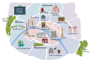
Picturesque Paris map, with famous landmarks, museums, markets, flea markets and parks

Infographics illustration of transportation

Paris, France, Monochrome Map Artprint, Vector Outline Version, ready for color change, Separated On White
Travel infographics with data icons and elements

Map Of Paris Attractions Vector And Illustration.

Detailed map of Paris. Famous landmarks, cathedrals, museums, palaces, parks, airports, railway stations.

Vector illustration of Paris Map in black and white

Layered editable vector illustration outline of Paris,France.

Ile-de-France, departments and prefectures of the Paris Region, political map. Most populous of the regions of France, centered on the capital Paris, located in the north-central part of the country.

Unique handdrawn map of Paris with all main tourist attractions and lettering.

Paris France Europe City map black white vector illustration

Map of the main roads of the French railway network

Map of Paris drawn by hand. Illustration for travel guide, poster or apparel design.

Cartoon map of Paris with famous sightseeings.

Vector poster map city Paris

Vector detailed map of the city of Paris with its famous attractions and names. Cathedrals, palaces, parks of Paris.

Set of hand drawn French icons, Paris sketch vector illustration, doodle elements, Isolated France national elements, Travel to France icons for cards and web pages, Paris symbols collection

High Quality map of Paris is a city of France, with borders of districts

Historical map of Paris, France.

Urban city map of Paris. Vector illustration, Paris map grayscale art poster. Street map image with roads, metropolitan city area view.

Green France map with regions and main cities

Map of administrative divisions of France
Travel and tourism background. Vector illustration

A fun placemat for kids. Printable Travel to Paris activity sheet with a labyrinth and find the differences. 17x11 inch printable vector file

Satellite map of Paris, the capital and most populous city of France. Division of the city into areas, arrondissement, municipalities. Streets of the capital. France

Set of cute hand drawn cartoon stickers on Paris: eiffel tower, flag, wine, croissant, macaroon. notre-dame. Travel concept for site, map, card

Paris map. Detailed vector map of Paris city administrative area. Poster with streets and water on white background.

Set of hand drawn French icons, Paris sketch doodle elements. Travel to France icons. Vector illustration

Welcome to Paris, The City of Love grunge rubber stamp on white, vector illustration

Vector map of Paris.

Beautiful girl in sketch-style on a french-background. Vector illustration
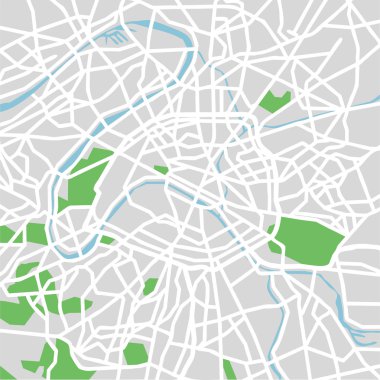
Vector illustration map of Paris.

Detailed map poster of Paris city administrative area. Cityscape panorama. Decorative graphic tourist map of Paris territory. Royalty free vector illustration.

Set vector line icons in flat design Paris and France with elements for mobile concepts and web apps. Collection modern infographic logo and pictogram.

Map of France. Bright illustration with map. Illustration with blue background. Vector illustration.

France country typical tourist places and borders geography outline map. French earth topography with nature, animals, cheese, wine and architecture elements vector illustration. Tourist travel items.

Paris City Name (France, Europe) with black white city map illustration vector
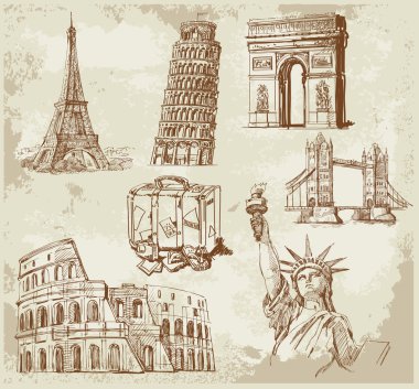
Travel original hand drawn collection

Abstract concept of digital Earth

Travel and tourism background

Sketches of streets in the old city

Europe skyline detailed silhouette. Vector illustration

Eiffel Tower on the map of France, sketchy style vector illustration

Design vector map city

TRAVEL word in shape World Map Typography, words cloud business concept background

Cartoon Map of Paris with Legend Icons. Print Design

Light blue paris post card with multicolored headline from paris with love vector illustration

Traditional symbols of France in the form of map

Abstract concept of digital Earth

Design vector map city

Isometric Paris building with hotel

Adorable France travel map with attractions and specialties
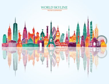
Abstract Travel and tourism background
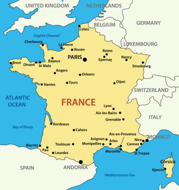
Map of France - vector illustration

France map hand drawn background vector,illustration

City Map of Paris with Paris landmarks

Map of France and flag - highly detailed vector illustration. Image contains land contours, country and land names, city names, water object names, flag, navigation icons, roads, railways, rivers.

Vector city map of Paris in black and white

France 2 digit postcodes postal codes vector map

This vector map of the French region Ile de France includes 6 editable layers for each of the 5 administrative levels (municipalities, subdistricts (cantons), districts (arrondissements), departments, and region) and the background

City map Paris, color detailed plan, vector illustration

Detailed France map with provinces, rivers and detailed national borders. Vector illustration.

Silhouettes of european country France and new regions
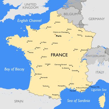
Vector detailed color France map

Detailed vector map of regions of France with flag

Vector detailed map Paris

Silhouettes of european country France and new regions

City map Paris, travel vector poster design

Cartoon vector map of France. Travel illustration with french main cities.
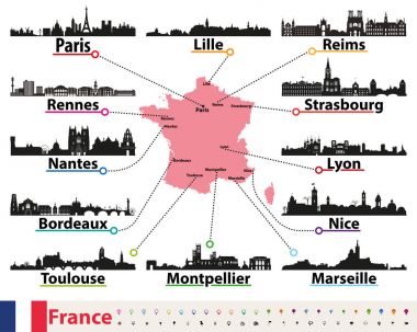
France map with largest cities skylines silhouettes vector set

Stylized map of Paris with the main tourist attractions. Vector illustration

Silhouettes of country France and new regions since 2016

High detailed France physical map.

Vector city map of Paris city with well organized separated layers. Vector illustration.

City map Paris, monochrome detailed plan, vector illustration

Silhouettes of country France and new regions since 2016

Detailed France map with provinces and detailed national borders. Vector illustration.

Beautiful and colorful detailes map of France with french islands, new regions and capitals. French names. Vector illustration II.

Blue-gray detailed map of France and administrative divisions and location on the globe. Vector illustration

Map of Paris, France, satellite view, map

White France vector map

Map pointer with Eiffel tower icon. Vector illustration
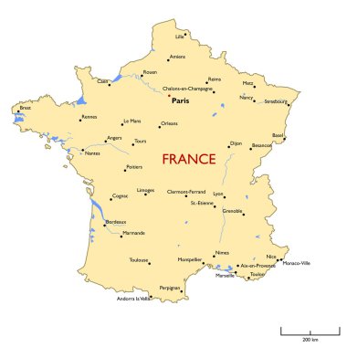
Vector detailed color France map

France blueprint map template with capital city. Paris marked on blueprint French map. Vector illustration.

High detailed France road map with labeling.

Zoom on France Map and Flag. World Map

Map of Paris, France, satellite view, map

France map

Vector map of France with main cities on it. French cities skylines icons

Outline France map with regions

France map - high details vector illustration

This is a simple map of France.

France - Highly detailed editable political map with labeling.

Vector map of France isolated on transparent background

Colorful France political map with clearly labeled, separated layers. Vector illustration.

Map of administrative divisions of France

Detailed France physical map.