Description:
The Rhode Island infographic SVG vector presents a comprehensive visual representation of data related to the state of Rhode Island. This vector format allows for scalability without loss of quality, making it perfect for various applications. The design features clearly labeled sections with informative graphics, which can highlight demographics, geography, and historical facts about the state. The SVG format supports a wide range of color customization and layering options. This graphic can be used in both digital and print formats, ensuring versatility in its application. Ideal for educators, marketers, and graphic designers, this vector simplifies complex information into easily digestible visuals.
Usage ideas:
This Rhode Island infographic SVG vector can be employed in numerous contexts, such as creating educational posters for classrooms, infographics for state-related websites, or promotional materials for tourism campaigns. Businesses can integrate this vector into their presentations to convey data during meetings or reports. It can also serve as a visual aid in social media posts to engage audiences with state-specific facts. Additionally, non-profit organizations may utilize it for fundraising efforts, illustrating community impact in their reports. The adaptability of this vector makes it an asset in multiple fields.

High Quality map of Rhode Island is a state of United States of America with borders of the counties

Northeast, census region of the United States of America, gray political map of census region 1, consisting of 9 single states. Map with geographical borders and capitals. Isolated illustration.

New England region, colored map. A region in the United States of America, consisting of the six states Maine, Vermont, New Hampshire, Massachusetts, Rhode Island and Connecticut. Illustration. Vector

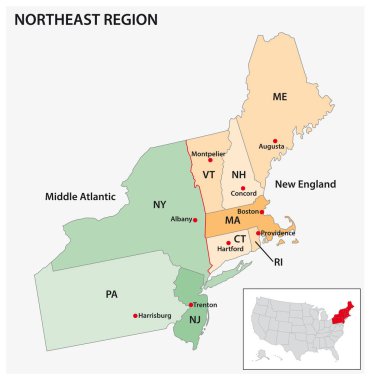
Administrative vector map of the US Census Region Northeast

3d sate with speech bubble on silver map

Highly detailed physical map of the US state of Connecticut

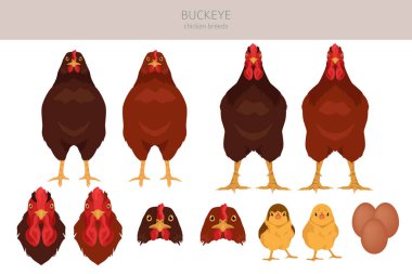
Buckeye Chicken breeds clipart. Poultry and farm animals. Different colors set. Vector illustration

Northeast, U.S. census region, multi colored political map. Census region 1 of the United States, consisting of 9 single states. Colored silhouettes of single states with borders and their capitals.

Hopkinton (Rhode Island) blank outline map

Counties of New England, outline map. Region in the Northeastern United States, consisting of the states Connecticut, Maine, Massachusetts, New Hampshire, Rhode Island, and Vermont. Isolated. Vector

Buckeye Chicken breeds clipart. Poultry and farm animals. Different colors set. Vector illustration

A Set of Infographic Elements for the State of Rhode Island

Northeast region of the United States, multi colored map. Also known as the Northeast, the East Coast, or the American Northeast. Geographic region of the USA, consisting of 11 contiguous states.

Black United States Of America map. US background template. Map of America with separated countries and interstate borders. All states and regions are named in the layer panel.

Charlestown (Rhode Island) blank outline map

Providence City in Rhode Island United Stated street road map,vector outline illustration image

Lighthouse Vector Map of Rhode Island, United States

Low poly map of Rhodes. Geometric illustration of the island. Rhodes polygonal map. Technology, internet, network concept. Vector illustration.

Rhodes icon. Polygonal map of the island in gradient ring. Round low poly Rhodes sign. Vector illustration.