Description:
This SVG vector illustration features a detailed map of the Solomon Islands, showcasing the geographical layout of the region. The map is designed in a clean and clear format suitable for various applications. It includes precise borders and labels for ease of understanding. The vector format allows for seamless scaling without loss of quality, making it ideal for both digital and printed materials. The design is straightforward, ensuring that crucial information is easily digestible for users. This map can serve as a valuable resource for geography enthusiasts, educators, and professionals. Available in SVG, this format is compatible with various design software, providing versatility in usage. Users can also customize the design to fit specific needs without compromising the map's integrity.
Usage ideas:
The Solomon Islands region map can be utilized in numerous contexts, including educational presentations, travel publications, and geographic studies. For example, educators can incorporate this map into lesson plans about Pacific geography or climate studies. Travel agencies may use it in brochures or website content to highlight tourist destinations and cultural landmarks within the islands. Moreover, urban planners and researchers can leverage this vector for demographic analysis or resource management. The adaptability of the SVG format allows designers to integrate it into infographics or interactive websites, enhancing user engagement. Digital marketers can also utilize this map in targeted advertising campaigns that focus on travel and tourism in the Pacific region.

Solomon Islands sticker flat design. Round flat style badges of trendy colors with country map and name. Country sticker vector illustration.

Tonga highly detailed political map
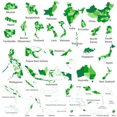
Asian, Australia and Oceania countries maps

Solomon Islands region map: grey outline on white background. Detailed map of Solomon Islands regions. Vector illustration.

Melanesia, subregion of Oceania, political map. Extending from New Guinea in southwestern Pacific Ocean to Tonga, including Fiji, Vanuatu, Solomon Islands and Papua New Guinea. Illustration. Vector.

Australia and Oceania region vector high detailed map with countries names and national flags

Fifteen Flags of Australia and Oceania countries - alphabetical order with name. Set of 2d geolocation signs like national flags of Australia and Oceania. Fifteen geolocation signs. EPS10.

Vector maps and flags of oceania countries with administrative divisions (regions borders)
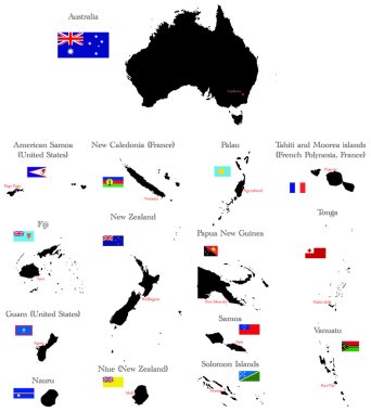
Countries of Oceania and Australia with borders, flags and capitals

Vector color map of Palau

Slovenia, Solomon Islands, Somalia, South Africa map and flag in circle. Vector Illustration.

Solomon Islands Location Highlighted on Oceania Map with Flag Icon.
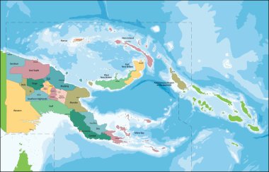
The Independent State of Papua New Guinea is an Oceanian country that occupies the eastern half of the island of New Guinea and its offshore islands in Melanesia.
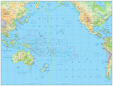
Pacific Ocean Physical Map. No bathymetry. Detailed Pacific Ocean Physical Map. Vector illustration.

Pacific Ocean Political Map. No bathymetry. No text. Detailed Pacific Ocean Vector Map. Vector illustration.

Pacific Ocean Map White Color. Detailed Pacific Ocean Vector Map. Vector illustration.

Pacific Ocean Physical Map White and Grey On Black. Detailed Pacific Ocean Physical Map. Vector illustration.

Pacific Ocean Physical Map. Detailed Pacific Ocean Physical Map. Vector illustration.

Pacific Ocean Political Map and bathymetry. Detailed Pacific Ocean Vector Map. Vector illustration.

Pacific Ocean Blue Map Isolated on white. Detailed Pacific Ocean Vector Map. Vector illustration.
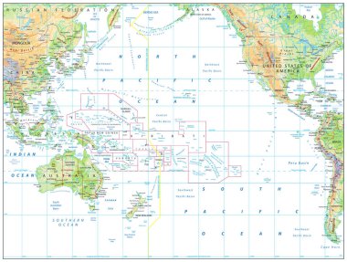
Pacific Ocean Physical Map Isolated on white. Detailed Pacific Ocean Physical Map. Vector illustration.

Pacific Ocean Blue Map and Colored Map Icons. Detailed Pacific Ocean Vector Map. Vector illustration.