Description:
This Sonora State SVG vector features an outline representation of the state of Sonora, capturing its unique geographical shape and regional features. The file format is scalable vector graphics (SVG), making it ideal for web and print applications without loss of quality. The design is presented in a flat style that emphasizes clarity and simplicity, ensuring easy integration into any project. This vector is perfect for maps, infographics, and educational content. As a versatile graphic, it can also be adapted for use in applications like custom merchandise and digital collages. Its straightforward design allows for multiple uses across various media. Overall, this vector serves as a valuable asset for artists and educators alike.
Usage ideas:
This Sonora State SVG vector can be effectively used in a variety of commercial and educational contexts. For instance, educators might include it in geography lessons or create informative posters detailing the state's features. In a business setting, travel agencies could utilize this vector in promotional materials or brochures highlighting tourist attractions in Sonora. Additionally, graphic designers may incorporate the vector into website designs, ensuring a local touch while promoting events or initiatives related to the state. The image can also serve as a foundational element in branding for local businesses that want to reflect their regional identity.

Sonora state blank vector outline map set

Sonora state blank outline map set

Sonora state blank contour map
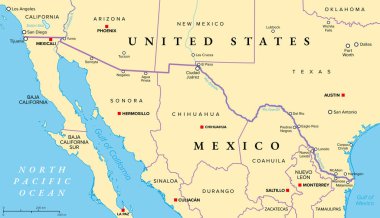
Mexico-United States border political map. International border between the countries Mexico and the USA, with states, capitals, and most important cities. Most frequently crossed border in the world.

Administrative county map of the federal state of california by population density
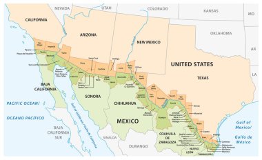
Vector map of the border districts in the United States and Mexico along the border

Vector road map of the mexican states of Baja California and Baja California South

Road map of the US American State of New Mexico
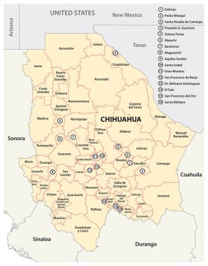
Administrative map of the Mexican state of Chihuahua

Administrative and political map of the mexican state of sonora in spanish language
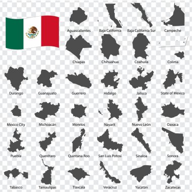
Tthirty two Maps United Mexican States - alphabetical order with name. Every single map of state are listed and isolated with wordings and titles. United Mexican States. EPS10.

Vector hand drawn stylized map of Mexico states. Travel illustration. The United Mexican States geography illustration. Latin America map element
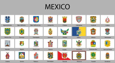
All Flags of regions of Mexico. Vector illustraion
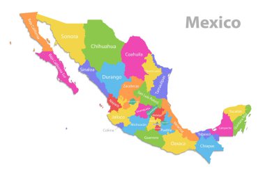
Mexico map, new political detailed map, separate individual states, with state names, isolated on white background 3D vector
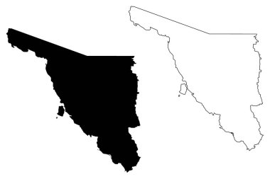
Sonora (United Mexican States, Mexico, federal republic) map vector illustration, scribble sketch Estado Libre y Soberano de Sonora map

3d map of Sonora is a state of Mexico, vector illustration

Sonora Mexico Map black inverted silhouette

High Quality map of Sonora is a state of Mexico, with borders of the municipalities
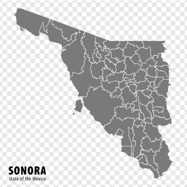
State Sonora of Mexico map on transparent background. Blank map of Sonora with regions in gray for your web site design, logo, app, UI. Mexico. EPS10.

Sonora region location within Mexico 3d isometric map

Large and detailed map of Tuolumne county in California, USA
San luas potosi Word Text with Handwritten Font Shape Vector Illustration.

WPA poster art of stenocereus thurberi growing in Organ Pipe Cactus National Monument located in Arizona, United States and the Mexican state of Sonora done in works project administration style.

Map of North America. Detailed map of North America with States of the USA and Provinces of Canada and all Mexican States. Template. EPS10.

Cactus wren icon clipart avatar logotype concepte isolated illustration

I love Tucson, city of United States. Hand drawn letters with red heart. Vector illustration lettering, modern design

Saguaro National National Park patch logo illustration
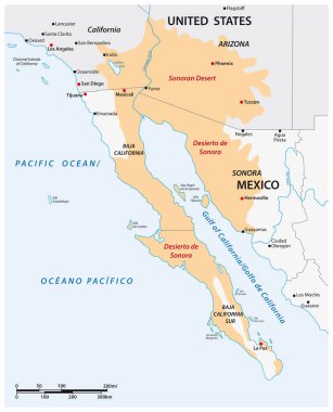
Vector map of the Sonoran Desert, Mexico, United States

Mexico map symbol shape, travel web flat concept icon vector illustration .