
Rainbow colored dotted Tuscany region map and seal stamps. Red rounded Herbicide Free grunge seal stamp. Gradiented rainbow colored Tuscany region map mosaic of random round elements.

Love collage Tuscany region map and distressed stamp seal with I Love You badge. Tuscany region map collage composed with randomized red heart icons.

Tuscany administrative and political map with flag

Map of Tuscany in Italy

Silhouette map of the region of Tuscany in Italy

Polygonal mesh map of Tuscany region in high detail resolution. Mesh lines, triangles and dots form map of Tuscany region.

Tuscany blank detailed outline map set

Tuscany region blank outline map set

Tuscany is a region of Italy, located in the central peninsular section of the country

Silhouettes of european country Italia and the regions

Vector Political Map of Italy with full Region and Provinces Boundaries, completed with Italian and EU flags.
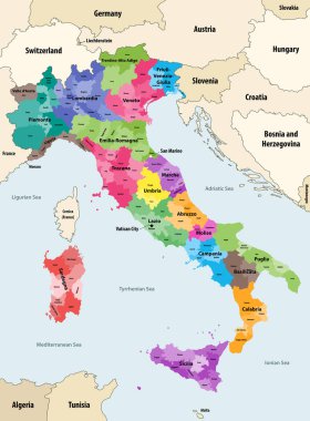
Italy provinces colored by regions vector map with neighbouring countries and territories

The grayscale map of Tuscany region with labels on white background

Tuscany regions map with labels isolated on white background

Map of Italy
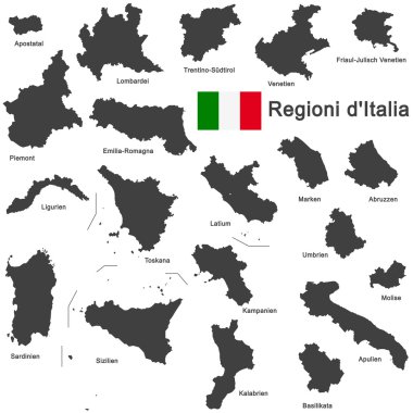
Silhouettes of european country Italia and the regions

Silhouettes of european country Italy and the regions

Silhouette and colored map of Italy regions

Vector Political Map of Italy with full Region and Provinces Boundaries, completed with flags and a 3d Globe of Earth centered on Italy.

Map of Italy divided into 20 administrative regions. Grey land, white borders and black labels. Simple flat vector illustration.

The Italian Republic is a unitary parliamentary republic in south-central Europe

Road vector map of the Italian region Tuscany

Silhouettes of european country Italy and the regions

The detailed map of the Italy with regions or states and cities, capital

Map of Italy divided into 20 administrative regions in four colors. White labels. Simple flat vector illustration.

Road vector map of the Italian region Tuscany

High quality colorful labeled map of Italy with borders of the regions

Administrative map of the Metropolitan City of Florence, Tuscany, Italy

Map of Italy

Map of Italy

Color detailed road map, urban street plan city Rome and Florence with colorful neighborhoods and districts, Travel vector poster

Map of Elba Island and the Tuscan Archipelago, Italy

Map of the Italian region of Tuscany

Blank map of Italy divided into 20 administrative regions.

Colorful Tuscany map vector silhouette illustration isolated on white background. Toscana, Italy province vector map. Separated regions with borders. Italian territory, EU, Europe.
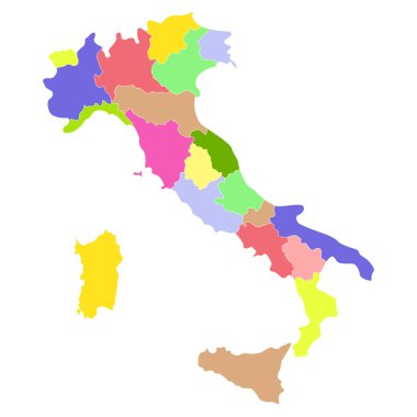
Italy map isolated on a white background. Vector illustration.
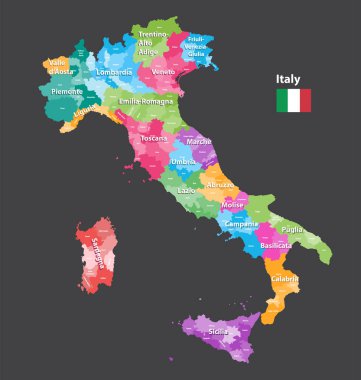
Vector Italy provinces map colored by regions. All layers detachable and labeled.

Stylized map of Italy with main attractions and landmarks. Vector illustration

Regions of Italy. Map of regional country administrative divisions. Colorful vector illustration.

Green Tuscany map silhouette vector, Toscana, Italy province vector map illustration isolated on background. Separated regions with borders.

Liguria and the Italian Riviera, the Ligurian Riviera, political map. Region of north-western Italy, with capital Genoa. A narrow coastal strip between Ventimiglia and La Spezia, on the Ligurian Sea.

The detailed map of the Italy with regions

Italy regions map isolated on white background. Cartography map of Italian regional administrative borders. Vector stock

Map of italy. Good use for symbol, logo, web icon, mascot, sign, or any design you want.

Travel poster, urban street plan city map Florence and Milan, vector illustration

Italy, political map with multicolored administrative divisions. Italian Republic with capital Rome, their 20 regions and borders. English labeling. Isolated illustration on white background. Vector.
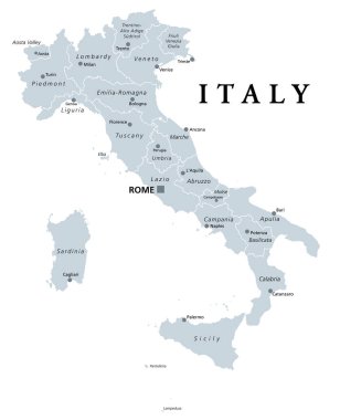
Italy, gray political map with administrative divisions. Italian Republic with capital Rome, 20 regions, their borders and capitals. English labeling. Isolated illustration on white background. Vector

Detailed illustration of a 3D Map of Italy, eps10 vector

Set Flags of the states of Italy, All Italian regions flag collection

The black and white maps of Italy regions

City map Florence, travel vector poster design art for interior decoration
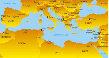
Vector color map of Mediterranean region countries

Vector map of Mediterranean region countries
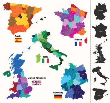
European regions map

City map Florence, monochrome detailed plan, vector illustration black and white city plan

Vector map of the city of Florence, Italy
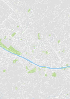
City map Florence, color detailed plan, vector illustration color navigation chart
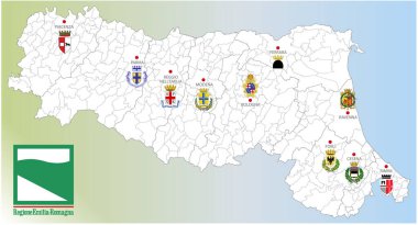
Emilia Romagna region, Italy, map of the region with borders, cities and coats of arms of the provincial capitals, vector illustration

Coat of arms of the state of Italy, All Italian regions emblem collection
Map of Italy

Italy, officially the Italian Republic is a unitary parliamentary republic in Europe.

Black and white vector city map of Florence with well organized separated layers.

Vector map of the city of Florence, Italy

Vector map of the city of Florence, Italy

Vector map of the city of Florence, Italy
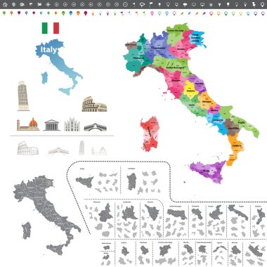
Vector Italy map colored by regions
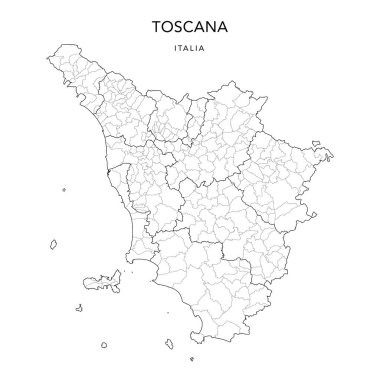
Vector Map of the Geopolitical Subdivisions of the Region of Tuscany (Toscana) with Provinces and Municipalities (Comuni) as of 2022 - Italy

Vector map of the city of Florence, Italy

Map of Italy

Map of Italy

Map of Italy

Map of Tuscany in Italy

Italy - highly detailed map.All elements are separated in editable layers. Vector illustration.

Map of Italy with regions and their capitals

Silhouettes of european country Italy and the regions

Vintage italy map with regions inscription sardinia, sicily, lazio, tuscany, liguria, marche, abruzzo, calabria, puglia, veneto trentino lombardy marche drawing on yellow paper

Map of Italy

Silhouettes of european country Italy and the regions

Map of Italy vector colorful, with countries, borders, High detailed, editable,

Map of Italy

Map of Italy

Map of Italy

Vector map of the city of Florence, Italy

Map of Italy

Vector map of Italy province gray color
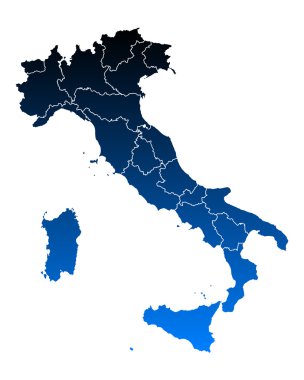
Map of Italy

Low Poly Italy Map with National Colors - Infographic - Vector Illustration

Map of Italy

Stylized map of Italy with main attractions, landmarks and cultural symbols

Vector Political Map of Italy with full Region and Provinces Boundaries, completed with flags and a 3d Globe of Earth centered on Italy.

Map of Italy divided into 20 administrative regions in four shades of grey. White labels. Simple flat vector illustration.

Map of Italy

Silhouettes of european country Italia and the regions
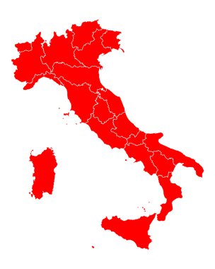
Map of Italy

Map of italy. High detailed vector map - italy.

Map of Italy divided into 20 administrative regions. White land and black outline borders. Simple flat vector illustration.
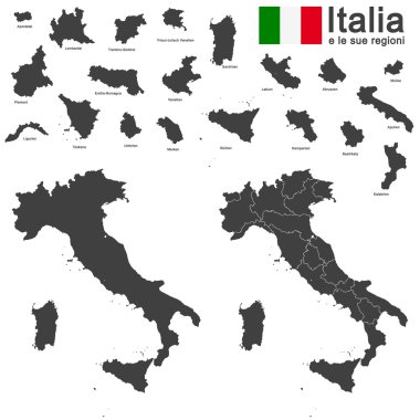
Silhouettes of european country Italia and the regions

Vector doodle illustration of main italian attractions and cultural symbols

Map of Italy

Vector illustration of the famous sausages from different regions of Italy