
Canada Provinces and Territories Flags Collection Design Template. Provinces Flag of Canada

Nova Scotia Flag Waving Vector Illustration on White Background. Provinces Flag of Canada. Correct Size, Proportion and Colors.

Nova Scotia Flag Vector Illustration on White Background. Provinces Flag of Canada. Correct Size, Proportion and Colors.

Canada All Provinces & Territories Flag Vector Illustration on White Background. Flags of Canada. Correct Size, Proportion and Colors.

Canada All Provinces & Territories Flag Waving Vector Illustration on White Background. Flags of Canada. Correct Size, Proportion and Colors.

Canada Province Alberta Vector Flag Design Template. Alberta Flag for Independence Day. Grunge Alberta Flag

Canada Province New Brunswick Vector Flag Design Template. New Brunswick Flag for Independence Day. Grunge New Brunswick Flag

Flag of Nova Scotia is one of Canada three Maritime Provinces, and one of the four provinces that form Atlantic Canada. Vector illustration

Vector flag of Nova Scotia province Canada. Halifax, Cape Breton

Nova Scotia Map on Canadian Flag. NS, CA Province Map on Canada Flag. EPS Vector Graphic Clipart Icon

Canada - highly detailed map. Vector illustration
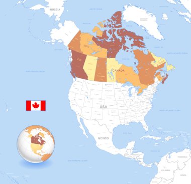
A High Detail vector Map of Canada, with capitals and major cities, a 3D globe centered on North America with canada Highlighted, and Canada flag.

Thirteen flags the Provinces of Canada - alphabetical order with name. Set of 2d geolocation signs like flags Provinces of Canada. Thirteen geolocation signs for your design. EPS10.
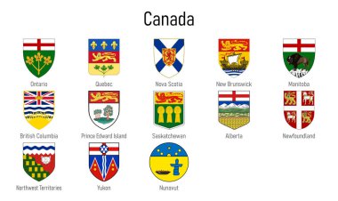
Coat of arms of the provinces of Canada, All Canadian regions emblem collection
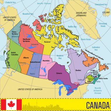
Vector highly detailed political map of Canada with regions and their capitals. All elements are separated in editable layers clearly labeled. EPS 10

Map of Nova Scotia. Flag of Nova Scotia. Provinces and territories of Canada. Vector illustration

Vector set. Map of Canada with provinces and territories borders and vector flags.

Coat of arms of Nova Scotia is one of Canada three Maritime Provinces, and one of the four provinces that form Atlantic Canada. Vector illustration

USA and Canada large detailed political map in colors of blue and map pointers

Canada Map with icons. Highly detailed vector illustration.
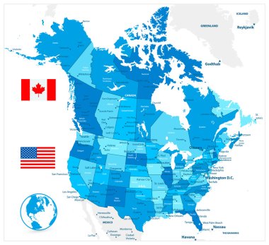
USA and Canada large detailed political map in colors of blue
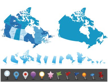
Canada - highly detailed map. Vector illustration

Ontario, Quebec and New Scotland Canada regions and provinces vector plates of Canadian flags and coat of arms. Vintage tin plates with gold maple leaves, heraldic fleur de lis, white and blue crosses

Canada map. Flat vector illustration

Canadian flags on white background. Vector icon set. Vector Illustration.

Waving flag of Nova Scotia - province of Canada on flagpole. Template for independence day poster

Thirteen flags the Provinces of Canada - alphabetical order with name. Set of 3d geolocation signs like flags Provinces of Canada. Thirteen 3d geolocation signs for your design. EPS10.

Canadian province of Nova Scotia flag waving form on gray background. Vector illustration.

Flag of Nova Scotia from brush strokes. Blank map of Nova Scotia Province. Canada. High quality map of Nova Scotia and flag on transparent background. Stock vector. EPS10.

A red colored pencil with a half finished Canadian Flag coloring page

Zoom on Canada Map and Flag. World Map

Maple Leaf Gold vector icon with black contour line. Flat computer symbol

Maple Leaf Simple line vector button. Thin line illustration icon. White outline symbol on grey background

Nature, sport and animals of northern Canadian country.
Nature, sport and animals of northern Canadian country.

Waving ribbon or banner with flag of Nova Scotia. Province of Canada. Template for poster design

Nature, sport and animals of northern Canadian country.

Nova Scotia car license plate pattern, Canada, vector illustration

All Flags provinces of Canada. Vector illustraion

Vector flags of provinces and territories of Canada. Vector illustration. Ottawa, Toronto, Vancouver

Canada map with flags of provinces and territories. Vector illustration. Ottawa, Toronto, Vancouver

All flags of the Canada regions. vector illustrations

Saskatchewan Map. Canada state with cities and towns.

Canada map. Flat vector
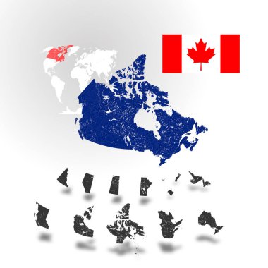
Map of Canada with rivers and lakes, maps of provinces and territories, map of world as background and flag of Canada. Please look at my other images of cartographic series - they are all very detailed and carefully drawn by hand WITH RIVERS AND LAKE

Flag Nova Scotia button

Canada flag on map of country

Vector illustration of Canada country map

Color contour map of Canada. Vector illustration

Map of Canada with vintage colors and navigation icon set. Highly detailed vector illustration. All layers are subscribed.

Vector illustration of Canada Administrative Map in Shades of Green

Contour map of Canada on white background. Vector illustration

Detailed Map of Canada. Each province is a separate element and is easily isolated.

Canadian maple leaf vector illustration

Maple leafs map of Canada

Detailed Map of Nova Scotia

Canadian hen

Canada - highly detailed map. Vector illustration

Detailed map of Canada isolated on white background

Vector illustration of Canada Administrative Map in vibrant colors
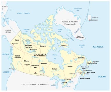
Canada vector map with provinces and boundary

Nova Scotia province of canada

Province quebec road vector map with flag
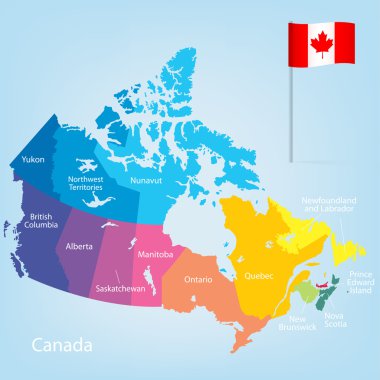
Colorful Canada map with provinces. Vector illustration.

Canadian provinces and territories map colored by regions. Map, flag and largest city skylines of Canada. Vector illustration