
Silhouette of skyscrapers of fort wayne city with inscription, vector illustration

City of Fort Wayne, Indiana postal rubber stamp, vector object over white background

Retro card. Typography design. vector illustration

Grunge rubber stamp set with names of Indiana cities, vector illustration

Vector illustration of the Indiana Welcome You road sign

Fort Wayne skyline in purple radiant orchid in editable vector file

Cityscape Building Abstract Simple shape and modern style art Vector design - Fort Wayne city
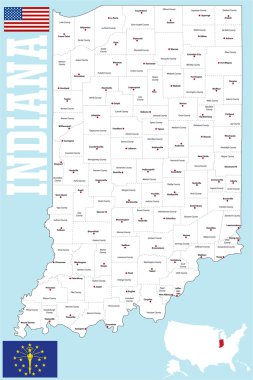
A large and detailed map of the State of Indiana with all counties and county seats.

Fort Wayne skyline in red and gray background in editable vector file

Empty vector map of Fort Wayne, Indiana, USA, printable road map created in classic web colors for infographic backgrounds.

Print Building view with landmark of Fort Wayne is a city in northeastern Indiana. Hand drawn sketch illustration in vector.

Fort Wayne - Comic book style word on comic book abstract background.

Set of Indiana cities stamps on white background, vector illustration

Indiana flag in state map shape symbol icon

Label set with names of Indiana cities, vector illustration

Grunge rubber stamp with name of Fort Wayne, Indiana, vector illustration

Silhouette of skyscrapers of fort wayne city with inscription, vector illustration

Stamp or label with name of Fort Wayne, Indiana, vector illustration
Usa flag in indiana state map shape symbol

Grunge vintage round stamp with text Fort Wayne, Indian, vector illustration

Welcome to Indiana road sign

Detroit grunge rubber stamp on white background, vector illustration

Stamp or label with text Fort Wayne, Indiana inside, vector illustration

Grunge rubber stamp or label with text Fort Wayne, Indiana written inside, vector illustration
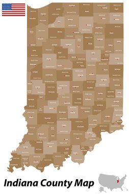
A detailed map of the State of Indiana with all counties and main cities.
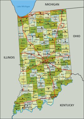
Highly detailed editable political map with separated layers. Indiana.
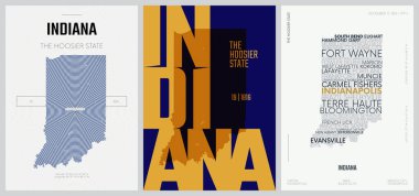
19 of 50 sets, US State Posters with name and Information in 3 Design Styles, Detailed vector art print Indiana map

Wayne County (North Carolina) blank outline map

Wayne County (Nebraska) blank outline map
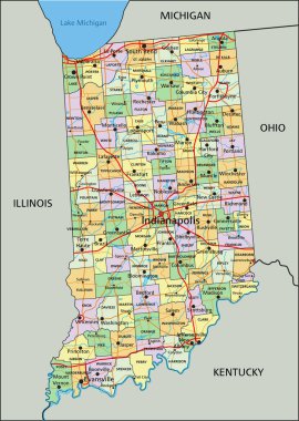
Indiana - Highly detailed editable political map with labeling.
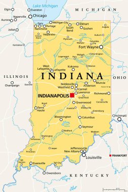
Indiana, IN, political map, with the capital Indianapolis, and most important cities, rivers and lakes. State in the Midwestern region of the United States of America, nicknamed The Hoosier State.
Fort Wayne skyline linear style with rainbow in editable vector file

A cartoon illustration of a hulk superhero looking angry.

Wayne (West Virginia) blank outline map
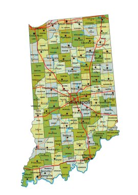
Highly detailed editable political map with separated layers. Indiana.
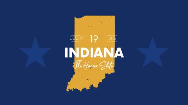
19 of 50 states of the United States with a name, nickname, and date admitted to the Union, Detailed Vector Indiana Map for printing posters, postcards and t-shirts

Vector illustration of a cartoon batman

Pine Belt, also known as Piney Woods, a region in Southeast Mississippi, political map. The region get its name from longleaf pine trees, abundant in nine counties, in the map highlighted in green.

Fort Wayne skyline in orange background in editable vector file

High detailed Indiana road map with labeling.
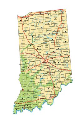
High detailed Indiana physical map with labeling.

Typography design of fort wayne indiana city text word in the United States of America graffitti style logo

Pine Belt, or Piney Woods, a region in Southeast Mississippi, political map. The region includes nine counties, highlighted in dark green, and get its name from longleaf pine trees, that are abundant.

Indiana - Highly detailed editable political map with labeling.
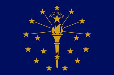
Vector flag illustration of Indiana state, Crossroads of America. United States of America.

Indiana State on USA Map. Indiana flag and map. US States.

Welcome to Detroit entrance road sign