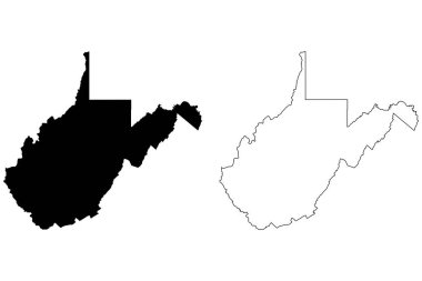
West Virginia WV state Map USA. Black silhouette and outline isolated maps on a white background. EPS Vector

West Virginia WV state Map USA with Capital City Star at Charleston. Black silhouette and outline isolated maps on a white background. EPS Vector

Virginia map high quality vector. American state simple hand made line drawing map

Illustration of State of West Virginia, USA

The Virginias, political map. The two Virginias, two states in the Southeastern and Mid-Atlantic regions of the United States. Virginia with capital Richmond and West Virginia with capital Charleston.
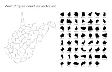
West Virginia map with shapes of regions. Blank vector map of the Us State with counties. Borders of the us state for your infographic. Vector illustration.

West Virginia WV State Border USA Map Outline

West Virginia vector maps counties, townships, regions, municipalities, departments, borders

West Virginia blank outline map set

West Virginia WV State Border USA Map Solid

3D West Virginia (USA) Blueprint Grunge outline map with shadow

Highly detailed vector illustration of West Virginia. With American flag.

Logan County (Nebraska) blank outline map

Grafton (West Virginia) blank outline map

Richwood (West Virginia) blank outline map

Loxton Waikerie, Mallala, Maralinga Tjarutja, Marion outline maps

Lockyer Valley, Logan, Longreach, Mackay outline maps

Moorefield (West Virginia) blank outline map

Point Pleasant (West Virginia) blank outline map

Eleanor (West Virginia) blank outline map

Glen Dale (West Virginia) blank outline map

Granville (West Virginia) blank outline map

Nutter Fort (West Virginia) blank outline map

Williamstown (West Virginia) blank outline map

Marion (Wisconsin) blank outline map

New Haven (West Virginia) blank outline map

Barrackville (West Virginia) blank outline map

Charles Town (West Virginia) blank outline map

Marion (North Carolina) blank outline map

Terra Alta (West Virginia) blank outline map

Wayne (West Virginia) blank outline map

Barboursville (West Virginia) blank outline map

Logan (Ohio) blank outline map

Kenova (West Virginia) blank outline map

Harrisville (West Virginia) blank outline map

Monongah (West Virginia) blank outline map

Pleasant Valley (West Virginia) blank outline map

West Liberty (West Virginia) blank outline map

Wellsburg (West Virginia) blank outline map

Randolph (New York) blank outline map

Randolph (Vermont) blank outline map

Montgomery (West Virginia) blank outline map

Salem (West Virginia) blank outline map

Ansted (West Virginia) blank outline map

Bethlehem (West Virginia) blank outline map

Chesapeake (West Virginia) blank outline map

Marion (South Carolina) blank outline map

Randolph (Washington) blank outline map

State of West Virginia, subdivided into 55 counties, outline map. State in the Southeastern and Mid-Atlantic regions of United States, nicknamed Mountain State. Contours with county names and borders.

Hinton (West Virginia) blank outline map

Rainelle (West Virginia) blank outline map

Belington (West Virginia) blank outline map

Logan (West Virginia) blank outline map

Parsons (West Virginia) blank outline map

Buckhannon (West Virginia) blank outline map

Dunbar (West Virginia) blank outline map

Marion (Texas) blank outline map

Glenville (West Virginia) blank outline map

Philippi (West Virginia) blank outline map

Keyser (West Virginia) blank outline map

Ravenswood (West Virginia) blank outline map

Sophia (West Virginia) blank outline map

Winfield (West Virginia) blank outline map

Ceredo (West Virginia) blank outline map

Marion (Virginia) blank outline map

Randolph (Wisconsin) blank outline map

Marion (New York) blank outline map

Marmet (West Virginia) blank outline map

Paden City (West Virginia) blank outline map

Ripley (West Virginia) blank outline map

Benwood (West Virginia) blank outline map

Clay County (Nebraska) blank outline map
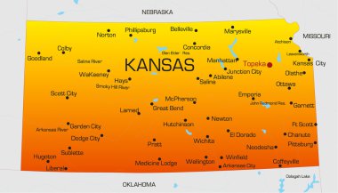
Vector color map of Kansas state. Usa

Map of USA in idea design

The vector gold usa map set

USA Map Each state in separate layers

Usa Vector Map
Map of USA in idea design

America Green Map Isolated on Blue Background
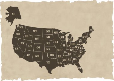
The vector retro usa map

Map of USA in idea design

United Stated map in silhouette version

Map of USA in idea design
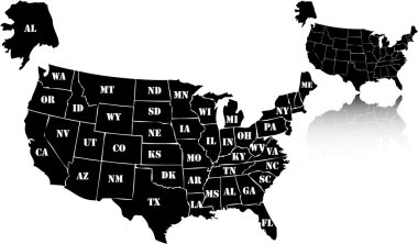
The vector black usa map set

Map of USA with vector

American golden map eps8 vector art

Vectors Map of USA

Map of USA with pointer vector

Map of USA in idea design

Map of USA in idea design

Retro Colors Political map of the USA with it's states and Large vector Image Set.

Map of USA in idea design

Map of west virginia. map concept

Every state is in its own shape.

American color map vector art

Map of USA in idea design

Map of USA in idea design

Map of USA in idea design

United States Election Word Cloud Map

Ohio state detailed editable map with cities and towns, geographic sites, roads, railways, interstates and U.S. highways. Vector EPS-10 file, trending color scheme