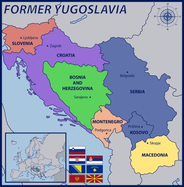
Map, Location and Flags of the Former Yugoslavia

Yugoslavia map vector, Yugoslavia flag vector, Yugoslavia isolated white background

Yugoslavia map, administrative division, separate individual regions with names, color map isolated on white background vector

Illustration of a Political Map of Yugoslavia with Names

Yugoslavia infographics, statistical data, sights. Vector illustration
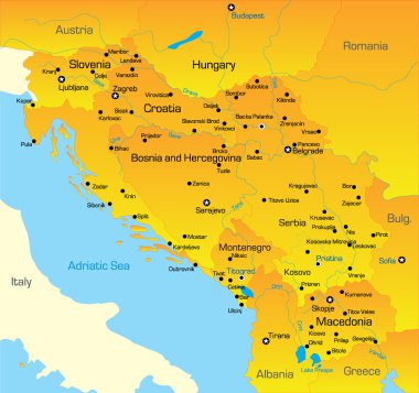
Vector color map of Balkan region

Yugoslavia map, administrative division with names, blue white card paper 3D vector

Yugoslavia infographics, statistical data, Yugoslavia information, vector illustration, Infographic template, country information

Kosovo map vector illustration, scribble sketch Kosovo map
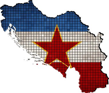
Abstract Mosaic Flag and map of Yugoslavia, Yugoslavia grunge mosaic flag
Flag of Yugoslavia grunge, flag of Yugoslavia with shadow on isolated background, vector illustration

Croatia marked by blue in grey political map of Europe. Vector illustration.

Political map of Balkans - States of Balkan Peninsula. Simple flat black outline with black country name labels.

Serbia marked by blue in grey political map of Europe. Vector illustration.

Political map of Balkans - States of Balkan Peninsula. Colorful vector illustration.

Political map of Balkans - States of Balkan Peninsula. Four shades of grey vector illustration.

A large, detailed map of Albania with all counties and bis cities.
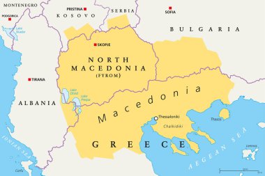
Macedonia region, political map. Region of the Balkan Peninsula in Southeast Europe. Part of Greece, North Macedonia, Bulgaria, Albania, Kosovo and Serbia. English labeling. Illustration. Vector.

Geographical region of Macedonia, political map. Region of the Balkan Peninsula in Southeast Europe, part of Greece, North Macedonia, Bulgaria, Albania, Kosovo and Serbia. Illustration. Vector.

Southeast Europe Region. Map of countries of Balkan Peninsula. Vector illustration.

North Macedonia political map with capital Skopje, borders, important cities, rivers and lakes. Former Yugoslav Republic of Macedonia, renamed in February 2019. English labeling. Illustration. Vector.

Southeast Europe Region. Map of countries of Balkan Peninsula. Vector illustration.

Highly detailed physical map of the Slovenia, in vector format,with all the relief forms,regions and big cities.

Southeast Europe Region. Colorful map of countries of Balkan Peninsula. Vector illustration.

Southeast Europe Region. Map of countries of Balkan Peninsula. Vector illustration.

Highly detailed physical map of the Croatia, in vector format,with all the relief forms,regions and big cities.
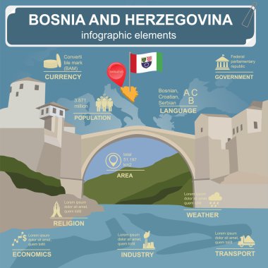
Bosnia and Herzegovina infographics, statistical data, sights. Vector illustration

Map of Kosovo with flag - vector illustration

Political map of Balkans - States of Balkan Peninsula. Four shades of turquoise blue vector illustration,

Vector color map of Balkan region
Colorful Mostar Bridge Bosnia-Hezegovina. Hand Drawn Vector Illustration, Paint Splatter Color Isolated on White Background. Business Travel and Tourism Concept with Modern Architecture.

Macedonia map flag glass card paper 3D vector

Shiny vector stickers in form of Bosnia

Highly detailed vector map of Bosnia & Herzegovina with administrative regions, main cities and roads.

Map of Croatia with position in Europe.

Political map of Balkans - States of Balkan Peninsula. Four shades of pink vector illustration.

Low Poly Map of Croatia isolated. Vector version

Shiny vector stickers in form of Montenegro
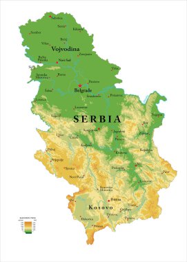
Highly detailed physical map of the Serbia, in vector format,with all the relief forms,regions and big cities.

Map of Kosovo - vector illustration

Slovenia marked by blue in grey political map of Europe. Vector illustration.

Political map of Balkans - States of Balkan Peninsula. Four shades of orange vector illustration.

Highly detailed vector map of Serbia with administrative regions,main cities and roads.

Republic of Croatia isolated map and official flag icons. vector Croatian political map 3d illustration. Central Europe country geographic banner template

Bosnia and Herzegovina landmarks. Retro styled image. Vector illustration

Republic of Croatia isolated map and official flag icons. vector Croatian political map outline. Balkans country geographic banner template
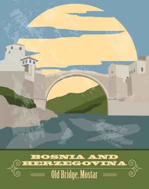
Bosnia and Herzegovina landmarks. Retro styled image. Vector illustration

Shiny vector stickers in form of Serbia

Bosnia and Herzegovina infographics, statistical data, sights. Vector illustration

Highly detailed vector map of Slovenia with administrative regions, main cities and roads.

Shiny icon in form of Bosnia and Herzegovina - vector illustration

Map of adriatic sea vector illustration

Detailed illustration of a map of Bosnia Herzegowina with flag, eps10 vector

Large and detailed map of Serbia

Vector illustration of a vintage sticker in form of Bosnia and Herzegovina

Shiny icon in form of Montenegro - vector illustration

Political map of Balkans - States of Balkan Peninsula. Simple flat black outline with black country name labels.

Shiny icon in form of Serbia - vector illustration

Republic of Croatia isolated map and official flag icons. vector Croatian political maps illustration. Balkans country geographic banner template

Bosnia and Herzegovina vector map flag silhouette illustration and. Bosnia flag isolated on white background. Balkan country, former Yugoslavia state member.
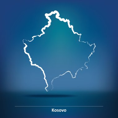
Doodle Map of Kosovo - vector illustration

North Macedonia Map Flag. Map of the Republic of North Macedonia with the Macedonian country banner. Vector Illustration.

Silhouette of soldier with Flag of Yugoslavia

Serbia map vector illustration, Serbia map silhouette, Serbia country Landscape, Black and white Serbia map

The Balkans, and the Balkan Peninsula, political map, with country borders, capitals, and largest cities. Geographical area in southeastern Europe, bordered by Adriatic, Ionian, Aegean, and Black Sea.

The Balkans and the Balkan Peninsula, multi colored political map, with country borders and capitals. Geographical area in southeastern Europe, bordered by the Adriatic, Ionian, Aegean, and Black Sea.

The Balkans and Balkan Peninsula, gray political map, with country borders, capitals, and largest cities. Geographical area in southeastern Europe, bordered by Adriatic, Ionian, Aegean, and Black Sea.