Description:
This SVG vector depicts the Zambezi River, one of Africa's longest rivers, flowing through several countries including Zambia and Zimbabwe. The design features a clean outline, enabling clear visibility of the river's winding path and adjoining landscapes. Formats include SVG, ensuring scalability and versatility for various applications. The vector design is suitable for both digital and print use, making it a practical choice for a range of projects. Whether used in maps or illustrations, it conveys geographical information effectively. This artwork is created in a flat style, emphasizing the river's unique shape and course.
Usage ideas:
The Zambezi River SVG vector can be utilized in educational settings, such as geography textbooks, where it illustrates river systems and hydrology. It's also suitable for use in travel brochures, providing a visual representation of the river for tourism campaigns. Graphic designers may use this vector in creating interactive maps or infographics that highlight significant landmarks along the river. Additionally, it can serve as a backdrop for digital presentations focused on environmental studies or conservation efforts related to the river's ecosystem. Artists may incorporate it into themed merchandise, such as stickers or apparel.

Vector map of the Republic of Zambia

Victoria Falls Zimbabwe Landmark Sketch, Hand drawn Vector Outline Artwork

Malawi Political Map with capital Lilongwe, national borders, important cities, rivers and lakes. English labeling and scaling. Illustration.

Victoria Falls Bridge in Zimbabwe. Flat cartoon style historic sight showplace attraction web site vector illustration. World countries cities vacation travel sightseeing Africa collection.

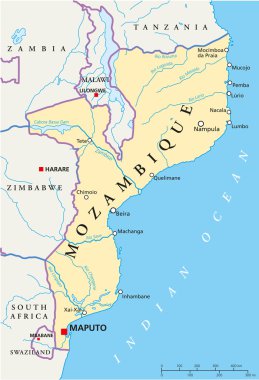
Political map of Mozambique with capital Maputo, with national borders, most important cities, rivers and lakes. Illustration with English labeling and scaling.

Republic of Zambia - vector map

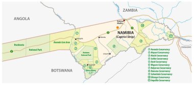
National park and conservancy map of the Caprivi Strip in the north east of Namibia

Zambia highly detailed physical map

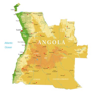
Angola highly detailed physical map

Highly detailed physical map of the Mozambique,in vector format,with all the relief forms,regions and big cities.