Locator map showing the location of the country British Indian Ocean Territory in Seven seas. The country is highlighted with a red polygon. No labels at all. Made with Natural Earth.

Locator map showing the location of the country Algeria in Africa. The country is highlighted with a red polygon. Small countries are also marked with a red circle. The map shows yellow land areas, blue sea, state borders and a blue grid lines.

Locator map showing the location of the country Andorra in Europe. The country is highlighted with a red polygon. No labels at all. Made with Natural Earth.

Locator map showing the location of the country Afghanistan in Asia. The country is highlighted with a red polygon. No labels at all. Made with Natural Earth.

Locator map showing the location of the country Albania in Europe. The country is highlighted with a red polygon. No labels at all. Made with Natural Earth.

Locator map showing the location of the country Andorra in Europe. The country is highlighted with a red polygon. Small countries are also marked with a red circle. The map shows yellow land areas, blue sea, state borders and a blue grid lines.

Locator map showing the location of the country Afghanistan in Asia. The country is highlighted with a red polygon. Small countries are also marked with a red circle. The map shows yellow land areas, blue sea, state borders and a blue grid lines.

Locator map showing the location of the country Albania in Europe. The country is highlighted with a red polygon. Small countries are also marked with a red circle. The map shows yellow land areas, blue sea, state borders and a blue grid lines.

Locator map showing the location of the country Algeria in Africa. The country is highlighted with a red polygon. No labels at all. Made with Natural Earth.

Saharanpur Division Highlighted in Uttar Pradesh State Map of India

Chitrakoot Division map of Uttar Pradesh State India

Ayodhya District orange color Map of Uttar Pradesh, India

Amethi District green Map of Uttar Pradesh, India

Agra District Vector Map with Bold blue Outline of Uttar Pradesh, India

Ambedkar District Map of Uttar Pradesh, India

Kanpur Dehat District Vector Map with Bold Black Outline of Uttar Pradesh, India

Jhansi District Map of Uttar Pradesh, India

Meerut Division map of Uttar Pradesh State India

Kanpur Division map of Uttar Pradesh State India

Basti Division Highlighted in Uttar Pradesh State Map of India

Kasganj (Kanshiram Nagar) District Vector Map with Bold Black Outline

Bareilly Division Highlighted in Uttar Pradesh State Map of India

Azamgarh Division Highlighted in Uttar Pradesh State Map of India

Agra Division Highlighted in Uttar Pradesh State Map of India

Lucknow Division Highlighted in Uttar Pradesh State Map of India

Kanpur Division Highlighted in Uttar Pradesh State Map of India

Mirzapur Division map of Uttar Pradesh State India

Kaushambi District Vector Map with Bold Black Outline

Balrampur District Vector Map with Bold red Outline of Uttar Pradesh, India

Ballia District green color Map of Uttar Pradesh, India

High detail Uttar Pradesh District Map Set Clean Vector Outline with Labels

Aligarh Division Highlighted in Uttar Pradesh State Map of India

Balrampur District Map of Uttar Pradesh, India

Ambedkar District Vector Map with yellow Outline of Uttar Pradesh, India

Kasganj (Kanshiram Nagar) District Map of Uttar Pradesh, India

Prayagraj Division map of Uttar Pradesh State India

Bareilly Division map of Uttar Pradesh State India

Jhansi Division map of Uttar Pradesh State India

Uttar Pradesh state map Uttar Pradesh state map illustration with all dist, India

Mau District Vector Map with Bold Black Outline

Bareilly District green Map of Uttar Pradesh, India

Jalaun District Vector Map of Uttar Pradesh state, India

Kannauj District Vector Map of Uttar Pradesh, India

Amroha District green Map of Uttar Pradesh, India

Aligarh District Map of Uttar Pradesh, India

Varanasi Division map of Uttar Pradesh State India

Basti Division map of Uttar Pradesh State India

Lucknow Division map of Uttar Pradesh State India

Devipatan Division map of Uttar Pradesh State India

Chitrakoot Division Highlighted in Uttar Pradesh State Map of India

Moradabad Division Highlighted in Uttar Pradesh State Map of India

Lucknow District Map of Uttar Pradesh, India

Bahraich District blue Map of Uttar Pradesh, India

Hathras (Mahamaya Nagar) District Vector Map with Bold blue Outline of Uttar Pradesh, India

Aligarh District Vector Map with Bold Black Outline of Uttar Pradesh, India

Aligarh District Vector Map with Bold Black Outline of Uttar Pradesh, India

Azamgarh Division map of Uttar Pradesh State India

Devipatan Division Highlighted in Uttar Pradesh State Map of India

Maharajganj District Map of Uttar Pradesh, India

Ayodhya Division map of Uttar Pradesh State India

Jhansi Division Highlighted in Uttar Pradesh State Map of India

Prayagraj Division Highlighted in Uttar Pradesh State Map of India

SAHARANPUR Division map of Uttar Pradesh State India

Moradabad Division map of Uttar Pradesh State India

Devipatan Division map of Uttar Pradesh State India

Baghpat District Vector Map with Bold colorful Outline of Uttar Pradesh, India

Ballia District Vector Map with Bold blue Outline of Uttar Pradesh, India

Kannauj District Map of Uttar Pradesh, India

Meerut Division Highlighted in Uttar Pradesh State Map of India

Varanasi Division Highlighted in Uttar Pradesh State Map of India

Barabanki District Vector Map with Bold Black Outline of Uttar Pradesh, India

Kanpur Dehat District Map of Uttar Pradesh, India

Azamgarh District blue Map of Uttar Pradesh, India

Agra District Map of Uttar Pradesh, India

Aligarh Division map of Uttar Pradesh State India

Gorakhpur Division map of Uttar Pradesh State India

Jhansi District Vector Map with Bold yellow Outline of Uttar Pradesh, India

Jaunpur District Vector Map with Bold green Outline of Uttar Pradesh, India

Jaunpur District green Map of Uttar Pradesh, India

Ayodhya District Vector Map with Bold orange Outline of Uttar Pradesh, India

Auraiya District Vector Map with Bold yellow Outline of Uttar Pradesh, India

Amethi District Vector Map with Bold Bblue Outline of Uttar Pradesh, India

Lucknow District Vector Map with Bold blue Outline

Auraiya District Map of Uttar Pradesh, India

Amroha District Vector Map with Bold red Outline of Uttar Pradesh, India

Kanpur Nagar District Map of Uttar Pradesh, India

Azamgarh District Vector Map with Bold blue color Uttar Pradesh, India

Baghpat District Map of Uttar Pradesh, India

Barabanki District blue Map of Uttar Pradesh, India

Moradabad Division Highlighted in Uttar Pradesh State Map of India

Gorakhpur Division Highlighted in Uttar Pradesh State Map of India

Kaushambi District Map of Uttar Pradesh, India

Bahraich District Vector Map with Bold blue Outline of Uttar Pradesh, India

Jalaun District Map of Uttar Pradesh, India

Ayodhya Division map of Uttar Pradesh State India

Kanpur Nagar District Vector Map with Bold pink Outline

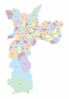
The Sao Paulo city colorful map divided into districts with labels, Brazil

The Sao Paulo city colorful map divided into districts and regions with labels, Brazil

The Sao Paulo city colorful map divided into districts and regions with labels, Brazil. Center, North, South, West and East Zones.

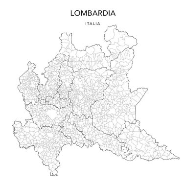
Vector Map of the Geopolitical Subdivisions of the Region of Lombardy (Lombardia) with Provinces and Municipalities (Comuni) as of 2022 - Italy