Description:
This SVG vector illustration represents the administrative regions of Guinea, showcasing clear and precise outlines of each area. The design is in a flat style, making it versatile for various applications. As a scalable vector graphic, it can be resized without losing quality, suitable for both print and digital formats. The image is designed to aid in understanding the geographical divisions of Guinea, making it a functional tool for education or presentation purposes. This vector is compatible with design software like Adobe Illustrator or CorelDRAW, providing flexibility for users. The image features clearly defined borders and labels for easy recognition of regions. It can cater to diverse design needs, such as infographics, maps, or educational resources.
Usage ideas:
This Guinea administrative SVG vector can serve multiple purposes in both commercial and educational contexts. For instance, educators can use it in classroom materials to teach geography, while businesses can incorporate it into market research presentations highlighting regional demography. Graphic designers may create promotional materials for travel agencies focusing on Guinea, or NGOs may utilize the vector in reports to illustrate their projects effectively. Additionally, the illustration can enhance websites or blogs that discuss governance, tourism, or regional development in Guinea. Its adaptability makes it valuable for diverse projects.

Blue-green detailed map of Equatorial Guinea administrative divisions with country flag and location on the globe. Vector illustration

Administrative division of the Republic of Guinea

Map of the West African state of Guinea

Blue-green detailed map of Papua New Guinea administrative divisions with country flag and location on the globe. Vector illustration
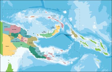
The Independent State of Papua New Guinea is an Oceanian country that occupies the eastern half of the island of New Guinea and its offshore islands in Melanesia.

Blue-gray detailed map of Sierra Leone administrative divisions and location on the globe. Vector illustration

OPEC (orange) and OPEC+ map with countries in World Equidistant Cylindrical (Sphere) Projection

Vector road map of the West African state of Senegal

Blue-gray detailed map of Senegal administrative divisions and location on the globe. Vector illustration

Ghana map in gray on a white background

Central Africa administrative map with flags
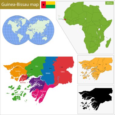
Administrative division of the Republic of Guinea-Bissau
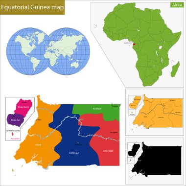
Equatorial Guinea map with high detail and accuracy and it is divided into provinces which are colored with different bright colors
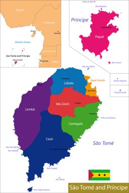
Administrative division of the Democratic Republic of Sao Tome and Principe
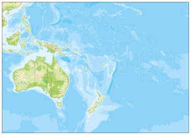
Blank Relief Map of Oceania. All elements are separated in editabe layers clearly labeled.

Guinea-Bissau political map of administrative divisions - regions and autonomous sector of Bissau. 3D turquoise vector map with name labels.

Ghana country detailed editable map with regions cities and towns, roads and railways, geographic sites. Vector EPS-10 file

Blank Relief Map of Oceania isolated on white. All elements are separated in editable layers clearly labeled.

Guinea Bissau Map icon. Guinea Bissau Map Clipart. Guinea Bissau Flag Map sign. Guinea Bissau Outline. flat style.

High detailed australia city vector map

Papua New Guinea Map Set with World Location.
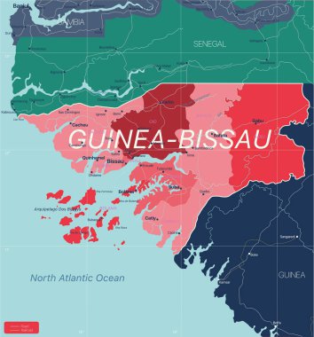
Guinea-Bissau country detailed editable map with regions cities and towns, roads and railways, geographic sites. Vector EPS-10 file
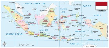
Indonesia administrative vector map with flag

Illustration of a Political Map of Oceania

Western africa administrative map with flags

Vector administrative and political map of the Federal Republic of Nigeria

Western Africa vector map high detailed silhouette illustration isolated on white background. Western Africa regional map with separated borders without country members. Cote d Ivore map.

Blue-green detailed map of Senegal administrative divisions with country flag and location on the globe. Vector illustration

Blank map Australia and New Zealand. Detailed map of Australia with States and territories and all Regions of New Zealand. Template. EPS10.

Guinea political map of administrative divisions - regions. 3D turquoise vector map with name labels.

Blue-gray detailed map of Australia administrative divisions and location on the globe. Vector illustration

Relief Map of Oceania. Names, town marks and national borders are in separate layers.

Equatorial Guinea political map of administrative divisions - provinces. 3D turquoise vector map with name labels.

Papua New Guinea Flag Oceania Country Waving Animation App Icon Vector

Blue-gray detailed map of Indonesia administrative divisions and location on the globe. Vector illustration

Relief Map of Oceania isolated on white. Names, town marks and national borders are in separate layers.