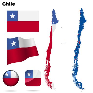
Chile vector set. Detailed country shape with region borders, flags and icons isolated on white background.

Chile map vector, Chile flag vector, isolated Chile

Political map of Chile. Vector illustration design

Grey map of Chile
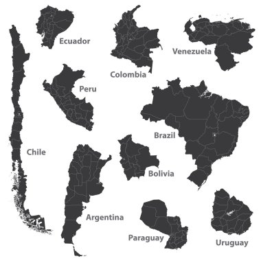
Vector maps of south american countries

Energy industry and ecology of Chile vector map with power stations infographic.
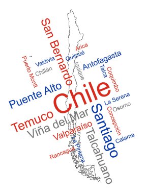
Chile map and words cloud with larger cities

Chile Landmark Global Travel And Journey Infographic Vector Design Template

Political map of South America. Vector illustration.

Political map of South America. Simple flat vector map with country name labels in grey.

Grey South America map with countries and capital cities
Blue polygonal South America map
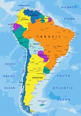
Colorful South America political map with clearly labeled, separated layers. Vector illustration.

South America Map Retro Colors and Flat Icons.All elements are separated in editable layers clearly labeled.

Political map of South America. Simple flat vector map with country name labels in four shades of turquoise blue.

North and South America high detailed vector map

Hand drawn vector map of South America. Text, line and colors on different layers. Perfect for infographics. Includes Brazil, Argentina, Chile, Paraguay, Uruguay, Colombia, Venezuela, Peru, Ecuador.

Chile map with borders, cities, capital and administrative divisions. Infographic vector map. Editable layers clearly labeled.

Hand drawn vector map of South America. Text, line and colors on different layers. Perfect for infographics. Includes Brazil, Argentina, Chile, Paraguay, Uruguay, Colombia,
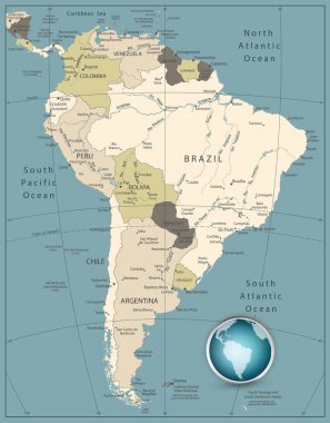
South America Highly Detailed Map. Retro Colors.

Political map of South America. Simple flat blank vector map in four shades of turquoise blue.

Vector Map Icon of the world in Globe form

Map of South America in high resolution. Vector illustration.

Flag of Chile - vector illustration

Vector map of South America, each country is the individual isolated object.

Isometric map and flag of Chile. 3D isometric shape of Chile. Vector Illustration.

Chile vector map. Editable template with regions, cities, red pins and blue surface on white background.

Chile vector map with infographic elements, pointer marks. Editable template with regions, cities and capital Santiago.

Political map of South America. Simple flat vector map with country name labels in four shades of gray.

Santiago - capital of Chile. Vector stamp

Vector Map Icon of the world in Globe form

Map of Chile - vector illustration

Geometric polygonal style vector map of chile. Low poly map of chile. Colorful Polygonal map shape of chile on white background - vector illustration eps 10.

Emblem or stamp with text Welcome to Chile, vector illustration

Detailed south america vector map

Shiny icon in form of Chile - vector illustration

Sketch of a map of Chile. Vector illustration design

Vintage label-sticker cards of Chile. Vector illustration

Atacama, Bio-Bio, Coquimbo, Libertador General Bernardo O Higgins outline maps

Chilean tourists attractions symbols isometric map with national flag food and places of interest poster vector illustration

Chile blank detailed vector outline map set

Chile infographics flat layout with border map and travel guide page text elements and symbols vector illustration

Chile infographics, statistical data, sights. Vector illustration
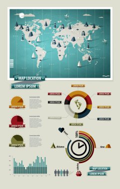
Set elements of infographics. World Map and Information Graphics

Editable template of map of Chile with marks. Chile on world map and on South America map.

Map Latin America. Poster map of Latin America. Black and white print map of Latin America for t-shirt, poster or geographic themes. Hand-drawn graphic map with countries. Vector Illustration

Illustration of elements of Chile's National Independence Day Fiestas Patrias background

Metro de Santiago vector map.

Santiago Chile City Map in Retro Style. Outline Map. Vector Illustration.

Chile infographics, statistical data, sights. Vector illustration

Chile Flag Collection, 12 versions

Chile map, black and white detailed outline regions of the country. Vector illustration

Set of vector polygonal maps of Chile. Bright gradient map of country in low poly style. Multicolored Chile map in geometric style for your infographics.

Chile map with shapes of regions. Blank vector map of the Country with regions. Borders of the country for your infographic. Vector illustration.

Map of South America with indication of Argentina

Map of South America. Political division - countries and capital ciites. Countries are separate objects, you can change color of every country.

Hand drawn vector map of South America with flags. Elements different layers. Perfect for infographics. Includes Brazil, Argentina, Chile, Paraguay, Uruguay, Colombia, Venezuela, Peru, Ecuador.
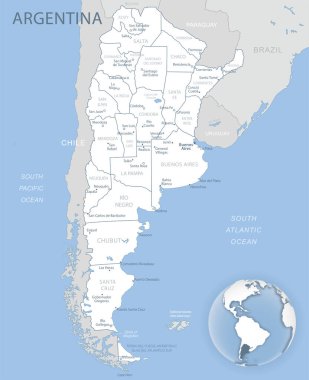
Blue-gray detailed map of Argentina administrative divisions and location on the globe. Vector illustration

South America map - highly detailed vector illustration.

Illustration of a gray South america map on white background
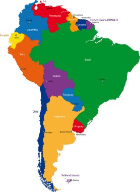
Colorful South America map with countries and capital cities
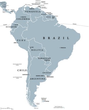
South America, gray political map with international borders and capitals. A continent, bordered by the Pacific and Atlantic Ocean, North America and the Caribbean Sea. Isolated illustration. Vector.

Administrative and political map of the republic of Chile

Vector road map of the Chilean island of Chiloe, Chile

South America political division map - vector illustration.
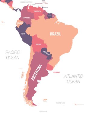
South America map. High detailed political map South American continent with country, ocean and sea names labeling.

Map of south america. map concept south america vector sketch

Map of South America in high resolution. Vector illustration.

Vector marijuana Chile map collage. Concept with green weed leaves for weed legalize campaign. Vector Chile map is designed with marijuana leaves.

Republic of Peru road and national park map

Chile map and flag - High Detailed Vector Illustration
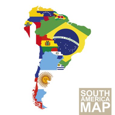
South America map. Vector map of South America with flags. Vector Illustration.

South America map - 4 bright color scheme. High detailed political map South American continent with country, ocean and sea names labeling.

Blank political map of South America. Simple flat vector outline map.

Color and black and white detailed map of South America with country silhouettes and flags

South America map - brown orange hue colored on dark background. High detailed political map South American continent with country, ocean and sea names labeling.

South America map. Molecule structure stylized design.
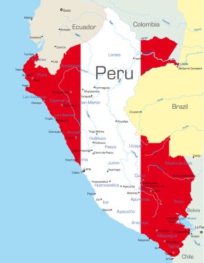
Abstract vector color map of Peru country colored by national flag

Highly Detailed South America Blind Map With Capital Dots.

The illustration of South America map with country borders. Vector Image.

Vector color map of South America

Chile - highly detailed blue map. Vector illustration
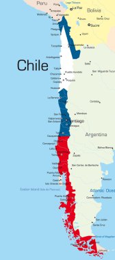
Abstract vector color map of Chile country colored by national flag

Abstract vector color map of Argentina country

South American flag set in alphabetical order, with an editable map.

South America Region. Map of countries in southern America. Vector illustration.

Vector highly detailed political map of Latin America and their capitals. All elements are separated in editable layers clearly labeled. EPS 10

Highly Detailed South America Blind Map.

Vector map of Patagonia, the southern part of south America, Chile and Argentina.
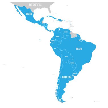
Political map of Latin America. Latin american states blue highlighted in the map of South America, Central America and Caribbean. Vector illustration.

Vector map of South America Continent with Countries, Capitals, Main Cities and Seas and islands names in brilliant colors.

South America map - green hue colored on dark background. High detailed political map South American continent with country, capital, ocean and sea names labeling.

Blue-green detailed map of Argentina administrative divisions with country flag and location on the globe. Vector illustration

Map of South America with indication of Peru

Map of South America with indication of Venezuela

Administrative and political vector map of agglomeration santiago Chile.

Highlighted Chile on Global Map with 3D Flag Location Pin of Chile.

High detailed map of North and South America

Map of South America with indication of Ecuador

Vector map of Chile country