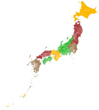
A large and detailed map of Japan with all regions, counties, islands and main cities.

Japav dotted map. Vector eps10

Vector Japan Pictogram isolated on white background

Vector detailed color map of Japan country

Map of Japan with borders in bright gray
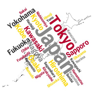
Map of Japan and text design with major cities

Kyoto map icon

Kyoto prefecture blank outline map set

Kumamoto, Kyoto, Mie, Miyagi outline maps

Kyoto prefecture blank contour map

Kyoto silhouette skyline. Japan - Kyoto vector city, japanese linear architecture, buildings. Kyoto line travel illustration, landmarks. Japan flat icon, japanese outline design banner

Map Of Kyoto Attractions Vector And Illustration.

High Quality map of Kyoto is a prefecture of Japan with borders of the districts
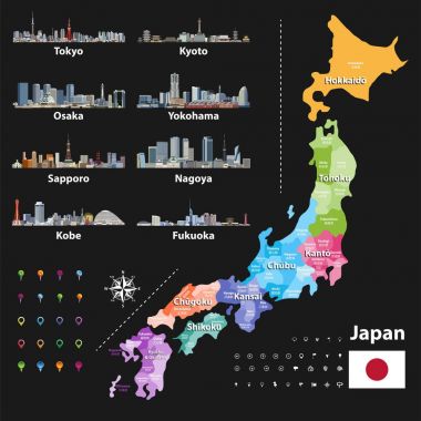
Vector illustration of Japanese flag and prefectures map colored by regions. Largest city skylines, navigation, location, and travel icons

Japan map. Color map of the provinces of Japan. Japan administrative map. Regions and prefectures.

Colorful political map of Japan divided into regions by color. Simple flat vector map with labels.

Blank political map of Japan. Administrative divisions - prefectures. Simple black outline vector map.

Red silhouette of Japan on white background. Detailed map of Japanese islands. Vector illustration

3d verctor map of cities and roads in Asia. Countries and their neighbors.

Political map of Japan. Administrative divisions - regions. Simple flat blank vector map

Japan political map. Main islands Honshu, Hokkaido, Kyushu, Shikoku and Okinawa. East Asian island country in the North Pacific bordered by Sea of Japan and Okhotsk, and East China and Philippine Sea.

Japan map. Color map of the provinces of Japan. Japan administrative map. Regions and prefectures.

Vector map of the East Asian island nation of Japan

Political map of Japan, North Korea and South Korea with the capitals Tokyo, Pyongyang and Seoul, with national borders, some important cities, with rivers and lakes. Vector illustration with english labeling and scale.

Japan, an island country in East Asia, political map, with capital Tokyo and the main islands Honshu, Hokkaido, Kyushu, Shikoku and Okinawa. Archipelago of 14,125 islands in the North Pacific Ocean.

Japan prefectures (japanese names gives in parentheses) vector map colored be regions with neighbouring countries and territories

The detailed map of the Japan with regions or states and cities, capitals

Vector map of Japan with cities and roads on separate layers. Tokyo, Kyoto, Osaka

Japan map in line style. Vector illustration on white background.

Colorful political map of Japan. Administrative divisions - regions. Simple flat vector map with labels.
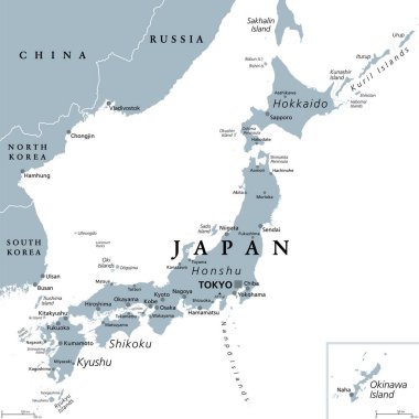
Japan, gray political map. The main islands Honshu, Hokkaido, Kyushu, Shikoku and Okinawa. East Asian island country in the North Pacific Ocean, archipelago of 14,125 islands and part of Ring of Fire.

Political map of Japan with regions and their capitals
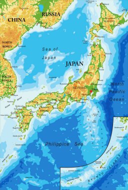
Japan highly detailed physical map,in vector format,with all the relief forms,regions and big cities.
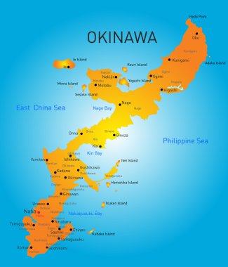
Vector color map of Okinawa, Japan
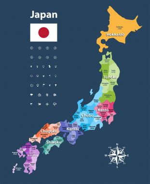
Japan prefectures vector map colored be regions. Japanese names gives in parentheses. Flag of Japan
Dotted Japan map on white

Vector japan map, simple line illustration.

Kuril Islands detailed editable map. Vector EPS-10 file

Modern Kyoto City Skyline Design

Japan on world map

Vector Japan Vintage Map isolated on white background

Stylized old vector Japan map with ship and paths
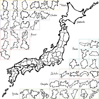
Japan map. Japanese prefectures. handwritten illustration.

Vector map of japan

Japan highly detailed vector map with main cities and roads.

2011 Japan Earthquake Map

Map of Japan with borders as scrible

Concept map of Japan, vector design Illustration

Map of the Japan in gray on a white background

Dotted map of Japan for your design, concept Illustration

Kanto Map. Map of Japan Prefecture. Vector illustration.

Cartoon vector map of Japan. Travel illustration with japanese main cities.

Japan map. Japanese prefectures. hand drawn illustration.
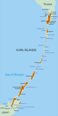
Vector color map of Kuril island

Japan map. Color map of the provinces of Japan. Japan administrative map. Regions and prefectures.

Map of Japan and Japanese Prefectures. hand drawn illustrations.

Zoom on Japan Map and Flag. World Map

Vector Japan Paint Concept isolated on white background

Concept map of Japan, vector design Illustration

Vector detailed map of Kuril island

Vector outline icons of Japan cities skylines with japanese flag and map
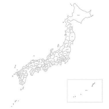
Blank political map of Japan. Administrative divisions - prefectures. Simple black outline vector map.
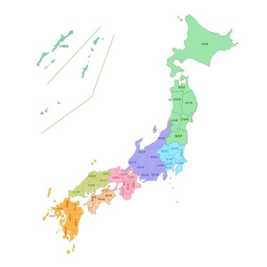
Japan Map Colorful Prefectures Icon
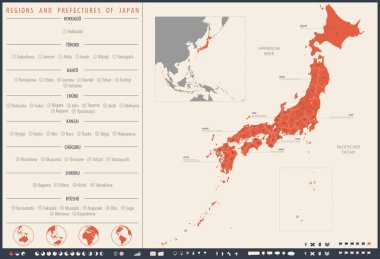
Detailed vector map Regions and prefectures of Japan

Japan Map Colorful Prefectures Icon

Map of Japan with abstract background in blue

Map of Japan conceptual poster. Travel to the Land of the Rising Sun. Flat vector cartoon illustration. Objects isolated on white background.

Japan map color line icon. Border of the country. Pictogram for web page, mobile app, promo. Editable stroke

Fukuoka prefecture icon vector isolated on white background for your web and mobile app design, fukuoka prefecture logo concept

Colorful political map of Japan divided into regions by color. Simple flat blank vector map

Japan map with landmark, mountain and sakura, Torii and Kyoto. Smiling geisha in national dress kimono making selfie, japanese architecture, female vector. Flat cartoon

The detailed map of the Japan with regions or states and cities, capitals

Grunge rubber stamp set with names of Japan cities (part one), vector illustration

Japanese tourist attractions set, vector file

Opera house icons set outline vector. Architecture building. Historic house

Modern Kyoto City Skyline Design

Cartoon woman travel happily in japan in winter with snow

Earth with recycling symbol

Japan map with cherry blossoms background.
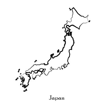
Map of Japan for your design, concept Illustration
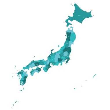
Turquoise blue political map of Japan. Administrative divisions - prefectures. Simple flat vector map with labels.

Hokkaido island vector color map

Map of Japan with borders in violet

Orange political map of Japan. Administrative divisions - prefectures. Simple flat vector map with labels.

Pink political map of Japan. Administrative divisions - prefectures. Simple flat vector map with labels.

Map of Japan with borders in green
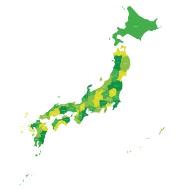
Green political map of Japan. Administrative divisions - prefectures. Simple flat vector map with labels.

Miyagi map, Japan, Asia. Filled and outline map designs. Vector illustration

Hand use magnifying glass searching on japan map

Seamless pattern with japan travel landmark

Bundle of Japan map icons : outline and solid black styles for infographics, education, and location-based design projects.

Seamless pattern with japan travel landmark

Travel to Japan infographic set. Japanese culture and food, people with fan and kimono, samurai with sword and sumo wrestler, daruma and bonsai, sushi and bamboo stickers cartoon vector illustration

Simplified vector illustration of the map of Japan in cartoon style. Design element for educational materials, travel content and cultural guides

Isolated Japan map icons for infographics, education, and location-based design projects.

Kyoto Japan Map Silhouette Icon