Description:
This SVG vector presents a detailed map of Curacao Island, showcasing its geographic layout and key features. The design is provided in scalable vector format, ensuring high-resolution quality for various applications. The style is flat, making it suitable for both digital and print media. The color palette follows a minimalist approach, emphasizing the island's boundaries and significant landmarks. This vector file is user-friendly and compatible with various graphic design tools. Use this map for travel-related projects or educational resources to convey geographical information effectively. Its clean lines and simplicity allow for versatile usage across different design contexts.
Usage ideas:
This Curacao Island map can be effectively utilized in a range of commercial applications, such as tourism marketing materials, travel guides, or educational presentations. Businesses in the travel industry might incorporate this vector into brochures or websites to attract potential visitors. Educational institutions can use it as a visual aid in geography lessons, helping students understand the island’s layout and significant locations. Additionally, it can be adapted for use on merchandise, such as t-shirts or tote bags, that promote Curacao as a travel destination and enhance the visitor experience.

Mesh polygonal Curacao Island map and grunge seal stamps. Abstract lines and dots form Curacao Island map vector model. Round red stamp with connecting hands.
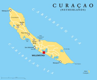
Curacao Political Map with capital Willemstad and important cities. English labeling and scaling. Illustration.
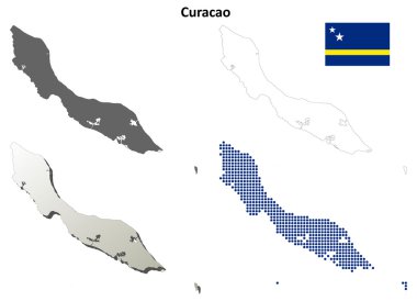
Curacao blank detailed outline map set - vector version

Abstract Curacao Island map isolated on a white background. Triangular mesh model in black color of Curacao Island map. Polygonal geographic scheme designed for political illustrations.
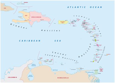
Vector map of the states of the lesser Antilles
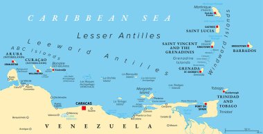
Hurricane free Caribbean islands, political map. The Leeward Antilles and Windward Islands are safest from Hurricanes. Aruba, Barbados, Bonaire, Curacao, Grenada, The Grenadines, Trinidad and Tobago.

Lesser Antilles of the Caribbean, multicolored political map. Group of islands between Greater Antilles and South America. Divided into the Leeward Islands, Windward Islands, and the Leeward Antilles.

Vector road map of the Caribbean ABC island of Curacao

National flag of Curacao that can be used for celebrating Curacao national days. Vector illustration
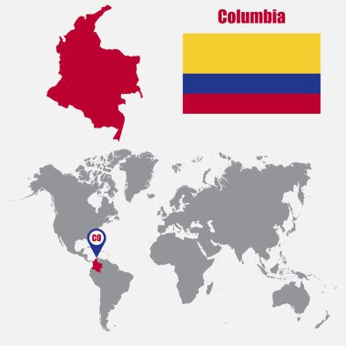
Columbia map on a world map with flag and map pointer. Vector illustration

Curacao map on white
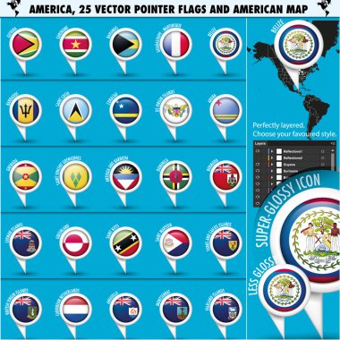
America Pointer Flag Icons with american Map set2 - subdivided states map, vector illustration in .CS and .EPS10. Contain transparency.

Map of the Aruba, Bonaire, Curacao islands drawn with high detail and accuracy.
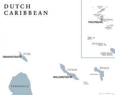
Dutch Caribbean political map with Aruba, Curacao, Bonaire, Sint Maarten, Saba and Sint Eustatius. Former Netherlands Antilles. Gray illustration isolated on white background. English labeling. Vector

Location map of the ABC islands in the Caribbean sea
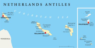
Netherlands Antilles Political Map. Aruba, Curacao, Bonaire, Sint Maarten, Saba and Sint Eustatius with capitals and important cities. English labeling and scaling. Illustration.

Map of Curacao

Map of Curacao

Map of Curacao

Map of Curacao

Map of Curacao

Outline map of Curacao marked with red line.

Set of official national flags of the world and other territories. Alphabetical order. North America. Vector design illustration