
Delhi blank detailed vector outline map set
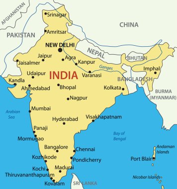
Republic of India - vector map

India isolated blank outline map set

Vector illustration of administrative division map of India.

Delhi India City Map in Retro Style. Outline Map. Vector Illustration.

India map, vector flat illustration, Elephant, cow sitar palm tree.

Abstract rounded World Map with pinned detailed India map. Vector Illustration.

Delhi blank detailed outline map set - vector version

Delhi (States and union territories of India, Federated states, Republic of India) map vector illustration, scribble sketch National Capital Territory of Delhi (NCT) map

Detailed map of Delhi city administrative area. Royalty free vector illustration. Cityscape panorama. Decorative graphic tourist map of Delhi territory.

Delhi (New York) blank outline map

Daman and Diu, Delhi, Goa, Gujarat outline maps

Delhi state blank outline map set
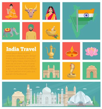
India decorative flat icons with map architecture cuisine and national suits isolated vector illustration
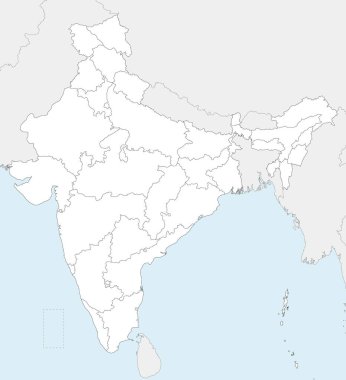
Vector blank map of India with states and territories and administrative divisions, and neighbouring countries. Editable and clearly labeled layers.

India map. hand drawn illustration.

Vector Map of the combined catchment areas of the Ganges, Brahmaputra and Meghna rivers.

High detailed India physical map.

Easy to edit vector illustration of Physical Map of India with different state

Vector map of India with states and territories and administrative divisions. Editable and clearly labeled layers.

Colorful India political map with clearly labeled, separated layers. Vector illustration.

High detailed India physical map with labeling.

Highlighted India on Global Map with 3D Flag Location Pin of India.

Highly detailed map of India.

India country detailed editable map with regions cities and towns, roads and railways, geographic sites. Vector EPS-10 file

Illustration of detailed map of India, Asia with all states and country boundary

Political detailed map of India with all states and country boundary

Magnifying glass showing a map of India on a world map.

Pacific Centered World map with magnified India. Flag and map of India.

High detailed India physical map with labeling.

India - Highly detailed editable political map with labeling.

India political map with capital New Delhi, national borders and neighbor countries. Republic and subcontinent in South Asia. Gray illustration, English labeling. Isolated on white background. Vector.

India - detailed map with administrative divisions country. Vector illustration

Vector map of India with states and territories and administrative divisions. Editable and clearly labeled layers.
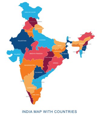
Abstract multicolor vector political india map with countries name,border.Detailed modern illustration can be use for presentation,report,t-shirt,poster,geographical templates.Simplified isolated administrative map.Hand drawn print map.

Vector blank map of India with states and territories and administrative divisions. Editable and clearly labeled layers.

India - Highly detailed editable political map with labeling.

Detailed vector map of India with states borders.

Detailed vector map of India with states borders.

Map of India - highly detailed vector illustration

India road map with the main cities
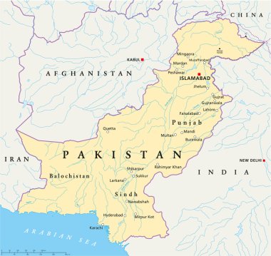
Political map of Pakistan with capital Islamabad, national borders, most important cities, rivers and lakes. Illustration with English labeling and scaling.
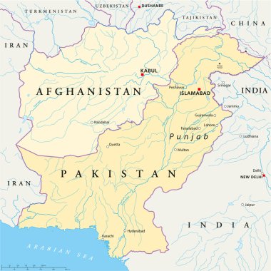
Political map of Afghanistan and Pakistan with capitals Kabul and Islamabad, with national borders, most important cities, rivers and lakes. Illustration with English labeling and scaling.

Easy to edit vector illustration of Famous National Park Map Of India

Illustration of detailed map of India, Asia with all states and country boundary

Detailed vector map of India with states borders.
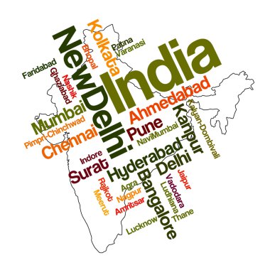
India map and words cloud with larger cities

A set of detailed accurate vector maps of India. Detailed map, with regional borders, a map of round points and a map in the colors of the flag.

Globe centered to India. Country highlighted with green color on world map. Satellite world projection. Attractive vector illustration.

India - Highly detailed editable political map with labeling.

High detailed India physical map with labeling.

India map - highly detailed vector illustration

India map. Cities regions Vector illustration

Colorful India political map with clearly labeled, separated layers. Vector illustration.

Colored Hand drawn doodle India map. India city names lettering and cartoon landmarks, tourist attractions cliparts. travel, trip comic infographic poster, banner concept design.

Map of India with the biggest cities and rivers

Illustration of detailed map of India, Asia with all states and country boundary

A High Detail vector Map of the Republic of India Federation states and Union Territories and major cities, with a 3D vector Globe centered on India

India map vintage stamp. Retro style handmade label, badge or element for travel souvenirs. Black rubber stamp with country map silhouette. Vector illustration.

India - country map and flag located on globe, world map. 3D Vector illustration

Map of India Vector illustration eps 10

Illustration of detailed map of India, Asia with all states and country boundary

Map of India silhouette, India map dotted, Flag of India. Vector illustration flat

Illustration map of India with nature, animals and landmarks. Editable Vector illustration

India round sign. Futuristic satelite view of the world centered to India. Country badge with map, round text and binary background. Awesome vector illustration.

Easy to edit vector illustration of different Mineral Map Of India

Flag map of India Vector illustration eps 10

Vintage map of India. Grunge sunburst around the country. Black India shape with sun rays on white background. Vector illustration.

India travel stamps set, postage stamps with symbols and cities of of Republic of India, vector

India map. Country poster with colored regions. Old grunge texture. Vector illustration of India with country name.

Blue india national map vector image on white background
India outdoor stamp. Round sticker with map of country with topographic isolines. Vector illustration. Can be used as insignia, logotype, label, sticker or badge of the India.

India flag and outline of the country on a white background. Vector illustration.

Colorful travel stamp cards set with traditional symbols and famous sights of india isolated on black background cartoon vector illustration

India flags collection. Flags and outline of the country. Vector illustration

Map of world with main cities in pastel orange

Set of India icons illustration vector

India, Sign and symbol, Vector infographics illustration.
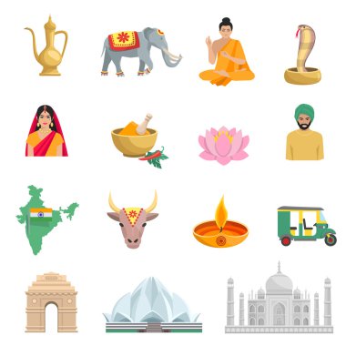
India flat icons set with symbols of culture and religion isolated vector illustration

India country theme symbols stickers set eps10

Map of world with borders in pastel orange

Map of world with main cities in gray

India wavy flag and mosaic map on light background. Creative background for the national indian poster. Vector tricolor design. Business booklet. State indian patriotic banner, flyer

Map of world with main cities in green

India set Asia country vector Indian architecture Asian traditions buddhism travel isolated icons.

India set Asia country vector Indian architecture Asian traditions buddhism travel isolated icons.

India heart flag logo. Country name text around India flag in a shape of heart. Superb vector illustration.

Andaman Islands map. Island silhouette icon. Isolated Andaman Islands black map outline. Vector illustration.

Map of the United States by population

Egypt and India culture seamless patterns. Vector pattern of Pyramids, Nefertiti, eye of Horus, Tutankhamun pharao, scarab, map, cuneiform, Amon Ra, Taj Mahal, Ganesha elephant, Hamsa hand amulet
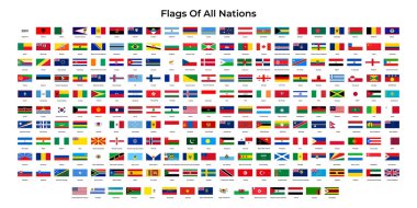
All Countries National Flags. Vector illustration.

Four clocks and globes for world time zones with city name signs.

India Map. Large group of people form to create a shape of India Map. vector illustration.

Flat India Map Set Vector Illustration

China and Asia, Global World

Map of world with main cities in gray

Delhi, India, colorful vector map. White streets, railways and water. Bright colored landmark shapes. Art print pattern.

Map of world with borders in gray

Map of world with main cities in gray

Delhi India City Map in Black and White Color. Vector Illustration. Outline Map.