Description:
This Latvia boundary SVG vector illustration offers a precise outline of the country's geographical shape. Available in scalable vector format, it allows for seamless resizing without loss of quality. The design features clean lines and is suitable for various applications, from geographical studies to travel-themed projects. The vector format ensures versatility, making it compatible with different design software. This clipart is especially useful for educators, graphic designers, and cartographers. The boundary can be used independently or in conjunction with other geographical elements. Overall, it serves as a reliable resource for accurate representations of Latvia's borders.
Usage ideas:
The Latvia boundary SVG vector can be utilized in numerous commercial and educational settings. For instance, it can enhance travel brochures, provide visual aids for geography lessons, or be incorporated into web designs focusing on Eastern Europe. Businesses can create informative infographics that showcase data related to Latvia, while educators may use the vector in presentations to illustrate the country's position in relation to neighboring nations. Additionally, designers may leverage this vector in projects like map-themed apps or online travel guides, enriching user experience through clear geographic representation.

Nordic-Baltic Eight (NB8) member states political map. Regional co-operation format of Denmark, Estonia, Finland, Iceland, Latvia, Lithuania, Norway and Sweden. English labeling. Illustration. Vector.

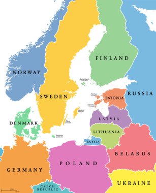
Baltic Sea area, colored countries, political map, with national borders and English names. Countries along the coast of the Baltic Sea, with surrounding countries in Europe. Isolated illustration.

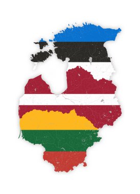
Map of Baltic states with rivers and lakes in colors of the national flags of Baltic states. Please look at my other images of cartographic series - they are all very detailed and carefully drawn by hand WITH RIVERS AND LAKES.

Boundary of Schengen Area, Europe with countries silhouettes. Eps file contains separate layers

Map of administrative divisions of Republic of Latvia

Latvia Map Illustration Icon Element Design

Latvia vector watercolor map illustration

European Union members and candidates, country silhouettes. Eps file contains separate layers

Map Of Latvia. Country closes border against refugees. Map of States with barbed wire. European country protects its borders. Latvian Flag. Surrounded by perimeter fence

Black map of administrative divisions of Republic of Latvia

Map of administrative divisions of Republic of Latvia

Signs of occupation of the baltic states. vector illustration

3d map of Latvia with borders of regions

Black map of Latvia for your design, concept Illustration.

Latvia vector set. Detailed country shape with region borders, flags and icons isolated on white background.

Detailed illustration of a ballotbox in front of a map of Latvia, eps10 vector

Map of administrative divisions of Republic of Latvia

Detailed illustration of a map of Latvia with flag, eps10 vector

Latvia blank detailed outline map set

Administrative division of the Republic of Latvia

Map of administrative divisions of Republic of Latvia

Latvia political map of administrative divisions - municipalities and cities. 3D turquoise vector map with name labels.

Set of state maps of Latvia with regions and municipalities division. Department borders, isolated vector maps on white background.