
Latvia map and flag vector, Latvia map, Latvia flag
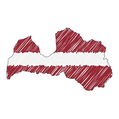
Latvia map hand drawn sketch. Vector concept illustration flag, childrens drawing, scribble map. Country map for infographic, brochures and presentations isolated on white background. Vector
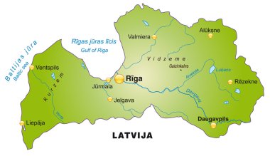
Map of Latvia as an overview map in green
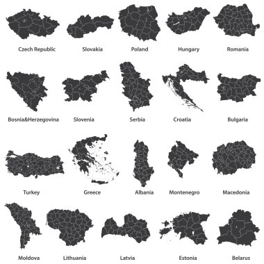
Vector maps of european countries

Map of administrative divisions of Republic of Latvia

Set of state maps of Latvia with regions and municipalities division. Department borders, isolated vector maps on white background.

Detailed map of Europe

Latvia Map and Flag. A large group of people in the Latvia flag color form to create the map. Vector Illustration.

Latvia map in gray on a black background 3d

Latvia vector map with infographic elements, pointer marks. Editable template with regions, cities and capital Riga.

Latvia map card paper 3D natural vector

Latvia Map in grey

Black abstract map of Latvia

Latvia road and National Park map

Latvia region map: golden gradient outline on dark background. Detailed map of Latvia regions. Vector illustration.

Vector maps set. High detailed 12 maps of Northern Europe countries with administrative division and cities. Political map, map of Europe continent, world map, globe, infographic elements.

Pen hand drawn Europe map vector on paper illustration

Vector Europe map

Latvia map in gray on a white background

Latvia map vector, Latvia flag vector, isolated Latvia

Vector detailed color Latvia map

Europe map illustration
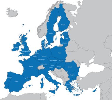
The 27 Member State of the European Union

North europe - vector maps of territories

Scandinavia map in white background, scandinavia map vector, map vector

Arctic Map - Vintage Detailed Vector Illustration

The European Union map and flags

Colorful Europe map
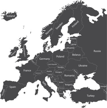
Europe political map with country names
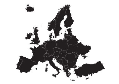
Vector map of Europe

Map of Europe in gray on a white background
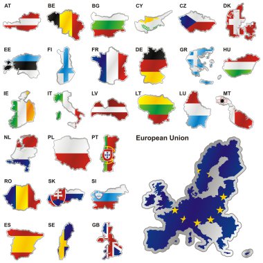
Fully editable vector illustration of all twenty-seven Member States of the European Union in map shape

Europa-highly detailed map. Vector illustration

Latvia map vector map.Hand drawn minimalism style.

Map of administrative divisions of Republic of Latvia

Riga Latvia Map in Retro Style. Vector Illustration. Outline Map.

Stylized map of Latvia. Isometric 3D green map with cities, borders, capital Riga, regions. Vector illustration. Editable layers clearly labeled. English language

Three versions of the World Map with the enlarged map of Latvia with flag.

Europe and European Union map with indication of Latvia
Glossy colorful Latvia map application point label symbol hanging over enlightened background

Latvia administrative blue-green map with country flag and location on a globe. Vector illustration

Vector polygonal Latvia map. Gray map of country in low poly style. EPS Illustration in geometric style for your infographics

Latvia country map polygonal with spot lights places

Latvia map glass card paper 3D vector

Zoom on Latvia Map and Flag. World Map

Stylized vector Latvia map. Infographic 3d gold map illustration with cities, borders, capital, administrative divisions and pointer marks, shadow; gradient background.

Latvia map in Europe continent illustration design

Map of administrative divisions of Republic of Latvia

Latvia, map with flag, vector illustration

Illustration of latvia map with stars european

Vector map and flag of Latvia

COVID-19 vaccination in Latvia, coronavirus vaccination illustration with vaccine bottle and syringe injection in map of Latvia.

White chalk texture hipster insignia with Republic of Latvia map on a green blackboard. Grunge rubber seal with country outlines, vector illustration.

Latvia map with shadow effect

Baltic Sea Area Map - Detailed Vector Illustration

Latvia blank detailed outline map set

Europe with highlighted Latvia map and flag

Vector dot abstract Latvia map and isolated clean black, grunge red, blue, green stamp seals. Latvia map label inside draft framed rectangles and with grunge rubber texture.

Map of Latvia and national flag in a circle. Latvia map contour with flag. Vector Illustration.

Latvia Map Pin with National Flag on Open World Map.

Latvia country black outline silhouettes in three different levels of smoothness. Simplified maps. Vector icons isolated on white background.

Latvia Highlighted in Flag Colors on Geographic Map.

Detailed map of Belarus with country flag and location on world map. Vector illustration

Latvia Highlighted on Europe Map with Flag Icon.

Latvia Outline Map with Green Colour. Modern Simple Line Cartoon Design - EPS 10 Vector

Isometric Map of Latvia. Simple 3D Map. Vector Illustration - EPS 10 Vector

Map and flag of Latvia for national or independance day banner with raised hands or fists., flag colors theme background and geometric abstract retro modern colorfull design

Poly map of Europe isolated on background. Vector version.

Low Poly Latvia Map with National Colors - Infographic - Vector Illustration

The set of national profile of the geographic maps of the latvia state designed cartoon on the colored background

Republic of Latvia isolated map and official flag icons. vector Latvian political thin line map over black background. European Union country geographic banner template

Detailed vector map of Latvia and capital city Riga

High detailed vector political Europe map with capitals, cities, towns, rivers and lakes.

Thin black outline map of European Union - EU. Vector illustration.

Baltic Sea Area Map - Vintage Detailed Vector Illustration

Estonia road and National Park map

Vector detailed map of Europe

Railway and political map of Europe and North Africa. European cities. Political map with the border of the states. Urban areas. Railway line.

Latvia blue Low Poly map with capital Riga, versions with flag, black and outline. Vector Illustration.
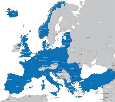
Members of NATO in Europe
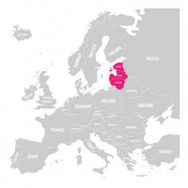
Baltic states Estonia, Latvia and Lithuania pink highlighted in the political map of Europe. Vector illustration.
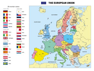
Vector highly detailed political map of The European Union with flags and capitals. All elements are separated in editable layers clearly labeled.
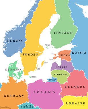
Baltic Sea area, colored countries, political map, with national borders and English names. Countries along the coast of the Baltic Sea, with surrounding countries in Europe. Isolated illustration.

Vector Scandinavian and Baltic countries map with flags and cities skylines: Copenhagen, Stockholm, Oslo, Reykjavik, Helsinki, Riga, Tallinn, Vilnius.

Vector Europe map

Political and administrative vector map of northern europe with state borders

Detailed map of Europe with cities

Illustration of a Political Map of USSR with Names

Administrative and district map of latvia capital riga
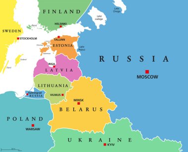
Baltic States, colored countries, political map. From Finland to Estonia, Latvia and Lithuania to Poland, and from the Russian exclave Kaliningrad Oblast, to Belarus and the European Part of Russia.

Estonia map, black and white detailed outline regions of the country. Vector illustration

Gulf of Finland and Gulf of Riga region, gray political map. The Nordic countries Finland, Estonia and Latvia with their capitals, and the seaway from the Baltic Sea to Saint Petersburg, Russia.

Arctic Map - Vintage Detailed Vector Illustration

Abstract vector color map of Norway and Sweden country coloured by national flag

European political map set with map pointers

Vector illustration of a Grey Europe map with Dark european countries

Boundary of Schengen Area, Europe with countries silhouettes. Eps file contains separate layers

Baltic States and Kaliningrad Oblast, gray political map. From Finland to Estonia, Latvia and Lithuania to Poland, and from the Russian exclave Kaliningrad, to Belarus and the European Part of Russia.

Colored Hand drawn doodle Latvia map. Latvian city names lettering and cartoon landmarks, tourist attractions cliparts. travel, banner concept design. Riga, Ventspils, mail symbols

Map of the railroad tracks in the three Baltic states