
Hong Kong map. Geometric style country outline. Overwhelming violet vector illustration.

Attractive Hong Kong travel elements collection in flat design style

Delicious Hong Kong cuisines collection in flat style

Lovely Hong Kong travel map on in flat style - lower right word is Hong Kong travel in Chinese word

Attractive Hong Kong travel map with attractions icons in flat design

Lovely Hong Kong map design in flat style - the upper left title is Hong Kong in Chinese word

Colorful Hong Kong travel map with attractions icons in flat design
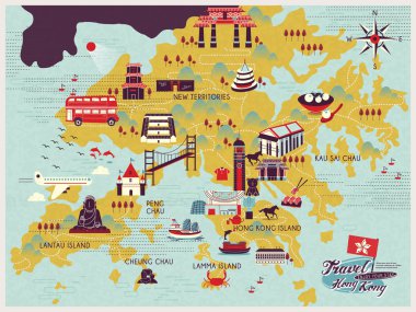
Attractive Hong Kong travel map with attractions icons in flat design

Hong Kong flag map pin vector design template

Vector poster map city Hong Kong

Attractive Hong Kong travel map with attractions icons in flat design
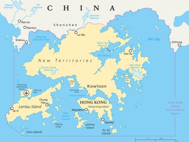
Hong Kong and vicinity political map. World financial Centre and Special Administrative Region in Guangdong Province of China. English labeling and scaling. Illustration.

Hong Kong map vector, Hong Kong flag vector, isolated Hong Kong

Beautiful isometric style design concept of Hong Kong city

Set of Hong Kong icons, vector illustration

Lovely Hong Kong map design in flat style - the upper right title is Hong Kong in Chinese word

Attractive Hong Kong travel elements collection in hand drawn style

Vector outline icons of hina cities skylines
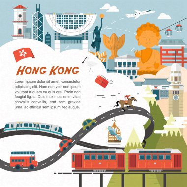
Attractive Hong Kong travel concept poster in flat design
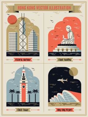
Hong Kong famous attractions set in lovely flat design style
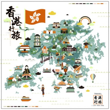
Attractive Hong Kong travel map with attractions icons in flat design
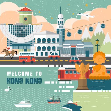
Attractive Hong Kong travel concept poster in flat design style

Adorable Hong Kong travel map in flat design

Adorable Hong Kong travel concept with attractions and dishes in thin line design
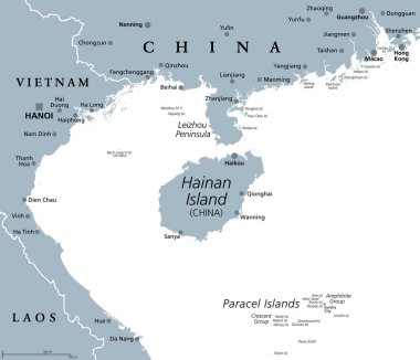
Hainan, southernmost province of China, and surrounding area, gray political map. Hainan Island, and Paracel Islands in the South China Sea, south of the Leizhou Peninsula, and east of Gulf of Tonkin.
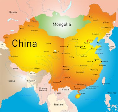
Vector map of China country

The detailed map of China with regions or states and cities, capitals. With map pins or pointers. Place location markers or signs

Hong Kong Special Administrative Region of the People s Republic of China road vector map

Vector blank map of China with provinces, regions and administrative divisions. Editable and clearly labeled layers.

China map. Cities regions Vector illustration

China, political map, with administrative divisions. PRC, People's Republic of China, capital Beijing, provinces with capitals, borders and neighbor countries. English labeling. Illustration. Vector.

China map, administrative division, separate individual region with names, color map isolated on white background vector

Vector map of China provinces colored by regions with neighbouring countries and territories

Detailed vector map of Hong Kong

Black and white map of China

East Asia political map with countries and borders. Eastern subregion of the Asian continent with China, Japan, Mongolia and Indonesia. English labeling. Gray illustration on white background. Vector.

Vector map of China with provinces, regions and administrative divisions. Editable and clearly labeled layers.
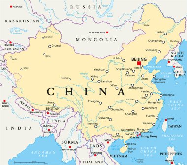
China political map with capital Beijing, national borders, important cities, rivers and lakes. English labeling and scaling. Illustration.
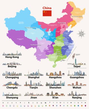
Vector map of China provinces colored by regions.

High quality colorful labeled map of China with borders of the provinces

Color map of China

Hong kong administrative division map

Color map of Eastern Asia divided by the countries

Black outline of Hong Kong map
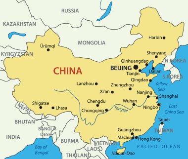
S Republic of China - vector map

East Asia, single states, political map. All countries in different colors, with national borders, labeled with English country names. Eastern subregion of the Asian continent. Illustration. Vector.

China Map - Vintage Detailed Vector Illustration

Peoples Republic of China, PRC, gray political map. Area controlled by China in yellow color, and claimed but uncontrolled regions shown in brown. English labeling. Illustration over white. Vector.

The detailed map of the China with regions or states and cities, capitals

China map. Vector illustration.

The detailed map of the China with regions or states and cities, capitals, national flag

Lovely hand drawn Hong Kong travel map
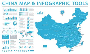
China Map - Detailed Info Graphic Vector Illustration

China highly detailed physical map,in vector format,with all the relief forms,regions and big cities.
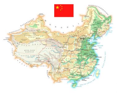
China - detailed topographic map - vector illustration

China Map - Vintage Detailed Vector Illustration

Moder map of China
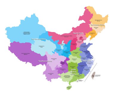
Vector map of China provinces colored by regions. Chinese names gives in parentheses

China map and flag - highly detailed vector illustration

Lovely hand drawn Hong Kong travel map

China, gray political map, with administrative divisions. PRC, People's Republic of China with capital Beijing, provinces with capitals and borders. English labeling. Illustration over white. Vector.

Vector China map with largest chinese city skylines

I love Hong Kong concept travel map with attractions icons in flat design

Attractive Hong Kong travel map in flat style

Flags of the countries of the world. Flags of Asian countries. Geography, atlas, world, travel

Members of the APECs flags in pointer icons

Adorable Hong Kong travel map in flat design
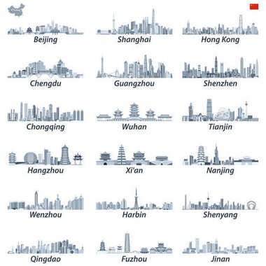
Vector high detailed illustration of chinese largest city skylines in tints of blue color palette with map and flag of China

Map pointer with national flag of Hong Kong logo. vector illustration

Hand drawn doodle China icons collection Vector illustration Sketchy Chinese icons set Big set of icons for Welcome to China Concept Tea Ceremony Chinese food National costume Lantern Dim Sum Dragon
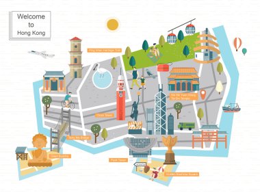
Fashionable Hong Kong travel concept map in flat design

Hand drawn doodle Mexico set Vector illustration Sketchy mexican food icons United Mexican States elements Flag Maracas Sombrero Welcome to Mexico Maya Pyramid Aztec Tequila Agave Poncho Guacamole

Attractive Hong Kong travel map with attractions icons in flat design

Hong Kong Flag in Red Map Outline Silhouette Vector Illustration

Hong Kong travel element - great for Hong Kong travel concept

Poster city skyline Hong Kong, Flat style vector illustration

Hong Kong beautiful country in world to visit on holiday. Vector illustration

Hand drawn doodle China icons collection. Vector illustration. Sketchy Chinese icons set. Big set of icons for Welcome to China Concept

Light blue design concept of Country Hong Kong Map isolated on dark green background - vector illustration

Hong Kong travel map on notepaper - the upper left title is Hong Kong travel in Chinese word

Attractive Hong Kong travel map design in flat style

Retro Hong Kong travel poster design - the upper right title is Hong Kong in Chinese word
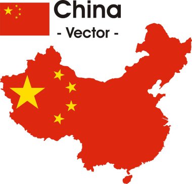
China map as vector image (with flag in the background)

Hong Kong flag, official colors. Vector illustration.

Hong Kong travel map drawn by a hand - the upper left title is Hong Kong travel in Chinese word

Adorable Hong Kong travel elements collection in flat design

Delicious Hong Kong cuisines collection poster in flat style

Vector graphic flat icon images and icons representing Hong Kong. The text says "Hong Kong" in Cantonese.

Delicious Hong Kong dessert collections in flat style

Hand drawn doodle China icons collection. Vector illustration. Sketchy Chinese icons set. Big set of icons for Welcome to China Concept

Hand drawn doodle China icons collection Vector illustration Sketchy Chinese icons set Big set of icons for Welcome to China Concept Tea Ceremony Chinese food National costume Lantern Dim Sum Dragon

Adorable Hong Kong travel concept with attractions and dishes in flat design

Hand drawn doodle China icons collection. Vector illustration. Sketchy Chinese icons set. Big set of icons for Welcome to China Concept
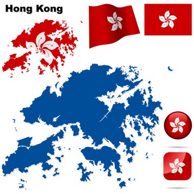
Hong Kong vector set. Detailed region shape, flags and icons isolated on white background.

Hong Kong colored vector map

Vector map of the world with set of the most famous landmarks.

Vintage Hong Kong travel concept map in flat design

A Country Shape isolated on background of the country of Hong Kong

Black map collection, black contour maps of World. Map collection Part 10.

All asian maps mixed with flags. Vector