
Adorable South Korea travel map with colorful attractions
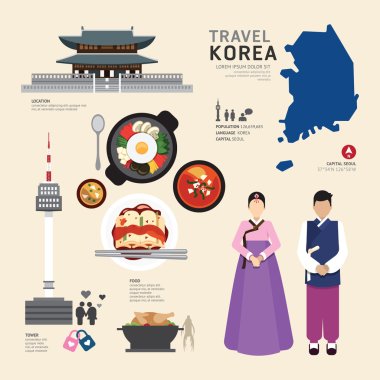
Korea Flat Icons Design Travel Concept.Vector

Map Of Korea Attractions Vector And Illustration.

Black and white map of South Korea
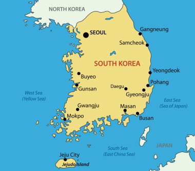
Republic of Korea - vector map
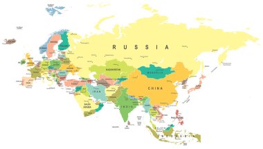
Eurasia map - highly detailed vector illustration.

Flag and Map of South Korea symbol isolated on Light blue background. Vector illustration.
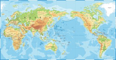
Political Physical Topographic Colored World Map Pacific Centered- vector
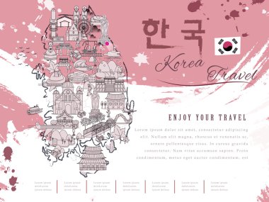
Attractive South Korea travel map - Korea in Korean words on upper right
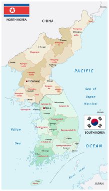
Administrative vector map of the states of north and south korea

Administrative vector map of the South Korean province of Gangwon-do with flag
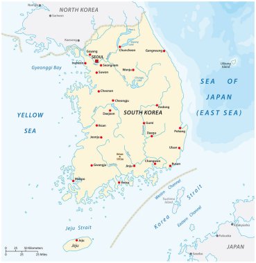
Vector map of the Republic of Korea, South Korea

South korea travel symbols set, vector illustration

The design of the world map composed of a straight line
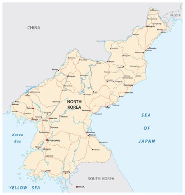
North Korea road vector map

Administrative map of the South Korean island Jeju

Expressway Map of South Korea s Gyeonggi Province and the capital of Seoul

South Korea map glowing silhouette outline made of stars lines dots triangles, low polygonal shapes. Communication, internet technologies concept. Wireframe futuristic design. Vector illustration.

Administrative vector map of the South Korean province of Gyeongsangnam-do with flag
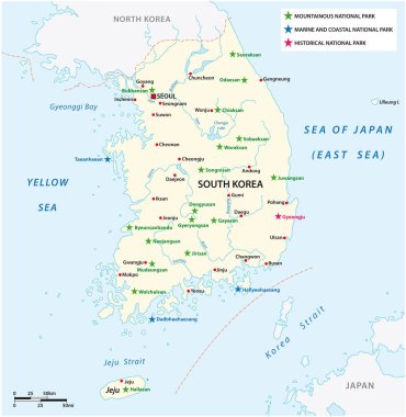
Vector map of the South Korean National Parks

Administrative vector map of the South Korean province of South Chungcheong with flag

Administrative vector map of the South Korean province of Jeollanam-do with flag

Administrative vector map of the South Korean province of Gyeonggi-do with flag
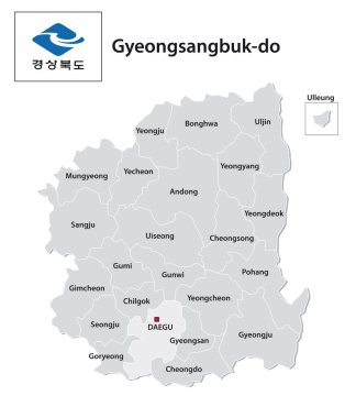
Administrative vector map of the South Korean province of Gyeongsangbuk-do with flag

Hand holding smart tablet booking travel destination.South Korea famous places.Vector concept banners in flat style with the set of traveling objects, accessories and tourism icon.

Blank map South Korea. High quality map of South Korea with the regiona and districts on transparent background for your web site design, logo, app, UI. Stock vector. Vector illustration EPS10.

Travel to Korea. Symbols of Korea. Set of traditional elements of Korean culture.

Korea Symbols , Thin Line and Pixel Perfect Icon

Amazing South Korea travel poster in flat style

Korean Peninsula, Demilitarized Zone, political map. North and South Korea with Military Demarcation Line, capitals, borders, most important cities and rivers. English labeling. Illustration. Vector.

Asia map - highly detailed vector illustration.

Glossy colorful South Korea map application point label symbol hanging over enlightened background

Map of administrative divisions of South Korea

Lovely South Korea travel map in flat style

Lovely South Korea travel poster in flat style

Retro South Korea travel map in flat style - Korea in Korean words on upper left

Adorable South Korea travel map in flat style - Korea in Korean words on upper left

Downtown vector map of Jeju, South Korea. This printable map of Jeju contains lines and classic colored shapes for land mass, parks, water, major and minor roads as such as major rail tracks.

Lovely South Korea travel map in flat style

Adorable South Korea travel map in flat style

Infographic travel and landmark korea map shape template design. country navigator concept vector illustration, graphic or web design layout.

Fantastic South Korea night travel map design in flat style

Political map of Japan, North Korea and South Korea with the capitals Tokyo, Pyongyang and Seoul, with national borders, some important cities, with rivers and lakes. Vector illustration with english labeling and scale.

Retro South Korea travel map in thin line style - Korea in Korean words on upper left

Attractive South Korea travel map - Korea in Korean words on upper right

Colorful poster with symbols of South Korea. Heart shape with flat icons. Vector illustration.
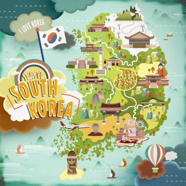
Abundant South Korea travel map in flat design

Retro South Korea travel map in flat style

Lovely South Korea travel map in flat style

Asian countries set, maps and flags, Part 2

Map black outline North and South Korea. Map of the Korean peninsula

South Korea map abstract geometric mesh polygonal light concept with black and white glowing contour lines countries and dots on dark background. Vector illustration

Map of administrative divisions of South Korea

South Korea map and flag - highly detailed vector illustration

Vector map of South Korea. High detailed country map with division, cities and capital Seoul. Political map, world map, infographic elements.

Vector map of asian island state japan

South Korea - detailed blue country map with cities, regions, location on world map and globe. Infographic icons. Vector illustration

South Korea map and flag - highly detailed vector illustration

South Korea map on a realistic squared sheet of paper torn from a block vector

Korea map, north and south administrative division with region names, color map isolated on white background vector

Japan political map. Main islands Honshu, Hokkaido, Kyushu, Shikoku and Okinawa. East Asian island country in the North Pacific bordered by Sea of Japan and Okhotsk, and East China and Philippine Sea.

Seoul South Korea Asia City map black white vector illustration

Japan map and flag - highly detailed vector illustration

Political vector map of Korea. South Korea and North Korea

Map of administrative divisions of South Korea

Outline of South Korea map

North Korea South Korea Japan China Russia Mongolia Map - Detailed Vector Illustration

Seoul, South Korea Urban detail Streets Roads Map ,vector element image for marketing ,digital product ,wall art and poster prints.

Japan map and flag - highly detailed vector illustration

Japan prefectures (japanese names gives in parentheses) vector map colored be regions with neighbouring countries and territories

Korean Peninsula Map - Detailed Vector Illustration

Korean Peninsula region, political map. Peninsular region Korea in East Asia, divided between the 2 countries North and South Korea, bordered by China and Russia, separated from Japan by Korea Strait.

Blue map of South Korea administrative divisions with travel infographic icons. Vector illustration

Simple Black Map of South Korea Isolated on White Background

Korean Peninsula Map - Vintage Detailed Vector Illustration

This is a simple map of South Korea.

South Korea map and flag - highly detailed vector illustration

Illustration of a Map of Location of Korea and Flags

High Detailed Purple Map of South Korea on isolated background, Vector Illustration EPS 10
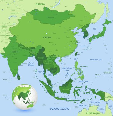
High detail map of far east Asia with a 3D Globe centered on these countries

South Korea map, Republic of Korea, administrative division with state names, color map isolated on white background vector

North Korea South Korea Japan China Russia Mongolia Map - Detailed Info Graphic Vector Illustration
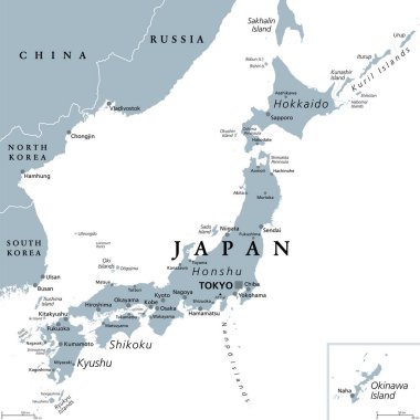
Japan, gray political map. The main islands Honshu, Hokkaido, Kyushu, Shikoku and Okinawa. East Asian island country in the North Pacific Ocean, archipelago of 14,125 islands and part of Ring of Fire.

Vector map of south east asian countries mixed with their national flags

Korean peninsula countries political map with North and South Korea and national borders. Gray illustration with English labeling and scaling on white background.

Map in form of South Korea, illustration, vector

South Korea map and flag - highly detailed vector illustration

Political map of Korean and Japanese region, South Korea, North Korea and Japan. Turquoise blue map with white labeling on white background. Vector illustration.
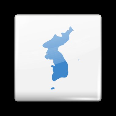
Flag of United Korea. Glassy Icon Square Shape. This is File from the Collection Flags of Asia

World map with magnified South Korea. South Korea flag and map.

South Korea 3d map with borders of regions. Vector illustration

South Korea map and flag - highly detailed vector illustration

Isometric Map of South Korea. Simple 3D Map. Vector Illustration - EPS 10 Vector

Korean Peninsula region, gray political map. Peninsular region Korea in East Asia, divided between North and South Korea, bordered by China and Russia, and separated from Japan by the Korea Strait.

Korean Peninsula Map - Detailed Vector Illustration

Political map of Korean and Japanese region, South Korea, North Korea and Japan. Black outline map with black labeling on white background. Vector illustration.

South Korea Physical Map. On White. Vector illustration.

National flag with heart shaped landscape : Vector Illustration
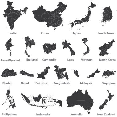
High detailed vector maps of asian countries, Australia and New Zealand

Administrative map of the South Korean province of Gyeonggi and the capital Seoul