
Political map of Japan, North Korea and South Korea with the capitals Tokyo, Pyongyang and Seoul, with national borders, some important cities, with rivers and lakes. Vector illustration with english labeling and scale.
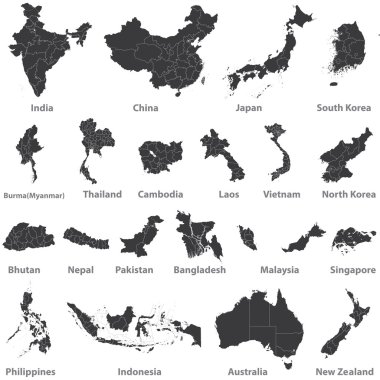
High detailed vector maps of asian countries, Australia and New Zealand
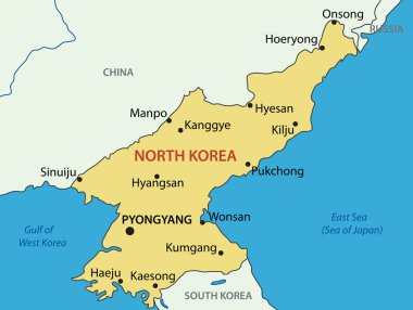
Democratic 's Republic of Korea - vector map

Korean Peninsula Map - Detailed Info Graphic Vector Illustration

Abstract North Korea map. Vector halftone geographic plan. Cartographic pixelated composition. Schematic North Korea map is done of regular sphere point grid.

Korean Peninsula, Demilitarized Zone, political map. North and South Korea with Military Demarcation Line, capitals, borders, most important cities and rivers. English labeling. Illustration. Vector.
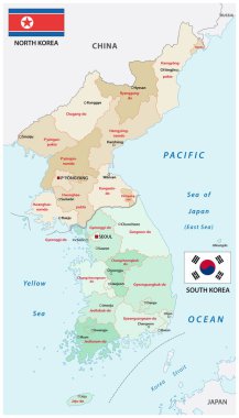
Administrative vector map of the states of north and south korea

North, South Korea map on white background. Vector

Illustration of a long shadow Korea map with flags

Illustration of a long shadow Korea map

Illustration of a long shadow Korea map

Korea map glass card paper 3D vector

Korea map card paper 3D natural vector

North Korea ( Democratic People 's Republic of Korea ) and South Korea ( Republic of South Korea ) ( flag and map ) ( transportation and tourism concept )

Asian countries set, maps and flags, Part 2

Illustration of a long shadow Korea map

Korea map white blue card paper 3D vector
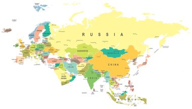
Eurasia map - highly detailed vector illustration.
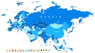
Eurasia map - highly detailed vector illustration. Image contains land contours, country and land names, city names, water object names, navigation icons.

South North Korea map glass card paper 3D divided vector

North Korea Map - Vintage High Detailed Vector Illustration

Korea peninsula vector color map

North Korea Map - Vintage High Detailed Vector Illustration

Korean Peninsula Map - Detailed Vector Illustration

Vector North Korea Map card paper on blue background, high detailed

North Korea South Korea Japan China Russia Mongolia Map - Detailed Vector Illustration

North Korea ( Democratic People 's Republic of Korea ) and South Korea 3D ( Republic of South Korea ) ( flag and map ) ( transportation and tourism concept )

Layered editable vector illustration country map of North Korea,which contains two versions, colorful country flag version and black silhouette version.

North and South Korea map with flags isolated on white background. Vector Illustration

Woodcut Illustration of Map of North and South Korea

North Korea vector set. Detailed country shape with region borders, flags and icons isolated on white background.
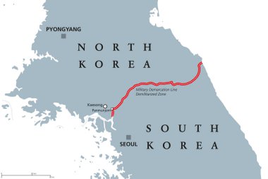
Korean Peninsula, Demilitarized Zone Area, political map. North and South Korea with red Military Demarcation Line, capitals and borders. English labeling. Gray illustration, white background. Vector.

Korean Peninsula Map - Detailed Vector Illustration

Illustration of a North Korea map icon

Black Location Map of South Korean Province of North Gyeongsang within Grey Map of South Korea

North Korea map round

North korea map city icon

Zoom on North Korea Map and Flag. World Map

South Korea detailed administrative blue map with country flag and location on the world map. Vector illustration
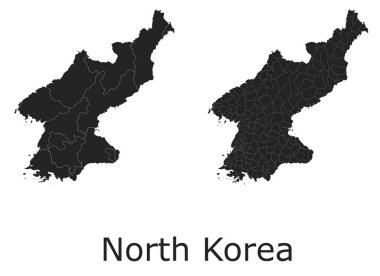
North Korea vector maps with administrative regions, municipalities, departments, borders
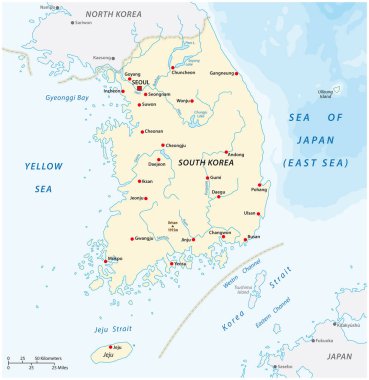
Vector map of the Republic of Korea, South Korea
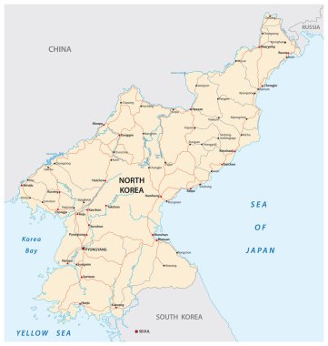
North Korea road vector map
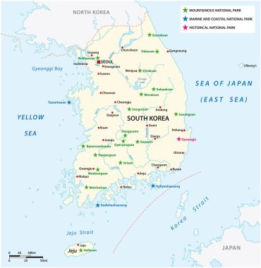
Vector map of the South Korean National Parks

Set of the political South Korea maps, markers and symbols for infographic
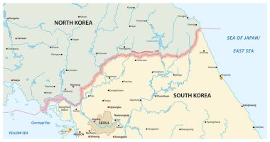
Vector map of the border region between north and south korea

Korean peninsula highly detailed vector map with administrative regions,main cities and roads.

Asia map - highly detailed vector illustration.

World Map Outline Contour Silhouette - Asia in Center - vector

An high quality world map in tones of grey with a cool flat shaded Shadow.

North Korea infographic map and flag - High Detailed Vector Illustration

South Korea vector set. Isolated

North Korea map and flag - High Detailed Vector Illustration

World map with magnifying on North Korea. Blue earth globe with North Korea flag pin. Zoom on North Korea map. Vector Illustration

Map black outline North and South Korea. Map of the Korean peninsula

Korean Peninsula region, political map. Peninsular region Korea in East Asia, divided between the 2 countries North and South Korea, bordered by China and Russia, separated from Japan by Korea Strait.
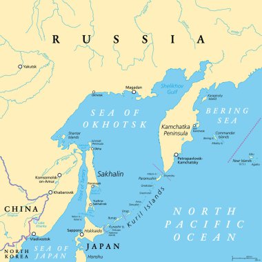
Sea of Okhotsk, political map. A marginal sea of the North Pacific Ocean, located between the Kamchatka Peninsula, the Kuril Islands, Hokkaido, Sakhalin, and a stretch of the eastern Siberian coast.

North Korea Map - High Detailed Vector Illustration

Political map of Korean and Japanese region, South Korea, North Korea and Japan. Black outline map with black labeling on white background. Vector illustration.

Vector map of asian island state japan

Japan political map. Main islands Honshu, Hokkaido, Kyushu, Shikoku and Okinawa. East Asian island country in the North Pacific bordered by Sea of Japan and Okhotsk, and East China and Philippine Sea.

Japan map and flag - highly detailed vector illustration

Political vector map of Korea. South Korea and North Korea

Administrative map of the South Korean province of Gyeonggi and the capital Seoul
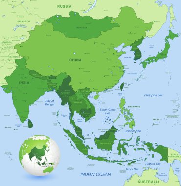
High detail map of far east Asia with a 3D Globe centered on these countries

Vector map of south east asian countries mixed with their national flags

North Korea South Korea Japan China Russia Mongolia Map - Detailed Vector Illustration

North Korea higt detailed map with subdivisions. Administrative map of North Korea with districts and cities name, colored by states and administrative districts. Vector illustration.

North Korea Map - High Detailed Vector Illustration

Japan map and flag - highly detailed vector illustration

Japan prefectures (japanese names gives in parentheses) vector map colored be regions with neighbouring countries and territories

Korean Peninsula Map - Detailed Vector Illustration

Color map of Eastern Asia divided by the countries
Flag of United Korea. Glassy Icon Square Shape. This is File from the Collection Flags of Asia

Korean Peninsula region, gray political map. Peninsular region Korea in East Asia, divided between North and South Korea, bordered by China and Russia, and separated from Japan by the Korea Strait.

Korea map, north and south administrative division with region names, color map isolated on white background vector

Korean Peninsula Map - Vintage Detailed Vector Illustration

Vector collection of asian countries maps that combined with their flags. Political map of Asia continent. Navigation and location icons

Political map of Korean and Japanese region, South Korea, North Korea and Japan. Turquoise blue map with white labeling on white background. Vector illustration.

Korean Peninsula Map - Detailed Vector Illustration
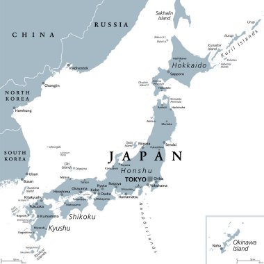
Japan, gray political map. The main islands Honshu, Hokkaido, Kyushu, Shikoku and Okinawa. East Asian island country in the North Pacific Ocean, archipelago of 14,125 islands and part of Ring of Fire.

North Korea South Korea Japan China Russia Mongolia Map - Detailed Info Graphic Vector Illustration

Stylized map of North Korea. Isometric 3D green map with cities, borders, capital Pyongyang , regions. Vector illustration. Editable layers clearly labeled. English language

All asian maps mixed with flags. Vector

Asia political map. Location, navigation and travel icons. Asian countries maps and flags vector set

North Korea - vintage map and flag - High Detailed Vector Illustration

Korean Peninsula large detailed physical map with roads, railroads, water objects, cities and capitals.

World map with magnified South Korea. South Korea flag and map.

Political vector map of Korea. South Korea and North Korea

Asia map - highly detailed vector illustration.

Vector illustration of Asia continent map with countries mixed with their national flags

Sea of Okhotsk, gray political map. Marginal sea of the North Pacific Ocean located between the Kamchatka Peninsula, the Kuril Islands, Hokkaido, Sakhalin, and a stretch of the eastern Siberian coast.

Korea map south north separate white blue card paper 3D vector

Asia map - highly detailed vector illustration.
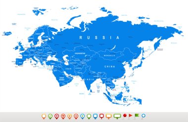
Eurasia map - highly detailed vector illustration.

Asia map - highly detailed vector illustration.

Asia map - highly detailed vector illustration.

Asia map - highly detailed vector illustration.

Silhouette of soldier with Flag of North Korea
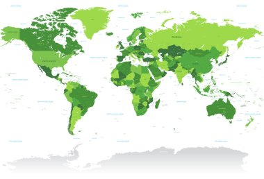
A High Detail vector Map of the world in shades of green. All countries are named with the respective english name.
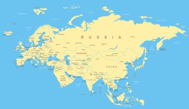
Eurasia map - highly detailed vector illustration.