
Map of new jersey. map concept

Vector color map of New Jersey state. Usa

New Jersey map on white background. New Jersey state sign. outline map of New Jersey. flat style.

New Jersey counties vector map with USA map colors national flag

New Jersey map. Blank vector map of the Us State with counties. Borders of New Jersey for your infographic. Vector illustration.

New Jersey NJ State Border USA Map Solid

Atlantic County (New Jersey) blank outline map
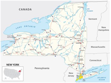
Road map of the US American State of New York

Northeast, census region of the United States of America, gray political map of census region 1, consisting of 9 single states. Map with geographical borders and capitals. Isolated illustration.

New Jersey NJ State Border USA Map Outline

Vector illustration of the Atlantic City Entering green road sign on metallic posts

Ocean County (New Jersey) blank outline map
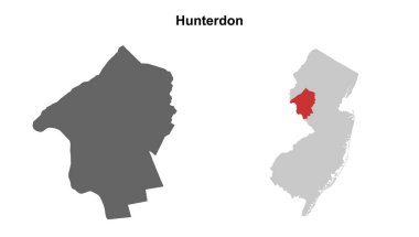
Hunterdon County (New Jersey) blank outline map set

Illustration of State of New Jersey, USA

U.S. states - map of New Jersey. Hand made. Rivers and lakes are shown. Please look at my other images of cartographic series - they are all very detailed and carefully drawn by hand WITH RIVERS AND LAKES.
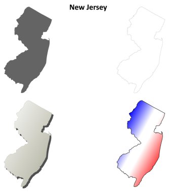
New Jersey blank outline map set

New Jersey NJ state Maps. Black silhouette and outline isolated on a white background. EPS Vector

New Jersey US Map. NJ USA State Map. Black and White New Jerseyan State Border Boundary Line Outline Geography Territory Shape Vector Illustration EPS Clipart

Salem (New Jersey) blank outline map

North Wildwood (New Jersey) blank outline map

Egg Harbor City (New Jersey) blank outline map

New Jersey map, united states of america. Flat concept icon symbol vector illustration

Northeast, U.S. census region, multi colored political map. Census region 1 of the United States, consisting of 9 single states. Colored silhouettes of single states with borders and their capitals.

Boonton (New Jersey) blank outline map

Belvidere (New Jersey) blank outline map

Ventnor City (New Jersey) blank outline map

Newton (New Jersey) blank outline map

New Jersey state map contour. In style of USA flag.

Bordentown (New Jersey) blank outline map

Sea Isle City (New Jersey) blank outline map

Brigantine (New Jersey) blank outline map

The New Jersey State county map with labels

New Jersey map, united states of america. Flat concept icon symbol vector illustration

Absecon (New Jersey) blank outline map

Beverly (New Jersey) blank outline map

Clinton (New Jersey) blank outline map

The New Jersey State county map isolated on white background

The outline of New York state

Colorful New Jersey map vector silhouette illustration isolated on white background. High detailed. United state of America country. New Jersey line contour map with separated county borders.

Monmouth County (New Jersey) blank outline map

Maryland state detailed editable map with cities and towns, geographic sites, roads, railways, interstates and U.S. highways. Vector EPS-10 file, trending color scheme

Outline map of the United States of America. States of the USA. Vector illustration.US map with state borders. usa silhouette

New Jersey map vector silhouette illustration isolated on white background. High detailed. United state of America country. New Jersey line contour map with separated county borders.
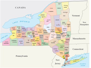
New york administrative and political map
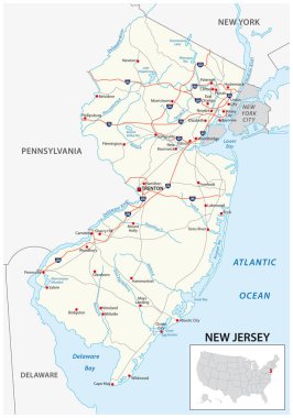
Road map of the US American State of new jersey

Port Republic (New Jersey) blank outline map

New Jersey NJ state Map USA with Capital City Star at Trenton. Black silhouette and outline isolated on a white background. EPS Vector

Linwood (New Jersey) blank outline map

Lambertville (New Jersey) blank outline map

Northfield (New Jersey) blank outline map

Margate City (New Jersey) blank outline map

Estell Manor (New Jersey) blank outline map

Wildwood (New Jersey) blank outline map