Description:
This SVG vector represents the boundary of Brussels, providing a clear outline of the city's geographical limits. The design features a precise and scalable format, making it perfect for both web and print applications. It is created using vector graphics, ensuring that it maintains its quality regardless of size adjustments. The style is flat, emphasizing clarity and simplicity, which makes it suitable for mapping and educational purposes. This vector can be easily integrated into various design projects, ensuring versatility for users. With its detailed representation, it serves as a foundational element for those looking to illustrate urban layout or geographical studies. The downloadable file is compatible with popular design software, facilitating easy editing and customization.
Usage ideas:
This Brussels boundary SVG vector can be utilized in various commercial and educational contexts. For example, educators can incorporate it into lesson plans about geography and urban development, helping students visualize city planning. Graphic designers might use this vector in developing promotional materials for tourism, highlighting the city's attractions within the defined boundary. Additionally, urban planners can leverage this image in presentations or reports to demonstrate city limits, complementing data visualizations. Marketing teams can also use it in digital content to target specific areas and understand demographic distributions.
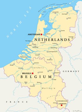
Benelux. Belgium, Netherlands and Luxembourg. Political map with capitals, borders and important cities. Benelux Union, a geographic, economic, cultural group. English labeling. Illustration. Vector.

Belgium round sign. Futuristic satelite view of the world centered to Belgium. Country badge with map, round text and binary background. Creative vector illustration.
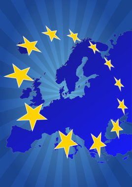
Illustration of euro currency symbol with europe maps

Brussels map Bruxelles Brussel administrative districts regions vector template with map of Belgium grey on white background. Contour line city map for infographic and web.
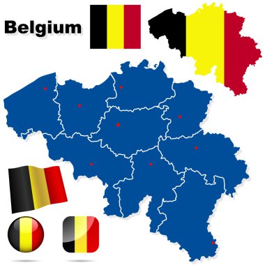
Belgium vector set. Detailed country shape with region borders, flags and icons isolated on white background.

Network map of Belgium. Country digital connections map. Technology, internet, network, telecommunication concept. Vector illustration.

Highly detailed vector map of Netherlands with administrative regions,main cities and roads.
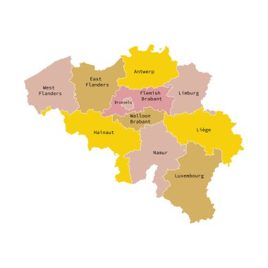
Vector illustration of administrative division map of Belgium. Vector map..

Illustration of euro currency symbol with europe maps

Illustration of euro currency symbol with europe maps

Illustration of euro currency symbol with europe maps

Illustration of euro currency symbol with europe maps

Map of world with borders with bright colors

Map of world with borders as scrible

Map of world with borders with bright colors

Colorful Belgium map with provinces and main cities

Map of Belgium with borders in violet

Country shape outlined and filled with the flag of Belgium isolated on blue background. European country. Vector template for website, design, cover, infographics. Graph illustration.

Map of world with borders in gray
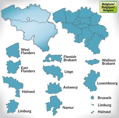
Map of Belgium with borders in blue

Map of world with borders in pastel green

Map of Benelux with borders in chrome

Map of world with borders in green

Belgium political map of administrative divisions - provinces. 3D turquoise vector map with name labels.

Map of world with borders in green