
Texas map icon set, Texas map isolated on transparent background, best vectors collection. State Border, United State, Variations. American map for poster, banner, t shirt. Design USA cartography map.

Map of the U.S. state of Texas

Texas map icon set, Texas map isolated on transparent background, best vectors collection. State Border, United State, Variations. American map for poster, banner, t shirt. Design USA cartography map.

Texas the Lone Star State vintage design

Map of Texas on white background, vector illustration

Texas map icon isolated on white background. Texas map icon. Texas symbol
Shiny vector stickers in form of Texas state, USA

Map of the U.S. state of Texas

Detailed illustration of a ballotbox in front of a map of Texas, eps10 vector

Texas state icon map set

Texas map icons set. Texas map icon. Texas symbol.

Texas blank outline map set

A Texas state outline with the date of statehood isolated on a white background

Texas map icon set, Texas map isolated on transparent background, best vectors collection. State Border, United State, Variations. American map for poster, banner, t shirt. Design USA cartography map

Shiny icon in form of Texas state, USA - vector illustration

Texas map icon Vector symbol or sign set collection in black and white outline

Texas vintage map. Grunge map of the us state with distressed texture. Texas poster. Vector illustration.

Detailed illustration of a map of Texas with flag, eps10 vector

Texas map icon , Texas map isolated on transparent background, flat black vector. State Border, United State, Variations. American map for poster, banner, t shirt. Design USA cartography map.

Texas map shape, united states of america. Flat concept icon symbol vector illustration .

Map of Texas state designed in illustration with the counties and the county seats

The seal of the United States of American state TEXAS isolated on a white background.
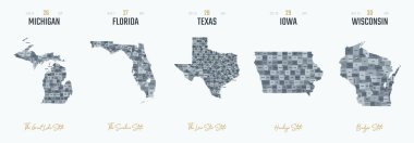
Vector set 6 of 10 Highly detailed silhouettes of US state maps, divided into counties with names and territory nicknames

Map of The United States of America USA with territories and Islands. Different map variations for your design. Stock Vector illustration isolatedon white background

Vector map of the Great Plains Region in North America

Texas state map icons with vector flag stars, blue, red and white stripes, lines and bull head. Silhouettes of Texas map, South Central region of USA country emblems, the lone star state prints

Texas map shape, united states of america. Flat concept icon symbol vector illustration .

United States of America - Highly detailed editable political map with labeling.

High detailed United States of America road map with labeling.

USA vector linear map. Thin line United States map.

Texas counties vector map with USA map colors national flag

United States of America map. United states outline isolated on white background. USA map icon. Usa map line vector icon

Texas map shape, united states of america. Flat concept icon symbol vector illustration .

Texas, state of USA - solid black outline map of country area. Simple flat vector illustration.

High detailed Texas road map with labeling.

Texas - Louisiana - Mississippi - Alabama - Florida Map labelled black illustration

Texas state map circle with long shadow

Vector illustration of a vintage sticker in form of Texas state, USA

Set of vector maps of Oklahoma. Vibrant waves design. Bright map of us state in geometric smooth curves style. Multicolored Oklahoma map for your design. Trendy vector illustration.
Sketch Texas (United States of America) letter text map, Texas map - in the shape of the continent, Map Texas - red and blue vector illustration

Texas hand written lettering logo, emblem, label with map. Print for tee, typography. USA Texas calligraphy design. Vector illustration.

Texas map. Texas map icon. Texas symbol.

Texas state outline contour. South Central region of the United States silhouette map flat vector black icon illustration

Texas icon set. texas sign symbol

Arizona state with beautiful view

Texas Map Vector Outline Design Template. Editable Stroke.

Vector illustration of map of Texas in low poly design

Isometric map and flag of Texas. 3D isometric shape of Texas State. Vector Illustration.

Business development logo design in texas

Map of the U.S. state of Texas on white background

Texas map shape, united states of america. Flat concept icon symbol vector illustration .

Texas Flag Lipstick On The Lips Isolated On A White Background. Vector Illustration. Kiss Mark In Official Colors And Proportions. Independence Day

Texas state map with American national flag on white background

The seal of the United Steas of American state TEXAS black line drawing isolated on a white background.

Texas. Outline of the map state with flag, Flat concept icon symbol vector illustration.

An outline map of Texas with the star and map colors

New Mexico - Kansas - Oklahoma - Texas labelled black illustration

Texas map icon isolated on white background. Texas map icon. Texas symbol

Texas state of United States of America, USA. Simplified thick black outline map. Simple flat vector illustration

Texas map line icon , Texas map isolated on transparent background, outline black vector. State Border, United State, Variations. American map for poster, banner, t shirt. Design USA cartography map.

Texas - vector map

Vector outline Texas map silhouette isolated on white background

High detailed Mexico road map with labeling.

Map of the U.S. state of Texas on a white background

28 of 50 states of the United States with a name, nickname, and date admitted to the Union, Detailed Vector Texas Map for printing posters, postcards and t-shirts

Texas state map. US state map. Texas silhouette symbol. Vector illustration

Texas map icons set. Texas map icon. Texas symbol

Texas state of United States of America, USA. Simplified thick black outline map with rounded corners. Simple flat vector illustration

Texas map. Texas map icon. Texas symbol.

Texas map icon isolated on white background. Texas map icon. Texas symbol

Vector illustration of administrative division map of Texas. Vector map.

Arizona state with beautiful view

Map of The United States of America (USA) Divided States Maps Outline Illustration on White Background

California flag vector illustration isolated. United states of America. National symbol of California. USA country.

Set 3 of 5 Highly detailed vector silhouettes of USA state maps with names and territory nicknames

USA Political Road Map with roads, water objects and cities.

High detailed United States of America road map with labeling.

United States of America - Highly detailed editable political map with labeling.

Flat hand drawn map composition. Usa States

United States of America - Highly detailed editable political map with labeling.
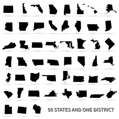
United States of America 50 states and 1 federal district. US states map.

North America administrative vector map with latitude and longitude

United States of America, gray political map. Fifty single states with their own geographic territories and borders, bound together in a union and federal government, with the capital Washington, D.C.

High detailed United States of America road map with labeling.
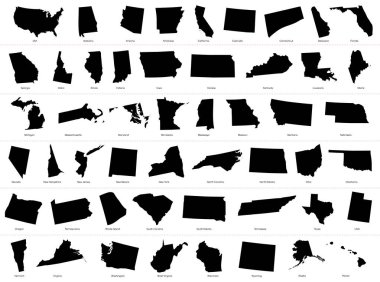
The United States of America (USA), commonly known as the United States (U.S.) or America, is a federal republic composed of 50 states, a federal district, five major self-governing territories, and various possessions. At 3.8 million square miles (9
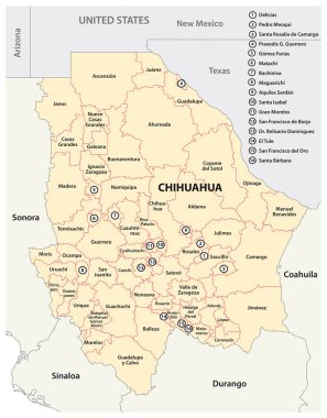
Administrative map of the Mexican state of Chihuahua

Pennsylvania state map silhouette in the United States

United States of America, multi colored political map. 50 states with own geographic territory, constituent entities, bound together in a union and a federal government. English. Illustration. Vector.
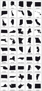
Black silhouette maps of 50 us states.

The United States of America (USA), commonly known as the United States (U.S.) or America, is a federal republic composed of 50 states, a federal district, five major self-governing territories, and various possessions. At 3.8 million square miles (9

United States of America 50 states and 1 federal district. Set of US states maps.

USA map silhouette. United States of America map. US map design for infographic. Vector

United State of America map illustration vector detailed USA map with states

The United States Of American Map Vector Illustration. USA map icon isolated on white background. Cartography symbol modern, simple, vector, icon for website design, mobile app, ui
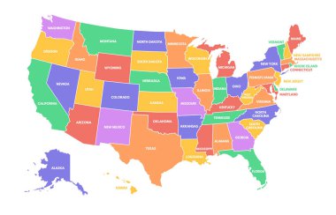
Colorful USA map. United States of America regions with different colors and names for travel and geography vector illustration infographic design. US land territory banner for education

Vector Texas Map silhouette. Isolated vector Illustration. Black on White background.

Old Texas state map with flag on a white background.

Map of the U.S. state of Texas with flag

The United States of America (USA), commonly known as the United States (U.S.) or America, is a federal republic composed of 50 states, a federal district, five major self-governing territories, and various possessions. At 3.8 million square miles (9

Map of the U.S. state of Texas