Description:
This Upper Peninsula SVG vector showcases a detailed and accurate representation of the Upper Peninsula region of Michigan. The design is offered in a scalable SVG format, ensuring flexibility for various project sizes without loss of quality. The representation is simple and clear, making it suitable for both digital and print applications. It features outlined borders for easy recognition and can be easily modified to fit specific design needs. This vector can serve as a geographical representation in maps or guides and is ideal for educational resources. As a scalable design, it meets the demands of both small-scale and large-scale uses. The minimalist style ensures it can blend well with other design elements.
Usage ideas:
The Upper Peninsula SVG vector can be used in various contexts, including travel brochures, educational materials, and promotional items for tourism in the region. Designers can incorporate this vector into website graphics to highlight the Upper Peninsula in travel blogs or informational sites. Additionally, it can serve as an engaging element in presentations concerning regional geography or history. Crafters might find it suitable for creating wall art, scrapbook layouts, or even custom apparel celebrating Michigan's unique geography. This versatility makes it a useful asset for both personal and commercial projects.

Michigan travel poster or sticker. Retro style vector illustration of sandstone cliffs on Lake Superior shoreline. Pictured Rocks National Lakeshore.

Illustration of fire in the camp on beach at night

Michigan postage stamp design. Vector illustration of sandstone formations on Lake Superior shoreline. Grunge postmark on separate layer.

Souvenir suitcase travel stickers of Indiana, Ohio, Michigan

WPA poster art of a Lighthouse at FJ McLain State Park on the Keweenaw Peninsula in Houghton County, Michigan, United States of America USA done in works project administration style.
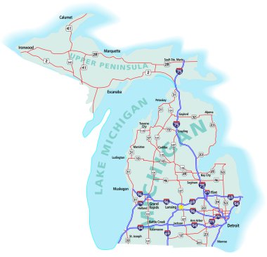
Michigan state road map with Interstates, U.S. Highways and state roads. All elements on separate layers for easy editing. Map created November 26, 2009. ZIP

The Mackinac Bridge connecting the Upper and Lower peninsula of the U.S. state of Michigan - vector illustration
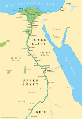
Historical map of Ancient Egypt with most important sights, with rivers and lakes. Illustration with English labeling and scaling.
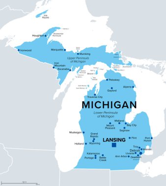
Michigan, U.S. state, political map. State in the Great Lakes region of upper Midwestern United States, with capital Lansing and metropolitan area Detroit. The Great Lake State, and Wolverine State.

Flag of Corsica is an island in the Mediterranean Sea belonging to France. Vector illustration

The Mackinac Bridge connecting the Upper and Lower peninsula of the U.S. state of Michigan - vector illustration

Ancient Egypt map with important sights, Sinai peninsula, Nile river and delta. Northeastern Africa. Kush, Upper and Lower Egypt and capitals Memphis and Thebes. English labeling. Illustration. Vector