
Map of the U.S. state of Washington on a white background
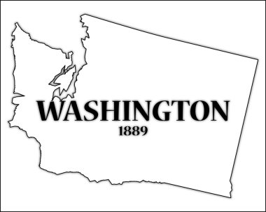
A Washington state outline with the date of statehood isolated on a white background

Detailed vector a large color map of the USA

Vector a large color map of the USA

American and Russian flags together in correct colors

High detailed United States of America physical map.

Washington counties vector map with USA map colors national flag

Map of The United States of America USA with territories and Islands. Different map variations for your design. Stock Vector illustration isolatedon white background

High detailed United States of America physical map.

Map of the watersheds in the United States of America
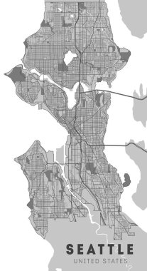
City map Seattle, monochrome detailed plan, vector illustration. Washington.
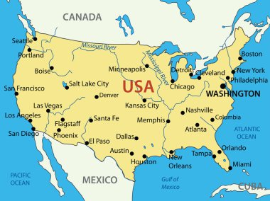
The United States of America - vector map

High detailed United States of America physical map with labeling.

United States of America - Highly detailed editable political map with labeling.

Maryland - Highly detailed editable political map with labeling.

United States of America - Highly detailed editable political map with labeling.

Highly detailed editable political map with separated layers. United States of America.

Washington map. Detailed map of Washington city administrative area. Cityscape panorama. Royalty free vector illustration. Outline map with highways, streets, rivers. Tourist decorative street map.

High detailed United States of America physical map with labeling.

High detailed United States of America road map with labeling.
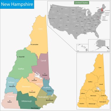
Map of New Hampshire state designed in illustration with the counties and the county seats

Modern City Map - Washington DC city of the USA with neighborhoods and titles

Washington DC city map with neighborhoods grey illustration silhouette shape

7 of 50 states of the United States with a name, nickname, and date admitted to the Union, Detailed Vector Maryland Map for printing posters, postcards and t-shirts

District of Columbia blank outline map set

Washington - Oregon - Idaho - Montana Map labelled black illustration
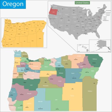
Map of Oregon state designed in illustration with the counties and the county seats

Washington Logo. Map of Washington with us state name and flag. Cool vector illustration.

Map of Commonwealth of Kentucky designed in illustration with the counties and the county seats

Map of Washington DC Metropolitan Area is the metropolitan area based in Washington DC

Washington badge. Colorful polygonal us state symbol. Multicolored geometric Washington logos set. Vector illustration.

Shiny vector stickers in form of Maryland state and washington dc

Map of California state designed in illustration with the counties and the county seats

US American Flag Map with Flag illustration icon vector image logo

Map of Utah state designed in illustration with the counties and the county seats

Map of Illinois state designed in illustration with the counties and the county seats

USA Political Road Map with roads, water objects and cities.

High detailed United States of America road map with labeling.
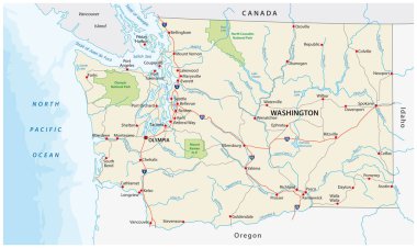
Washington state road and national park vector map

United States of America - Highly detailed editable political map with labeling.

Map of the USA with the names of the states. Administrative map of the United States of America with borders and names. Vintage political map.

States capitals and major cities of the United States of America. Beautiful modern graphic vector USA map. Alaska and Hawa. Pastel tones.

Washington map shape, united states of america. Flat concept icon symbol vector illustration .

Map of Connecticut state designed in illustration with the counties and the county seats

High detailed United States of America physical map with labeling.

Map of Arkansas state designed in illustration with the counties and the county seats

High detailed United States of America road map with labeling.
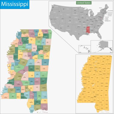
Map of Mississippi state designed in illustration with the counties and the county seats

Map of Hawaii state designed in illustration with the counties and the county seats

Map of Pennsylvania state designed in illustration with the counties and the county seats

The United States Of American Map Vector Illustration. USA map icon isolated on white background. Cartography symbol modern, simple, vector, icon for website design, mobile app, ui

United States of America, multi colored political map. 50 states with own geographic territory, constituent entities, bound together in a union and a federal government. English. Illustration. Vector.
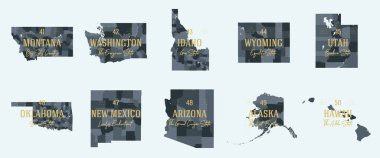
Set 5 of 5 Division United States into counties, political and geographic subdivisions of a states, Highly detailed vector maps with names and territory nicknames

Colorful United States of America political map with clearly labeled, separated layers. Vector illustration.

Map of Georgia state designed in illustration with the counties and the county seats

Map of Colorado state designed in illustration with the counties and the county seats

Usa map graphic design template vector isolated illustration

United States of America map. United states outline isolated on white background. USA map icon. Usa map line vector icon

USA map silhouette. United States of America map. US map design for infographic. Vector

Map of South Carolina state designed in illustration with the counties and the county seats

Map of Texas state designed in illustration with the counties and the county seats

Vector map of United States of America with states, cities, rivers, lakes and highways on separate layers. High quality vector illustration

Eagle grip the USA ribbon sign with the flag as a background

Vector illustration USA map. States and territories of United States of America. Washington city marked with U.S.A flag

Washington map shape, united states of america. Flat concept icon symbol vector illustration .

Usa map graphic design template vector isolated illustration

Map of the USA. Image with clipping path and name of states. State mark. Vector illustration.

Modern City Map - Seattle Washington city of the USA with neighborhoods and titles

USA map icon. Business cartography concept United States of America pictogram. Vector illustration on white background.

Colorful United States of America political map with clearly labeled, separated layers. Vector illustration.

North America administrative vector map with latitude and longitude

United states. Standard time zones of united states. USA region

Highly detailed Washington physical map with labeling.
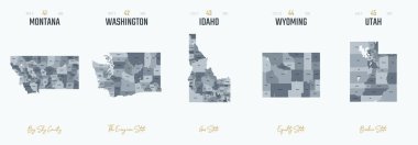
Vector set 9 of 10 Highly detailed silhouettes of US state maps, divided into counties with names and territory nicknames

Maui icon. Island map on dark background. Stylish Maui map with island name. Vector illustration.

Map of the USA. Image with clipping path and name of states. State mark. Rhode Island. Vector illustration.

Map of the USA. Image with clipping path and name of states. State mark. Hawaii. Vector illustration.

Map of the USA. Image with clipping path and name of states. State mark Vector illustration.

Map of the USA. Image with clipping path and name of states. State mark. Maryland. Vector illustration.
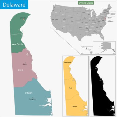
Map of Delaware state designed in illustration with the counties and the county seats

USA round sign. Futuristic satelite view of the world centered to USA. Country badge with map, round text and binary background. Creative vector illustration.

The United States of America - vector map USA

Map of Ohio state designed in illustration with the counties and the county seats

North America map. Vector illustration

Map of North America. Detailed map of North America with States of the USA and Provinces of Canada. Template. Stock vector. EPS10.
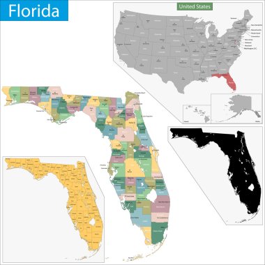
Map of Florida state designed in illustration with the counties and the county seats.

Hawaii high detailed map. Island silhouette icon. Isolated Hawaii black map outline. Vector illustration.
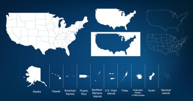
Map of The United States of America USA with States Name in Blue Color Illustration on White Background

Flat hand drawn map composition. Usa States
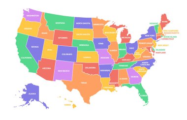
Colorful USA map. United States of America regions with different colors and names for travel and geography vector illustration infographic design. US land territory banner for education

USA hand-drawn map. Colourful sketchy country outline. Exotic USA map with provinces. Vector illustration.
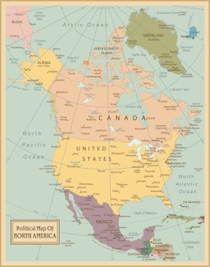
North America -highly detailed map. Vector illustration

Washington DC, USA - September 15, 2019. Caricature of Greenland and Donald Trump. US President with Danish Island Hairstyle. Editorial politics celebrity news. Comic cartoon pop art retro vector

North America Political Map Vintage Colors. Highly detailed map. All elements are separated in editable layers clearly labeled.
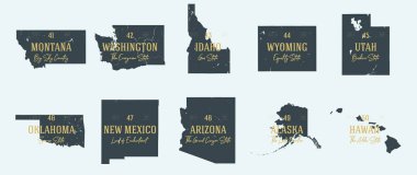
Set 5 of 5 Highly detailed vector silhouettes of USA state maps with names and territory nicknames

New Jersey state detailed editable map with cities and towns, geographic sites, roads, railways, interstates and U.S. highways. Vector EPS-10 file, trending color scheme

Vector illustration shows approximately migratory of the Monarch butterfly. The map is a schematic preview, only just to describe migratory routes.

United State of America map illustration vector detailed USA map with states

Pennsylvania state map silhouette in the United States
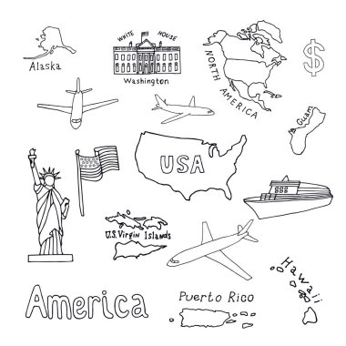
Map of the United States of America and its territories. North America, Alaska, USA, Hawaii, Guam and the US Virgin Islands. Statue of Liberty and the White House. vector black sketch.