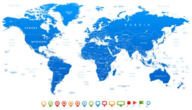
Highly detailed world map: countries, cities, water objects

Vector illustration of World map and navigation icons

Highly detailed world map: countries, cities, water objects

Highly detailed world map: countries, cities, water objects.

World map infographic with map pointers - Template vector design

Map of America vector illustration, scribble sketch America

Detailed Political World map. Vector illustration.

Map of America vector illustration, scribble sketch America

World Map and navigation icons. Flat style.

Americas round green icon
Americas map vector black icon

Americas map vector on blue button

Red grunge continent America logo on a white background. Vector illustration

Americas map vector icon

Americas round orange pointer

Detailed Political World map isolated on white. Vector illustration.
Flat simple Brazil map, vector background illustration

Political World Map Pacific Centered - vector

Vintage World Map and Markers - Detailed Vector Illustration

Flat simple Brazil map, vector background illustration
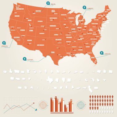
Infographic vector illustration with Map of United States of America

Silhouette of black world map, vector illustration

Pacific Ocean Blue Map and Colored Map Icons. Detailed Pacific Ocean Vector Map. Vector illustration.

Map of America vector illustration, scribble sketch America

World map vector on a white background.

Americas map vector blue and black icon

Gold continent America logo on a white background. Vector illustration

Globe Icon Set - Round World Map Vector Flat Illustration

Americas map vector icon

Americas map pointer

Americas map green icon. Vector illustration

U.S. states - map of Delaware. Hand made. Rivers and lakes are shown. Please look at my other images of cartographic series - they are all very detailed and carefully drawn by hand WITH RIVERS AND LAKES.
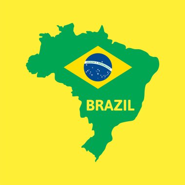
Flat simple Brazil map, vector background illustration

World banner set vector illustration. All elements are layered separately in vector file.

Vector illustration of World map and navigation icons.

Vintage Political World Map Pacific Centered - Info Graphic vector

Political World Map Pacific Centered - vector

Political World Map Pacific Centered - vector

Vintage World Map and Markers - Detailed Vector Illustration

Vintage World Map and Markers - Detailed Vector Illustration

World map. Highly detailed map of the world with detailed borders of all countries, cities, regions and bodies of water in blue tones. Vector illustration

Vector halftone Dotted map of Peru country for your design, Travel Illustration concept.

Vintage World Map and Markers - Detailed Vector Illustration

World Map Gray - Asia in Center- vector

Political World Map Pacific Centered - vector
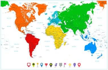
World map with colorful continents and flat map pointers. Highly detailed illustration: countries, cities, navigation icons.
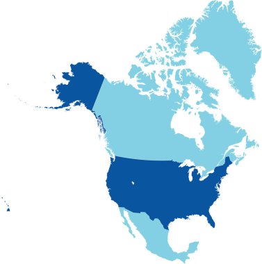
Dark blue detailed blank political map of the UNITED STATES on transparent background using orthographic projection of the light blue North American continent
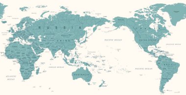
Vintage Political World Map Pacific Centered - vector

Vintage Political World Map Pacific Centered - vector
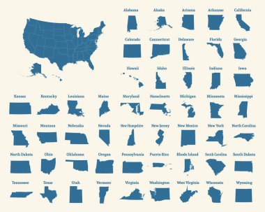
Outline map of the United States of America. States of the USA. Vector illustration.
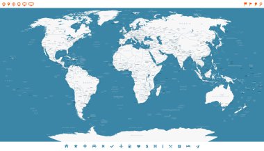
Highly detailed world map: countries, cities, water objects.

World Map. Highly detailed map of the world with detailed borders of all countries in blue colors. Vector illustration

World map. Detailed map of the world with borders of all countries. Vector illustration

Vintage World Map and Markers - Detailed Vector Illustration

Highly detailed vector illustration of world map, globes and continents.

World map with colorful continents and flat map pointers isolated on white. Highly detailed map illustration with countries, cities and navigation symbols.

Vintage World Map and Markers - Detailed Vector Illustration

Outline map of Americas

World Map Blue and Globes - Asia in Center - vector

Vintage World Map and Markers - Detailed Vector Illustration

Black CMYK federal map of OHIO inside detailed gray blank political map of the United States of America on transparent background

World map, Globes with countries. Planet Earth. Vector illustration isolated on white background

Vintage Political World Map Pacific Centered - vector
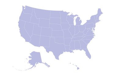
USA Map Silhouette on white background

Vintage Political World Map Pacific Centered - vector

Outline map of the United States of America. States of the USA. Vector illustration.

Political World Map Pacific Centered - vector

Vintage Political World Map Pacific Centered - vector

World map. Highly detailed map of the world with detailed borders of all countries, cities and bodies of water. Vector map in brown and green colors.

Highly detailed world map: countries, cities, water objects.

Pacific Ocean Political Map and bathymetry. Detailed Pacific Ocean Vector Map. Vector illustration.

North and South America map. Vector eps10

Vector illustration of World map and navigation icons.

Chile map dotted with flag and pin. Illustration for technology design or infographics. Isolated on white background. Travel vector illustration

Vintage World Map and Markers - Detailed Vector Illustration

Outline map of Americas

Political World Map Pacific Centered - vector

World Map Color - Asia in Center- vector

Highly detailed world map: countries, cities, water objects

Vector illustration of World map and navigation icons

World map. Highly detailed map of the world with detailed borders of all countries, cities, regions and bodies of water in blue tones. Vector illustration

Vintage Political World Map Pacific Centered - vector

Blue map of Americas

Outline map of Americas

American continent design, vector illustration eps10 graphic

Brazil silhouette simple vector illustration.

Paraguay political map and map pointers isolated on white. Highly detailed vector map illustration. All elements are separated in editable layers clearly labeled.

All flags Globe vector Illustration, part of full set, more flags set, earth globe with world map vector in my portfolio)

All flags Globe vector Illustration, part of full set, more flags set, earth globe with world map vector in my portfolio)

Quebec (provinces and territories of Canada) map vector illustration, scribble sketch Quebec map
Black half world map and windrose silhouette isolated on white background

Colour abstract map of the world in the form infographicss.

Globe Icon Set - Round World Map Vector Flat Illustration

All flags in globe form, vector illustration

Mexico map dotted on white background vector isolated. Illustration for technology design or infographics.

Canada map on white background with maple leaf

Cube Globe with World Flags Banner Original Vector Illustration

Black flat blank vector administrative map of the Canadian territory of NEWFOUNDLAND AND LABRADOR, CANADA

Four view of Earth on a white background

Vector illustration of shiny blue Earth globe