Description:
This SVG vector depicts the outline and key features of Baltimore County, designed for versatility in various design projects. The image is available in SVG format, allowing for scalability without loss of quality. It features a clean, flat style, making it suitable for both digital and print media. Ideal for both beginners and professionals, this vector can be easily customized to fit specific design needs. It displays geographical landmarks and can be used as educational material or for local representation. The design is straightforward, making it user-friendly for various applications. This clipart provides an efficient solution for map-related projects, geographic studies, or community-themed crafts. Its clear lines and structured format enhance usability across different platforms.
Usage ideas:
This Baltimore County SVG clipart can be effectively used in a variety of commercial and educational contexts. For instance, educators can include it in lesson plans or presentations about Maryland's geography, allowing students to visualize the region easily. Graphic designers can utilize this vector in creating promotional materials for local businesses, maps for travel guides, or community event flyers. Additionally, crafters can leverage this SVG for custom t-shirt designs, stickers, or home décor projects focused on regional pride. Nonprofits can include this vector in their awareness campaigns or informational brochures, making it a versatile asset in both the creative and educational fields.

Baltimore City ( United States cities, United States of America, usa city) map vector illustration, scribble sketch City of Baltimore map
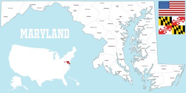
A large and detailed map of the State of XXX with all counties and county seats.

Baltimore rubber stamp. Grunge design with dust scratches. Effects can be easily removed for a clean, crisp look. Color is easily changed.

Maryland, U.S. state, gray political map with borders and county names. State in the Mid-Atlantic region of the USA, subdivided into 23 counties and the independent City of Baltimore. Old Line State

State of Maryland, subdivided into 23 counties and the independent City of Baltimore, outline map. State in the Mid-Atlantic region of the United States, nicknamed Old Line State. Isolated. Vector

Flag of Baltimore is the most populous city in the U.S. state of Maryland in the United States. Vector illustration

Baltimore grunge rubber stamp on white background, vector illustration

Road map of the US American State of Maryland
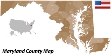
A large and detailed map of the State of Maryland with all counties and main cities.

Maryland - Highly detailed editable political map with labeling.
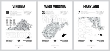
Highly detailed vector silhouettes of US state maps, Division United States into counties, political and geographic subdivisions of a states, South Atlantic - Virginia, West Virginia, Maryland - set 8 of 17
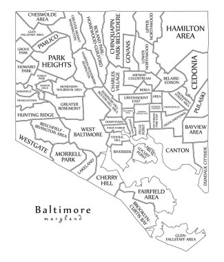
Modern City Map - Baltimore Maryland city of the USA with neighborhoods and titles outline map
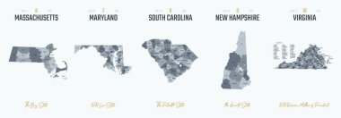
Vector set 2 of 10 Highly detailed silhouettes of US state maps, divided into counties with names and territory nicknames

Flag of Maryland from brush strokes. United States of America. Flag Maryland on transparent background for your web site design, logo, app, UI. Stock vector. Vector illustration EPS10.
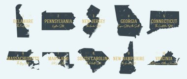
Set 1 of 5 Highly detailed vector silhouettes of USA state maps with names and territory nicknames

Map of Maryland state designed in illustration with the counties and the county seats

Modern City Map - Baltimore Maryland city of the USA with neighborhoods

Baltimore Maryland city map USA labelled black illustration

Blue vector map of United States with indication of Maryland

Silhouette map of the city of Baltimore in Maryland

United States, Maryland cityscape line vector. Travel flat city landmark, oultine illustration, line world icons

Baltimore Maryland map with American national flag illustration

Coat of arms of Prince George's County is a county in the U.S. state of Maryland. Vector illustration

Flag of Baltimore, Maryland, USA. Vector Format
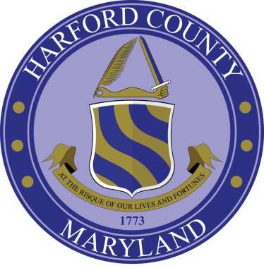
Coat of arms of Harford County is a county in the U.S. state of Maryland. Vector illustration

Coat of arms of Anne Arundel County is a county located in the U.S. state of Maryland. Vector illustration

Flag of Maryland from brush strokes. United States of America. Flag Maryland on transparent background for your web site design, logo, app, UI. Stock vector. Vector illustration EPS10.

Maryland USA state map vector tag cloud illustration
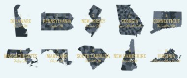
Set 1 of 5 Division United States into counties, political and geographic subdivisions of a states, Highly detailed vector maps with names and territory nicknames

Maryland map shape, united states of america. Flat concept icon symbol vector illustration .

Colorful Maryland political map with clearly labeled, separated layers. Vector illustration.

Set of Maryland map, united states of america. Flat concept icon vector illustration .

Maryland - Highly detailed editable political map with labeling.

Maryland map shape, united states of america. Flat concept icon symbol vector illustration .