10 FREE IMAGES of ShutterstockTry Shutterstock and Get 10 Free Images

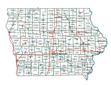
iowa county map SVG, Vector And Clipart Images

() iowa county map SVG Vectors and Transparent background iowa county map ClipArts. All Download the royalty free graphic in the form of SVG, PNG, EPS, AI or PSD.

Description:

This Iowa county map SVG vector presents a detailed outline of the counties within Iowa. Created in a scalable vector format, this image is suitable for various graphic design projects. The design features distinct county boundaries, allowing for easy customization. With its clean lines and scalable properties, it can be resized without loss of quality, making it perfect for both print and digital use. The vector is compatible with design software like Adobe Illustrator and Inkscape, which enhances its usability. This image serves well for anyone needing precise geographical representations.

Usage ideas:

The Iowa county map SVG vector can be utilized in a wide range of applications, such as educational materials, geographical presentations, and digital mapping projects. Educators can incorporate this vector into lesson plans to teach about state geography. Businesses can use it in market analysis presentations to showcase regional data. Additionally, urban planners might integrate it into project proposals to visualize community development plans. Graphic designers can apply it in brochures or websites that require detailed maps. Non-profits can utilize it for awareness campaigns focusing on specific counties.

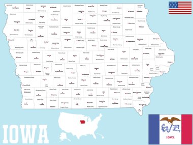
A large and detailed map of the State of Iowa with all counties and county seats. clipart svg vector

A large and detailed map of the State of Iowa with all counties and county seats.

Map of Iowa state designed in illustration with the counties and the county seats clipart svg vector

Map of Iowa state designed in illustration with the counties and the county seats

Map of Wapello in Iowa clipart svg vector

Map of Wapello in Iowa

A large and detailed map of the USA with every single county. clipart svg vector

A large and detailed map of the USA with every single county.

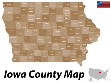
Iowa counties vector map with USA map colors national flag clipart svg vector

Iowa counties vector map with USA map colors national flag

Michigan administrative and political vector map with flag clipart svg vector

Michigan administrative and political vector map with flag

A large and detailed map of the USA with every single county. clipart svg vector

A large and detailed map of the USA with every single county.

Illustration of State of Iowa, USA clipart svg vector

Illustration of State of Iowa, USA

Iowa US state car license plate pattern, United States of America, numbers, letters and symbols, vector illustration clipart svg vector

Iowa US state car license plate pattern, United States of America, numbers, letters and symbols, vector illustration

Grey map of Iowa clipart svg vector

Grey map of Iowa

Accurate map of Iowa clipart svg vector
Accurate map of Iowa

Vector set 6 of 10 Highly detailed silhouettes of US state maps, divided into counties with names and territory nicknames clipart svg vector

Vector set 6 of 10 Highly detailed silhouettes of US state maps, divided into counties with names and territory nicknames

USA map with abbreviated state names. United States of America cartography with colored states. Vector illustration. clipart svg vector

USA map with abbreviated state names. United States of America cartography with colored states. Vector illustration.

Iowa - Highly detailed editable political map with labeling. clipart svg vector

Iowa - Highly detailed editable political map with labeling.

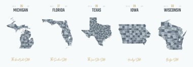
Set 3 of 5 Highly detailed vector silhouettes of USA state maps with names and territory nicknames clipart svg vector

Set 3 of 5 Highly detailed vector silhouettes of USA state maps with names and territory nicknames

Set 3 of 5 Division United States into counties, political and geographic subdivisions of a states, Highly detailed vector maps with names and territory nicknames clipart svg vector

Set 3 of 5 Division United States into counties, political and geographic subdivisions of a states, Highly detailed vector maps with names and territory nicknames

Highly detailed vector silhouettes of US state maps, Division United States into counties, political and geographic subdivisions of a states, West North Central - Kansas, Iowa, Missouri - set 6 of 17 clipart svg vector

Highly detailed vector silhouettes of US state maps, Division United States into counties, political and geographic subdivisions of a states, West North Central - Kansas, Iowa, Missouri - set 6 of 17

29 of 50 states of the United States with a name, nickname, and date admitted to the Union, Detailed Vector Iowa Map for printing posters, postcards and t-shirts clipart svg vector

29 of 50 states of the United States with a name, nickname, and date admitted to the Union, Detailed Vector Iowa Map for printing posters, postcards and t-shirts

Vector map of United States with indication of Iowa clipart svg vector

Vector map of United States with indication of Iowa

Accurate map of Iowa clipart svg vector

Accurate map of Iowa

Nebraska state detailed editable map with cities and towns, geographic sites, roads, railways, interstates and U.S. highways. Vector EPS-10 file, trending color scheme clipart svg vector

Nebraska state detailed editable map with cities and towns, geographic sites, roads, railways, interstates and U.S. highways. Vector EPS-10 file, trending color scheme

Iowa state outline administrative and political vector map in color clipart svg vector

Iowa state outline administrative and political vector map in color

The Illinois State counties map isolated on white background clipart svg vector

The Illinois State counties map isolated on white background

USA vehicle registration plates with state symbols. Vector American car number plates of Kansas, Minnesota or Maryland and Florida, Indiana and Tennessee plate with of Arizona and California clipart svg vector

USA vehicle registration plates with state symbols. Vector American car number plates of Kansas, Minnesota or Maryland and Florida, Indiana and Tennessee plate with of Arizona and California

Iowa state outline administrative and political vector map in black and white clipart svg vector
Iowa state outline administrative and political vector map in black and white

Detailed map of the State of Iowa with all counties and main cities. clipart svg vector

Detailed map of the State of Iowa with all counties and main cities.

The Illinois State map with counties labels clipart svg vector

The Illinois State map with counties labels

Accurate map of Iowa clipart svg vector

Accurate map of Iowa

Accurate map of Iowa clipart svg vector

Accurate map of Iowa

High Quality map of Iowa is a state of United States of America with borders of the counties clipart svg vector

High Quality map of Iowa is a state of United States of America with borders of the counties

Blue abstract outline of Iowa map clipart svg vector

Blue abstract outline of Iowa map

Accurate map of Iowa clipart svg vector

Accurate map of Iowa

Outline map of Iowa white background. USA state,  vector map with contour. clipart svg vector
Outline map of Iowa white background. USA state, vector map with contour.

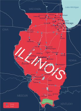
Illinois state detailed editable map with with cities and towns, geographic sites, roads, railways, interstates and U.S. highways. Vector EPS-10 file, trending color scheme clipart svg vector

Illinois state detailed editable map with with cities and towns, geographic sites, roads, railways, interstates and U.S. highways. Vector EPS-10 file, trending color scheme

Highly detailed map with flag inside of the state of Iowa clipart svg vector

Highly detailed map with flag inside of the state of Iowa

Iowa map with American national flag illustration clipart svg vector

Iowa map with American national flag illustration

Accurate map of Iowa clipart svg vector

Accurate map of Iowa

A Merry Christmas Illustration with Santa landing in the State of Iowa clipart svg vector

A Merry Christmas Illustration with Santa landing in the State of Iowa

Shape of Texas state map with American flag. vector illustration. can use for united states of America indepenence day, nationalism, and patriotism illustration. USA flag design clipart svg vector

Shape of Texas state map with American flag. vector illustration. can use for united states of America indepenence day, nationalism, and patriotism illustration. USA flag design

Abstract vehicle registration plates. Vector number plates of California, Alabama or Virginia and Hawaii, Montana or Illinois and US Georgia or Delaware, Idaho and Michigan. Abstract numbers clipart svg vector

Abstract vehicle registration plates. Vector number plates of California, Alabama or Virginia and Hawaii, Montana or Illinois and US Georgia or Delaware, Idaho and Michigan. Abstract numbers

Iowa Map Black. State Border. United States. US America. clipart svg vector

Iowa Map Black. State Border. United States. US America.

Iowa map outline isolated on white background clipart svg vector

Iowa map outline isolated on white background

Hampton (Iowa) blank outline map clipart svg vector

Hampton (Iowa) blank outline map

Iowa Map Black. State Border. United States. US America. clipart svg vector

Iowa Map Black. State Border. United States. US America.

Iowa silhouettes maps vector isolated on transparent background clipart svg vector

Iowa silhouettes maps vector isolated on transparent background

Iowa USA state map vector tag cloud illustration clipart svg vector

Iowa USA state map vector tag cloud illustration

High detailed Iowa physical map with labeling. clipart svg vector

High detailed Iowa physical map with labeling.

Carlisle (Iowa) blank outline map clipart svg vector
Carlisle (Iowa) blank outline map

Iowa road and highway map. Vector illustration. clipart svg vector

Iowa road and highway map. Vector illustration.

Iowa - Highly detailed editable political map with labeling. clipart svg vector

Iowa - Highly detailed editable political map with labeling.

Iowa map shape, united states of america. Flat concept icon symbol vector illustration . clipart svg vector

Iowa map shape, united states of america. Flat concept icon symbol vector illustration .

Iowa silhouettes maps vector transparent background clipart svg vector

Iowa silhouettes maps vector transparent background

County map of the US American state of Illinois clipart svg vector

County map of the US American state of Illinois

Iowa state map contour. In style of USA flag. clipart svg vector

Iowa state map contour. In style of USA flag.