10 FREE IMAGES of ShutterstockTry Shutterstock and Get 10 Free Images

massachusetts county SVG, Vector And Clipart Images

() massachusetts county SVG Vectors and Transparent background massachusetts county ClipArts. All Download the royalty free graphic in the form of SVG, PNG, EPS, AI or PSD.

Description:

This Massachusetts County SVG vector features an intricate outline of the counties within Massachusetts, representing geographic boundaries and key areas. The file format allows for easy scalability, maintaining quality across various sizes. Designed in a clean style, this SVG is perfect for use in maps, educational graphics, and presentations. It includes detailed outlines that help users visualize county divisions clearly. The design is versatile, suitable for both digital and print applications. This clipart can be easily customized, making it an excellent resource for graphic designers and educators alike.

Usage ideas:

This Massachusetts County SVG can be utilized in various commercial and educational projects. For educators, it serves as an excellent visual aid in geography lessons, enhancing student understanding of state and county structures. Designers can incorporate this vector into marketing materials, brochures, or websites that focus on Massachusetts. Additionally, this clipart is useful for creating presentations that require geographical context, such as tourism promotions, local business advertisements, or informational graphics about state demographics and statistics.

New england states administrative map clipart svg vector

New england states administrative map
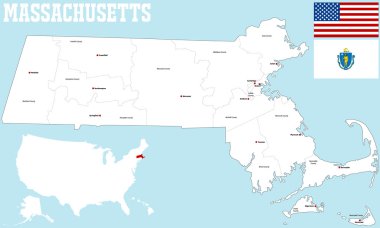
A large and detailed map of the State of Massachusetts with all counties and county seats. clipart svg vector
A large and detailed map of the State of Massachusetts with all counties and county seats.

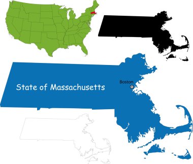
Illustration of State of Massachusetts, USA clipart svg vector

Illustration of State of Massachusetts, USA

Vector illustration of Massachusetts state in USA, black and white clipart svg vector

Vector illustration of Massachusetts state in USA, black and white

The Massachusetts State County Map isolated on white background clipart svg vector
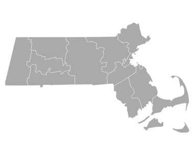
The Massachusetts State County Map isolated on white background

Accurate map of Massachusetts clipart svg vector

Accurate map of Massachusetts

Massachusetts vector maps counties, townships, regions, municipalities, departments, borders clipart svg vector

Massachusetts vector maps counties, townships, regions, municipalities, departments, borders

City map Boston, monochrome detailed plan, vector illustration clipart svg vector
City map Boston, monochrome detailed plan, vector illustration

Set 1 of 5 Highly detailed vector silhouettes of USA state maps with names and territory nicknames clipart svg vector

Set 1 of 5 Highly detailed vector silhouettes of USA state maps with names and territory nicknames

A large and detailed map of the USA with every single county. clipart svg vector

A large and detailed map of the USA with every single county.

Travel poster, urban street plan city map Boston and Philadelphia, vector illustration clipart svg vector
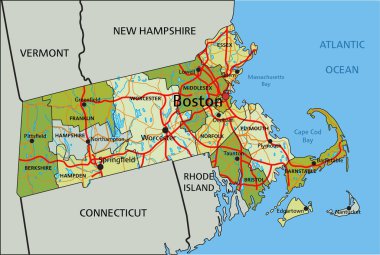
Travel poster, urban street plan city map Boston and Philadelphia, vector illustration

Highly detailed editable political map with separated layers. Massachusetts. clipart svg vector

Highly detailed editable political map with separated layers. Massachusetts.

Boston seamless pattern. Creative design for various backgrounds. clipart svg vector

Boston seamless pattern. Creative design for various backgrounds.

Highly detailed vector silhouettes of US state maps, Division United States into counties, political and geographic subdivisions of a states, New England - Connecticut, Massachusetts, Rhode Island - set 2 of 17 clipart svg vector

Highly detailed vector silhouettes of US state maps, Division United States into counties, political and geographic subdivisions of a states, New England - Connecticut, Massachusetts, Rhode Island - set 2 of 17
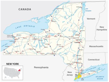
Road map of the US American State of New York clipart svg vector
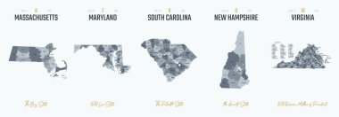
Road map of the US American State of New York

Vector set 2 of 10 Highly detailed silhouettes of US state maps, divided into counties with names and territory nicknames clipart svg vector

Vector set 2 of 10 Highly detailed silhouettes of US state maps, divided into counties with names and territory nicknames

Massachusetts state outline administrative and political vector map in color clipart svg vector
Massachusetts state outline administrative and political vector map in color

USA map. Very high accurate drawing. Alaska, Hawaii, USA Vector eps10 clipart svg vector

USA map. Very high accurate drawing. Alaska, Hawaii, USA Vector eps10

USA map. Very high accurate drawing. USA vector eps10. clipart svg vector

USA map. Very high accurate drawing. USA vector eps10.

Dukes County, Commonwealth of Massachusetts (U.S. county, United States of America, US) map vector illustration, scribble sketch Martha's Vineyard, Chappaquiddick, Elizabeth and Nomans Land island map clipart svg vector

Dukes County, Commonwealth of Massachusetts (U.S. county, United States of America, US) map vector illustration, scribble sketch Martha's Vineyard, Chappaquiddick, Elizabeth and Nomans Land island map

Yellow map of Massachusetts clipart svg vector
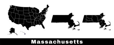
Yellow map of Massachusetts

Massachusetts state map, USA. Set of Massachusetts maps with outline border, counties and US states map. Black and white color vector illustration. clipart svg vector

Massachusetts state map, USA. Set of Massachusetts maps with outline border, counties and US states map. Black and white color vector illustration.

USA map with abbreviated state names. United States of America cartography with colored states. Vector illustration. clipart svg vector

USA map with abbreviated state names. United States of America cartography with colored states. Vector illustration.
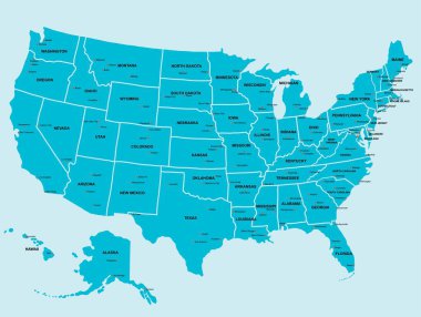
Doodle freehand drawing USA political map with major cities. Vector illustration. clipart svg vector
Doodle freehand drawing USA political map with major cities. Vector illustration.

Set 1 of 5 Division United States into counties, political and geographic subdivisions of a states, Highly detailed vector maps with names and territory nicknames clipart svg vector

Set 1 of 5 Division United States into counties, political and geographic subdivisions of a states, Highly detailed vector maps with names and territory nicknames

Usa map on white background. flat style. United States of America map. usa vector map. clipart svg vector

Usa map on white background. flat style. United States of America map. usa vector map.

United States of America map. United states outline isolated on white background. USA map icon. Usa map line vector icon clipart svg vector

United States of America map. United states outline isolated on white background. USA map icon. Usa map line vector icon

Florida state map silhouette in the United States clipart svg vector

Florida state map silhouette in the United States

United States country map silhouette on white background clipart svg vector

United States country map silhouette on white background

Accurate map of Massachusetts clipart svg vector

Accurate map of Massachusetts

Accurate map of Massachusetts clipart svg vector

Accurate map of Massachusetts

Accurate map of Massachusetts clipart svg vector

Accurate map of Massachusetts

Accurate map of Massachusetts clipart svg vector

Accurate map of Massachusetts

A large and detailed map of the State of Massachusetts with all counties, islands and main cities. clipart svg vector

A large and detailed map of the State of Massachusetts with all counties, islands and main cities.

Map of Nantucket Island in the US state of Massachusetts clipart svg vector

Map of Nantucket Island in the US state of Massachusetts

Vector hand drawn stylized map of The United States of America. Travel illustration of USA states. Hand drawn lettering illustration. North America map element clipart svg vector

Vector hand drawn stylized map of The United States of America. Travel illustration of USA states. Hand drawn lettering illustration. North America map element

Modern City Map - Boston Massachusetts city of the USA with boroughs and titles clipart svg vector

Modern City Map - Boston Massachusetts city of the USA with boroughs and titles

Vector map of United States with indication of Massachusetts clipart svg vector

Vector map of United States with indication of Massachusetts

Modern City Map - Boston Massachusetts city of the USA with boroughs and titles outline map clipart svg vector

Modern City Map - Boston Massachusetts city of the USA with boroughs and titles outline map

Rhode Island state detailed editable map with cities and towns, geographic sites, roads, railways, interstates and U.S. highways. Vector EPS-10 file, trending color scheme clipart svg vector

Rhode Island state detailed editable map with cities and towns, geographic sites, roads, railways, interstates and U.S. highways. Vector EPS-10 file, trending color scheme

Accurate map of Massachusetts clipart svg vector
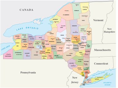
Accurate map of Massachusetts

New york administrative and political map clipart svg vector

New york administrative and political map

Rhode island administrative vector map with flag clipart svg vector

Rhode island administrative vector map with flag

3d map of Massachusetts is a state of United States clipart svg vector
3d map of Massachusetts is a state of United States

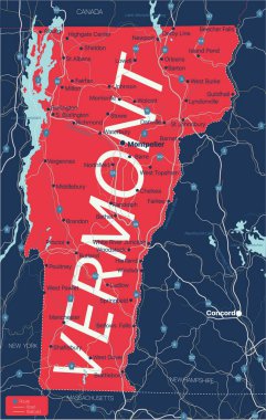
Vermont state detailed editable map with cities and towns, geographic sites, roads, railways, interstates and U.S. highways. Vector EPS-10 file, trending color scheme clipart svg vector

Vermont state detailed editable map with cities and towns, geographic sites, roads, railways, interstates and U.S. highways. Vector EPS-10 file, trending color scheme

Boston Massachusetts city map USA labelled black illustration clipart svg vector

Boston Massachusetts city map USA labelled black illustration

Boston Massachusetts city map with boroughs grey illustration silhouette shape clipart svg vector

Boston Massachusetts city map with boroughs grey illustration silhouette shape

California state map silhouette in the United States clipart svg vector
California state map silhouette in the United States

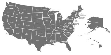
USA map. United States of America poster with state names. Geographic american maps including Alaska and Hawaii. USA geography, geography mapping vector illustration clipart svg vector

USA map. United States of America poster with state names. Geographic american maps including Alaska and Hawaii. USA geography, geography mapping vector illustration

Boston Massachusetts Map with neighborhoods and modern round shapes clipart svg vector

Boston Massachusetts Map with neighborhoods and modern round shapes

Shape of Massachusetts state map with American flag. vector illustration. can use for united states of America indepenence day, nationalism, and patriotism illustration. USA flag design clipart svg vector

Shape of Massachusetts state map with American flag. vector illustration. can use for united states of America indepenence day, nationalism, and patriotism illustration. USA flag design

USA map silhouette isolated on white. United States of America country. Vector illustration. clipart svg vector
USA map silhouette isolated on white. United States of America country. Vector illustration.

Nantucket Town and County, Commonwealth of Massachusetts (U.S. county, United States of America, USA, U.S., US) map vector illustration, scribble sketch Nantucket, Tuckernuck and Muskeget island map clipart svg vector

Nantucket Town and County, Commonwealth of Massachusetts (U.S. county, United States of America, USA, U.S., US) map vector illustration, scribble sketch Nantucket, Tuckernuck and Muskeget island map
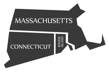
Massachusetts - Connecticut - Rhode Island Map labelled black illustration clipart svg vector

Massachusetts - Connecticut - Rhode Island Map labelled black illustration

New Bedford in Massachusetts, USA, vintage engraved illustration. Trousset encyclopedia (1886 - 1891). clipart svg vector

New Bedford in Massachusetts, USA, vintage engraved illustration. Trousset encyclopedia (1886 - 1891).
Flag of Worcester is a city in, and the county seat of, Worcester County, Massachusetts, United States. Vector illustration clipart svg vector

Flag of Worcester is a city in, and the county seat of, Worcester County, Massachusetts, United States. Vector illustration
Massachusetts USA state map vector tag cloud illustration clipart svg vector

Massachusetts USA state map vector tag cloud illustration

Newburyport in Massachusetts, USA, vintage engraved illustration. Trousset encyclopedia (1886 - 1891). clipart svg vector

Newburyport in Massachusetts, USA, vintage engraved illustration. Trousset encyclopedia (1886 - 1891).

Flag of Cambridge is a city in Middlesex County, Massachusetts, and part of the Boston metropolitan area. Vector illustration clipart svg vector

Flag of Cambridge is a city in Middlesex County, Massachusetts, and part of the Boston metropolitan area. Vector illustration

Boston text sign illuatration on white background clipart svg vector

Boston text sign illuatration on white background

Coat of arms of Worcester is a city in, and the county seat of, Worcester County, Massachusetts, United States. Vector illustration clipart svg vector

Coat of arms of Worcester is a city in, and the county seat of, Worcester County, Massachusetts, United States. Vector illustration

Massachusetts silhouettes maps vector transparent background clipart svg vector

Massachusetts silhouettes maps vector transparent background

Dover (Massachusetts) blank outline map clipart svg vector

Dover (Massachusetts) blank outline map

Colorful Massachusetts political map with clearly labeled, separated layers. Vector illustration. clipart svg vector

Colorful Massachusetts political map with clearly labeled, separated layers. Vector illustration.

Contour map of the state of Massachusetts, USA. Vector graphic illustration on a transparent background with black region borders clipart svg vector

Contour map of the state of Massachusetts, USA. Vector graphic illustration on a transparent background with black region borders
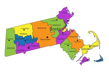
Colorful Massachusetts political map with clearly labeled, separated layers. Vector illustration. clipart svg vector

Colorful Massachusetts political map with clearly labeled, separated layers. Vector illustration.

Counties of New England, outline map. Region in the Northeastern United States, consisting of the states Connecticut, Maine, Massachusetts, New Hampshire, Rhode Island, and Vermont. Isolated. Vector clipart svg vector

Counties of New England, outline map. Region in the Northeastern United States, consisting of the states Connecticut, Maine, Massachusetts, New Hampshire, Rhode Island, and Vermont. Isolated. Vector

Massachusetts - Highly detailed editable political map. clipart svg vector

Massachusetts - Highly detailed editable political map.

Flag of Nantucket, Massachusetts, USA. Vector Format clipart svg vector

Flag of Nantucket, Massachusetts, USA. Vector Format

Massachusetts state map contour. In style of USA flag. clipart svg vector

Massachusetts state map contour. In style of USA flag.

Contour map of the state of Massachusetts, USA. Vector graphic illustration on a transparent background with black region borders clipart svg vector

Contour map of the state of Massachusetts, USA. Vector graphic illustration on a transparent background with black region borders

United state map vector illustration, USA map vector illustration scribble sketch Republic of USA map,  usa map silhouette clipart svg vector

United state map vector illustration, USA map vector illustration scribble sketch Republic of USA map, usa map silhouette

County map of the US American state of New York clipart svg vector

County map of the US American state of New York