Description:
This Jamaica Regions SVG vector presents a detailed illustration of the various regions of Jamaica, each represented in clear, defined sections. The image is designed in the Scalable Vector Graphics (SVG) format, ensuring high quality at any scale. It features a flat design style with distinct colors demarcating each region for easy identification. The illustration is perfect for use in educational materials, geographic studies, or travel publications. The vector format allows for easy customization, enabling users to modify colors or add labels as needed. This Jamaica Regions SVG can be seamlessly integrated into various digital projects such as websites or presentations, making it a versatile resource. Its clear lines and defined boundaries facilitate accurate representation and analysis of Jamaican geography.
Usage ideas:
The Jamaica Regions SVG vector can be effectively utilized in educational contexts such as classroom displays, geography workbooks, or online learning modules. For instance, teachers can use this vector to create interactive maps that engage students in exploring Jamaican culture and geography. Additionally, travel agencies can incorporate this SVG in brochures or websites to highlight the distinct regions of Jamaica, offering insights into tourism hotspots. Graphic designers may find this vector useful for creating infographics or thematic illustrations related to Jamaica, encouraging users to connect with the island's diverse regions. This image also serves well in presentations, enhancing the visual appeal and informational content for business meetings or seminars focused on Caribbean studies.

Central America map - highly detailed vector illustration. Image contains land contours, country and land names, city names, water object names, navigation icons.

The Caribbean Map - Vintage Detailed Vector Illustration

The Caribbean Map - Detailed Info Graphic Vector Illustration

The Caribbean Map - Detailed Vector Illustration

The Caribbean Map - Vintage Detailed Vector Illustration

Jamaica Map Vector New 2024 Colorful - Customizable layered political map of Jamaica with administrative divisions for website, education, reports, news, politics, print, poster and wallpaper

Central America map - highly detailed vector illustration.

The Caribbean Map - Detailed Vector Illustration

The Caribbean Map - Vintage Detailed Vector Illustration

The Caribbean Map - Vintage Detailed Vector Illustration
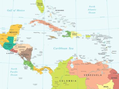
Central America map - highly detailed vector illustration.
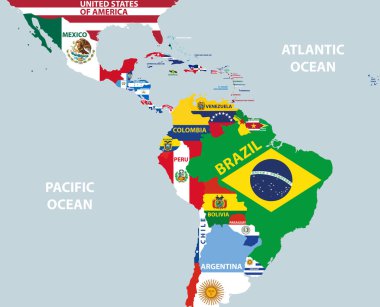
Vector part of world map with region of Latin American countries mixed with their national flags

The Caribbean Map - Detailed Vector Illustration

The Caribbean Map - Detailed Vector Illustration

Central America map - highly detailed vector illustration.

The Caribbean Map - Detailed Vector Illustration

Central America map - highly detailed vector illustration.

Central America map - highly detailed vector illustration.

Vector illustration of Central America map and navigation icons.

Central America map - highly detailed vector illustration. Image contains land contours, country and land names, city names, water object names, navigation icons.
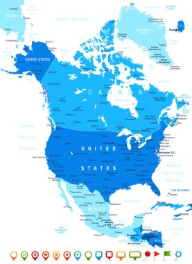
North America map - highly detailed vector illustration. Image contains land contours, country and land names, city names, water object names, navigation icons.

North America map - highly detailed vector illustration.

North and South America map - highly detailed vector illustration.

The Caribbean Map - Vintage Detailed Vector Illustration

North America map - highly detailed vector illustration.

Central America map - highly detailed vector illustration.

North America map - highly detailed vector illustration. Image contains land contours, country and land names, city names, water object names, navigation icons.

North America map - highly detailed vector illustration. Image contains land contours, country and land names, city names, water object names, navigation icons.

Central America map - highly detailed vector illustration. Image contains land contours, country and land names, city names, water object names, navigation icons.

Jamaica with parishes Map grey

The Caribbean Map - Detailed Vector Illustration

Jamaica Map black country illustration

Jamaica vector set. Detailed country shape with region borders, flags and icons isolated on white background.

Vector illustration of North America map and navigation icons.

Vector illustration of North and South America map and navigation icons.
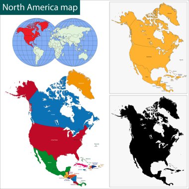
Colorful North America map with countries and capital cities

Central America map - highly detailed vector illustration.

North and South America map - highly detailed vector illustration.

North and South America map - highly detailed vector illustration.

North America map - highly detailed vector illustration.

Jamaica Location Highlighted on American Map with Flag Icon.

North America map - highly detailed vector illustration.

North America map - highly detailed vector illustration.
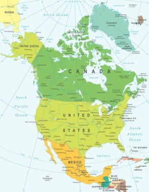
North America map - highly detailed vector illustration.

North and South America map - highly detailed vector illustration.

Vector illustration of North America map.