Description:
The Lincoln boundary SVG vector features a detailed outline of the geographic boundaries of Lincoln. This vector is provided in SVG format, allowing for easy scaling without loss of quality. The design follows a crisp, clean line style, making it suitable for both professional and educational applications. It can be used in various sizes, from small icons to large posters. The vector format ensures compatibility with a range of graphic software, including Adobe Illustrator and Inkscape. This image is specifically designed for usage in cartographic projects, urban development plans, and educational presentations. Its precise detailing offers accurate geographical insights.
Usage ideas:
This Lincoln boundary SVG vector can be utilized in numerous commercial or educational contexts. For example, city planners might integrate this vector into urban development presentations to visualize zoning and district planning. Educators can use it in lesson materials focused on geography or local government studies. Graphic designers could incorporate it into marketing materials, illustrating regional services or tourism opportunities. Additionally, real estate agents may find it useful for property listings, showcasing nearby amenities and boundaries.

Lincoln County (Kentucky) blank outline map set

Lincoln County (Nebraska) blank outline map

Lincoln (Vermont) blank outline map

Lincoln (Washington) blank outline map

Lincoln (New Hampshire) blank outline map

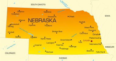
Vector color map of Nebraska state. Usa

Illinois, U.S. state subdivided into 102 counties, political map with borders and county names. State in the Midwestern region of the USA. Land of Lincoln, Prairie State, and The Inland Empire State.

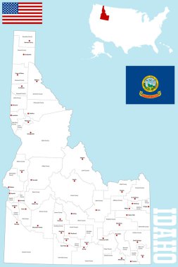
A large and detailed map of the State of Idaho with all counties and county seats.

Nebraska line art map from colorful curved lines

Illustration of State of Washington, USA

Nebraska state detailed editable map with cities and towns, geographic sites, roads, railways, interstates and U.S. highways. Vector EPS-10 file, trending color scheme

Nebraska blank outline map set

Lincoln Beach (Oregon) blank outline map

Illinois, U.S. state subdivided into 102 counties, gray political map with borders and county names. State in the Midwestern region of USA. Land of Lincoln, Prairie State, and The Inland Empire State.

Lincoln Village (Ohio) blank outline map

Minster (Ohio) blank outline map

Playford, Port Adelaide Enfield, Port Augusta, Port Lincoln outline maps

Lincoln County (North Carolina) blank outline map

A large, detailed map of the State of Idaho with every county and main city.

Lincoln (North Dakota) blank outline map

Nebraska Map Flag. Map of NE, USA with the state flag isolated on white background. United States, America, American, United States of America, US State. Vector illustration.

The black and white administrative maps of Idaho State, USA