
Palau map vector illustration, scribble sketch Republic of Palau

Palau map vector, Palau flag vector, isolated Palau

Map of The United States of America USA with territories and Islands. Different map variations for your design. Stock Vector illustration isolatedon white background

Infographic for Palau, detailed map of Palau with flag. Vector Info graphic green map.

Oceania flag set in alphabetical order, with an editable map.

Palau Location Highlighted on Oceania Map with Flag Icon.

Palau Map Pin with National Flag on Open World Map.

Map and Flag of Palau Vector Design Template with Editable Stroke

Map of Palau - vector illustration

Vector color map of Palau
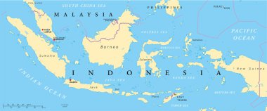
Political map of Malaysia and Indonesia with capitals Kuala Lumpur and Jakarta, with national borders and lakes. Vector illustration with English labeling and scaling.

Oceania, political map. Australia and the Pacific, including New Zealand. Geographic region, southeast of the Asia-Pacific region, including Australasia, Melanesia, Micronesia and Polynesia. Vector.

Oceania silhouette map isolated

Melanesia, Micronesia and Polynesia, political map. Colored geographic regions of Oceania, southeast of the Asia-Pacific region. English labeling. Illustration on white background. Vector.
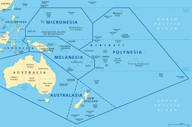
Subregions of Oceania, political map. Geoscheme with regions in the Pacific Ocean and next to Asia. Melanesia, Micronesia, Polynesia, and Australasia, short for Australia and New Zealand. Vector.

Vector color map of Palau

Vector map of Australia, Oceania and South East Asian countries mixed with their national flags

Vector map of Palau with infographic elements: regions, cities, charts, icons. Blue color scheme, flat modern style. Ideal for reports, presentations, and educational use.

Regions of Oceania, political map. Colored geographic regions, southeast of the Asia-Pacific region including Australasia, Melanesia, Micronesia and Polynesia. English. Illustration over white. Vector
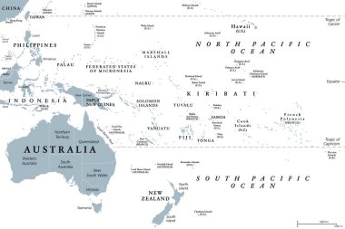
Oceania, gray political map. Australia and the Pacific, including New Zealand. Geographic region, southeast of the Asia-Pacific region, including Australasia, Melanesia, Micronesia and Polynesia.

Map of oceania with countries

Oceania map and flags

Vector map of south east asian countries mixed with their national flags

Blue map of oceania

Palau on the globe. Earth hemisphere centered at the location of the Republic of Palau. Palau map.

Australia and Oceania region vector high detailed map with countries names and national flags
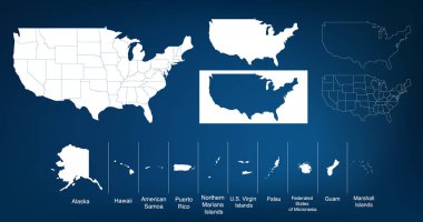
Map of The United States of America USA with States Name in Blue Color Illustration on White Background

Vector Map Icon of the world in Globe form

Vector Map Icon of the World Globe

Metal map markers steel with glare and shadows

Australia and New Zealand, South Pole, Antarctica, Global World
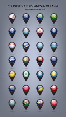
White map markers with flags -countries and islands in Oceania. Vector EPS10 illustration

Australia and New Zealand, South Pole, Antarctica, Global World
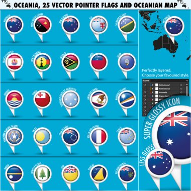
Set of Australian, Oceania Round Pointer Flag and Geographic Map, Zip includes 300 dpi JPG, Illustrator CS, EPS10. Vector with transparency.

Vector Map Icon of the world in Globe form

OCEANI countries flags in pointer icons

Australia and New Zealand, Global World

Asia and Australia, Global World

Vector Map Icon of the world in Globe form

Vector Map Icon of the world in Globe form

Energy industry and ecology of Palau vector map with power stations infographic.

OCEANI countries flags in pointer icons

Palau travel destination grand vector illustration.
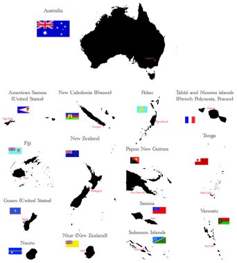
Countries of Oceania and Australia with borders, flags and capitals

Palau travel destination grand vector illustration.

Vector maps and flags of oceania countries with administrative divisions (regions borders)

Oceania flags collection. Big set of blue pin icon with flags of Oceanian countries. Vector Illustration.

World map with magnified Palau. Palau flag and map.

Gold and Silver Palau Flag Map Pin Icon

Palau Flag Pole Vector Illustration