
Green map of the United Kingdom

World Map vector. Gray similar world map blank vector on transparent background. Gray similar world map with borders of all countries and States of USA map, States of Australia and Countries of the UK. Quality world map.

Scotland map with borders, cities, capital and administrative divisions. Infographic vector map. Editable layers clearly labeled.

Colorful map of countries of United Kingdom with indication of capital cities

Simple contour map of United Kingdom of Great Britain and Northern Ireland. Black outline vector map isolated on white background.

United Kingdom countries, UK regions and London vector map

Stylized vector Scotland map showing big cities, capital Edinburgh, administrative divisions.

Colorful map of countries of United Kingdom

Great Britain vector color map
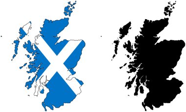
Layered editable vector illustration country map of Scotland,which contains two versions, colorful country flag version and black silhouette version.

Map of United Kingdom

High Detail Colorful vector Map of United Kingdom Regions, Administrative divisions and major cities, with also a 3D globe centered on UK
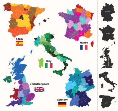
European regions map

Scotland blank detailed outline map set
Set of vector graphic flat icons representing symbols and landmarks of Scotland.

Scotland travel collection Isolated on white.

Vector map of the city of Dundee, Scotland, UK
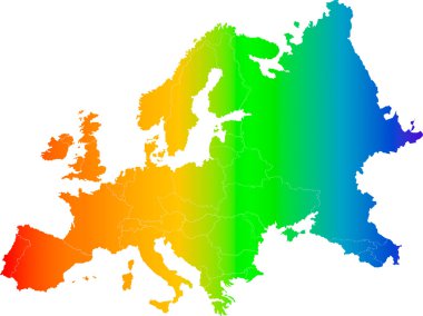
Abstract europe color vector map on white

Great Britain United Kingdom map card paper 3D natural vector

United Kingdom Country Infographics Template Vector

Great Britain United Kingdom map glass card paper 3D vector
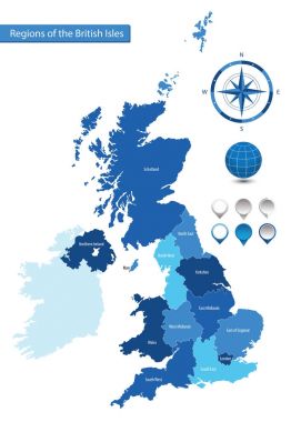
Vector map of the regions of the British Isles

United Kingdom flag inside the British map borders vector illustration

Illustration of a long shadow UK flag icon with a map of Russia

East Renfrewshire (Scotland) blank outline map set

Argyll and Bute (Scotland) blank outline map set

Inverclyde (Scotland) blank outline map set

Dumbarton (Virginia) blank outline map

Glasgow (Scotland) blank outline map set

South Ayrshire (Scotland) blank outline map set

Shetland Islands (Scotland) blank outline map set

Dundee (Scotland) blank outline map set

Upper Gascoyne, Victoria Park, Victoria Plains, Vincent outline maps

Midlothian (Scotland) blank outline map set

East Dunbartonshire (Scotland) blank outline map set

Scotland County (North Carolina) blank outline map

Clackmannanshire (Scotland) blank outline map set
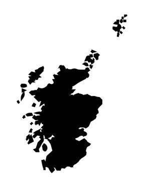
Silhouette outline map of the United Kingdom country of Scotland over a white background

All about Scotland elements. National map,food,tourist attractions,castle,flower and etc.

Map of United Kingdom, Great Britain, England template vector illustration. Icons with British travel destinations. Explore UK concept image

Blue map of Scotland with indication of Edinburgh

Lovely United Kingdom impression collection in flat style

Attractive United Kingdom travel map with attractions

Vintage united kingdom map with regions inscription scotland, northern ireland, england, wales drawing on dirty paper background
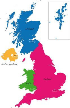
The countries of the United Kingdom and capital cities

Lovely United Kingdom attractions map in printing style

Lovely United Kingdom impression collection in flat style

Travel poster, urban street plan city map Belfast and Edinburgh, vector illustration

Vector poster detailed city map Edinburgh
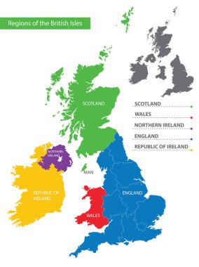
Color detailed map of the regions and countries of the British Isles for your design

United Kingdom Blank Physical Map isolated on white. Vector illustration.

United Kingdom Blank Map with water objects. Vector illustration.

United Kingdom Political Map with roads and water objects. Vector illustration.

High detailed United Kingdom physical map with labeling.

Black and white map of the UK and Ireland

Administrative divisions of the United Kingdom

Contour of Scotland in grey and in flag colors

Illustration of a Map and Flags of British Isles

Highly detailed physical map of United Kingdom and Ireland,in vector format,with all the relief forms,states and big cities.

Simple map of Northern Ireland and the northern part of the Republic of Ireland

High detailed United Kingdom road map with labeling.

Vector blank map of UK with administrative divisions. Editable and clearly labeled layers.

Vector road map of the Scottish Isle of Skye

High Detail Colorful vector Map of United Kingdom Regions, Administrative divisions and major cities.

United Kingdom, aka UK, of Great Britain and Northern Ireland hand-drawn blank map. Divided to four countries - England, Wales, Scotland and NI. Simple flat vector illustration.

Vector Great Britain Pictogram isolated on white background
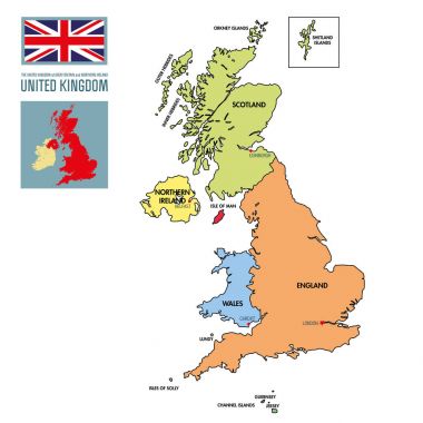
Vector highly detailed political map of The United Kingdom of Great Britain and Northern Ireland with regions and their capitals. All elements are separated in editable layers clearly labeled. EPS 10
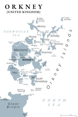
Orkney or Orkney Islands, gray political map. Archipelago of about 70 islands in the Northern Isles of Scotland, situated off the coast of the island of Great Britain, with Mainland as largest island.

British Isles Map with capitals, national borders, rivers and lakes. Illustration with English labeling and scaling.
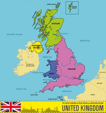
Vector highly detailed political map of The United Kingdom of Great Britain and Northern Ireland with regions and their capitals. All elements are separated in editable layers clearly labeled. EPS 10

Hand drawn map of Wales and the British Isles. Colorful hand drawn vector illustration. Green

High detailed United Kingdom physical map.

Administrative divisions of the United Kingdom

British Isles countries silhouettes map. Ireland and United Kingdom countries England, Scotland, Wales, Northern Ireland, Guernsey, Jersey and Isle of Man in different colors. Vector illustration.

High detailed United Kingdom physical map with labeling.

Highly detailed Shetland Islands road map with labeling, United Kingdom

High detail map of Great Britain and Ireland

Shetland islands road map, Scotland, United Kingdom

Color map of Great Britain and Ireland

High detailed United Kingdom road map with labeling.

Vector road map of scottish archipelago hebrides at the north west coast of scotland

High detailed United Kingdom physical map with labeling.
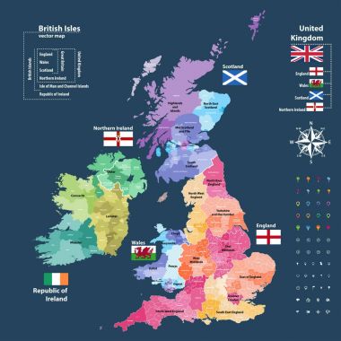
Vector map of British Isles administrative divisions colored by countries and regions. Districts and counties maps and flags of United Kingdom,Northern Ireland, Wales, Scotland and Republic of Ireland

Large and detailed maps of all scottish areas.

Lewis and Harris map. Island silhouette icon. Isolated Lewis and Harris black map outline. Vector illustration.

Illustration of a Political Map of United Kingdom
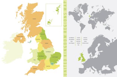
Color vector illustration, United Kingdom Regions Map

Vector map of the Scottish highlands, United Kingdom

United Kingdom road and highway map. Vector illustration.

Colorful United Kingdom political map with clearly labeled, separated layers. Vector illustration.

Countries of British Isles: United Kingdom(England, Scotland, Wales, Northern Ireland) and Republic of Ireland map combined with flags

The detailed map of the United Kingdom with regions or states. Actual current relevant UK, Great Britain administrative devision.

Hand drawn map of the United Kingdom including England, Wales, Scotland and Northern Ireland and their capital cities. Colorful hand drawn vector illustration.

On Europe map vector. Vector illustration.

United Kingdom map, administrative division, separate individual regions with names, color map isolated on white background vector
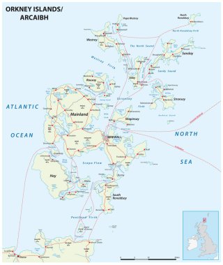
Highly detailed Orkney Islands road map with labeling, United Kingdom
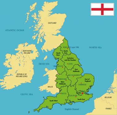
Vector highly detailed political map of England with regions and their capitals. All elements are separated in editable layers clearly labeled. EPS 10

Vector map of the British province of Northern Ireland

Black outline vector map of The British Isles illustration including England, Scotland, Wales & Ireland.

The United Kingdom of Great Britain and Northern Ireland map, detailed web vector illustration .