Faro district blank outline map set

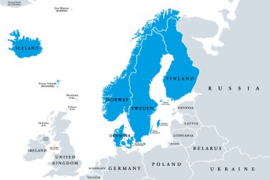
Scandinavia, political map. A subregion in Northern Europe, most commonly referring to Denmark, Norway, and Sweden, and more broadly also with Aland, Faroe Islands, Finland and Iceland. Illustration.

Faroe Islands Map Flag. Map of Faroes with flag isolated on white background. Autonomous territory within the Kingdom of Denmark. Vector illustration.

Streymoyar, Suduroyar, Vago outline maps

Eysturoyar, Norderoerne, Sandoyar outline maps

Portugal political map of administrative divisions - districts. 3D turquoise vector map with name labels.